Saint-Philippe-de-Néri, Quebec
| Saint-Philippe-de-Néri | |
|---|---|
| Parish municipality | |
 Location within Kamouraska RCM | |
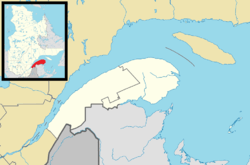 Saint-Philippe-de-Néri Location in eastern Quebec | |
| Coordinates: 47°28′N 69°53′W / 47.467°N 69.883°WCoordinates: 47°28′N 69°53′W / 47.467°N 69.883°W[1] | |
| Country |
|
| Province |
|
| Region | Bas-Saint-Laurent |
| RCM | Kamouraska |
| Constituted | December 29, 1875 |
| Government[2] | |
| • Mayor | Gilles Lévesque |
| • Federal riding | Montmagny—L'Islet—Kamouraska—Rivière-du-Loup |
| • Prov. riding | Côte-du-Sud |
| Area[2][3] | |
| • Total | 32.60 km2 (12.59 sq mi) |
| • Land | 33.41 km2 (12.90 sq mi) |
| There is an apparent contradiction between two authoritative sources | |
| Population (2011)[3] | |
| • Total | 868 |
| • Density | 26.0/km2 (67/sq mi) |
| • Pop 2006-2011 |
|
| • Dwellings | 384 |
| Time zone | EST (UTC−5) |
| • Summer (DST) | EDT (UTC−4) |
| Postal code(s) | G0L 4A0 |
| Area code(s) | 418 and 581 |
| Highways |
|
| Website |
www |
Saint-Philippe-de-Néri is a parish municipality in the Canadian province of Quebec, located in the Kamouraska Regional County Municipality.
See also
Municipal council
- Mayor: Gilles Lévesque
- Councillors: Jean-Pierre Bérubé, François Dionne, Michel Dionne, Henri Drapeau, Roland Lévesque, Lise Viens
References
 |
Saint-Denis-De La Bouteillerie | Kamouraska | Saint-Pascal | |
| Rivière-Ouelle | |
|||
| ||||
| | ||||
| Saint-Pacôme | Mont-Carmel |
| Cities & Towns | |
|---|---|
| Municipalities | |
| Parishes | |
| Unorganized territories | |
| |
This article is issued from Wikipedia - version of the 11/13/2016. The text is available under the Creative Commons Attribution/Share Alike but additional terms may apply for the media files.