Saint-Denis-De La Bouteillerie
| Saint-Denis-De La Bouteillerie | |
|---|---|
| Municipality | |
 | |
_Quebec_location_diagram.png) Location within Kamouraska RCM | |
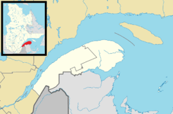 Saint-Denis Location in eastern Quebec | |
| Coordinates: 47°30′N 69°56′W / 47.500°N 69.933°WCoordinates: 47°30′N 69°56′W / 47.500°N 69.933°W[1] | |
| Country |
|
| Province |
|
| Region | Bas-Saint-Laurent |
| RCM | Kamouraska |
| Constituted | July 1, 1855 |
| Government[2] | |
| • Mayor | Jean Dallaire |
| • Federal riding | Montmagny—L'Islet—Kamouraska—Rivière-du-Loup |
| • Prov. riding | Côte-du-Sud |
| Area[2][3] | |
| • Total | 97.30 km2 (37.57 sq mi) |
| • Land | 33.71 km2 (13.02 sq mi) |
| Population (2011)[3] | |
| • Total | 503 |
| • Density | 14.9/km2 (39/sq mi) |
| • Pop 2006-2011 |
|
| • Dwellings | 356 |
| Time zone | EST (UTC−5) |
| • Summer (DST) | EDT (UTC−4) |
| Postal code(s) | G0L 2R0 |
| Area code(s) | 418 and 581 |
| Highways |
|
| Website |
www |
Saint-Denis-De La Bouteillerie is a municipality in the Canadian province of Quebec, located in the Kamouraska Regional County Municipality.
Prior to November 16, 2013, it was known simply as Saint-Denis and was a parish municipality. The name change was a revival of an old name used from 1845 to 1855. When the name was officially changed, it was also retroactively declared that the name should have been known as Saint-Denis de Kamouraska since 1855.[4]
It contains the house of Jean-Charles Chapais, a National Historic Site of Canada.
See also
References
- ↑ Reference number 416348 of the Commission de toponymie du Québec (French)
- 1 2 Geographic code 14055 in the official Répertoire des municipalités (French)
- 1 2 "(Code 2414055) Census Profile". 2011 census. Statistics Canada. 2012.
- ↑ "Modifications aux municipalités du Québec" (PDF). Institut de la statistique du Québec. 2013. ISSN 1715-6408.
External links
-
 Media related to Saint-Denis-De La Bouteillerie at Wikimedia Commons
 |
La Malbaie Saint Lawrence River |
Kamouraska | | |
| |
||||
| ||||
| | ||||
| Rivière-Ouelle | Saint-Philippe-de-Néri |
| Cities & Towns | |
|---|---|
| Municipalities | |
| Parishes | |
| Unorganized territories | |
| |
This article is issued from Wikipedia - version of the 12/1/2016. The text is available under the Creative Commons Attribution/Share Alike but additional terms may apply for the media files.