Saint-Géréon
| Saint-Géréon | ||
|---|---|---|
|
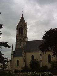
The church in Saint-Géréon | ||
| ||
 Saint-Géréon | ||
|
Location within Pays de la Loire region  Saint-Géréon | ||
| Coordinates: 47°22′12″N 1°11′50″W / 47.37°N 1.1972°WCoordinates: 47°22′12″N 1°11′50″W / 47.37°N 1.1972°W | ||
| Country | France | |
| Region | Pays de la Loire | |
| Department | Loire-Atlantique | |
| Arrondissement | Ancenis | |
| Canton | Ancenis | |
| Intercommunality | Pays d'Ancenis | |
| Government | ||
| • Mayor (2008–2014) | Jean-Pierre Fleurance | |
| Area1 | 7.51 km2 (2.90 sq mi) | |
| Population (1999)2 | 2,487 | |
| • Density | 330/km2 (860/sq mi) | |
| Time zone | CET (UTC+1) | |
| • Summer (DST) | CEST (UTC+2) | |
| INSEE/Postal code | 44160 / 44150 | |
| Elevation |
6–51 m (20–167 ft) (avg. 28 m or 92 ft) | |
|
1 French Land Register data, which excludes lakes, ponds, glaciers > 1 km² (0.386 sq mi or 247 acres) and river estuaries. 2 Population without double counting: residents of multiple communes (e.g., students and military personnel) only counted once. | ||
.svg.png)
Saint-Géréon is a commune in the Loire-Atlantique department in western France.
See also
References
| Wikimedia Commons has media related to Saint-Géréon. |
This article is issued from Wikipedia - version of the 2/6/2015. The text is available under the Creative Commons Attribution/Share Alike but additional terms may apply for the media files.