Guémené-Penfao
| Guémené-Penfao | ||
|---|---|---|
|
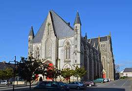
The church in Guémené-Penfao | ||
| ||
 Guémené-Penfao | ||
|
Location within Pays de la Loire region  Guémené-Penfao | ||
| Coordinates: 47°37′51″N 1°49′53″W / 47.6308°N 1.8314°WCoordinates: 47°37′51″N 1°49′53″W / 47.6308°N 1.8314°W | ||
| Country | France | |
| Region | Pays de la Loire | |
| Department | Loire-Atlantique | |
| Arrondissement | Châteaubriant | |
| Canton | Guémené-Penfao | |
| Intercommunality | Pays de Redon | |
| Government | ||
| • Mayor (2008–2014) | Yannick Bigaud | |
| Area1 | 105.51 km2 (40.74 sq mi) | |
| Population (2006)2 | 4,876 | |
| • Density | 46/km2 (120/sq mi) | |
| • Urban | 52,758 | |
| Time zone | CET (UTC+1) | |
| • Summer (DST) | CEST (UTC+2) | |
| INSEE/Postal code | 44067 / 44290 | |
| Elevation | 2–83 m (6.6–272.3 ft) | |
| Website | http://www.mairie-guemene-penfao.fr/ | |
|
1 French Land Register data, which excludes lakes, ponds, glaciers > 1 km² (0.386 sq mi or 247 acres) and river estuaries. 2 Population without double counting: residents of multiple communes (e.g., students and military personnel) only counted once. | ||
.svg.png)
Guémené-Penfao is a commune in the Loire-Atlantique department in western France, north of Nantes. The commune is widespread, and includes the former communes of Beslé-sur-Vilaine and Guénouvry.
Its name comes from the Breton language: "gwen" (white), "menez" (hill, mountain), "pen" (head), and "faou" (beech tree). The main economic activity is agriculture.
Édith Cresson's doctoral thesis was on the demography of women in Guémené-Penfao.[1]
See also
References
| Wikimedia Commons has media related to Guémené-Penfao. |
This article is issued from Wikipedia - version of the 6/11/2016. The text is available under the Creative Commons Attribution/Share Alike but additional terms may apply for the media files.