Le Loroux-Bottereau
| Le Loroux-Bottereau | ||
|---|---|---|
|
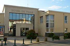
The town hall in Le Loroux-Bottereau | ||
| ||
 Le Loroux-Bottereau | ||
|
Location within Pays de la Loire region  Le Loroux-Bottereau | ||
| Coordinates: 47°14′20″N 1°20′52″W / 47.2389°N 1.3478°WCoordinates: 47°14′20″N 1°20′52″W / 47.2389°N 1.3478°W | ||
| Country | France | |
| Region | Pays de la Loire | |
| Department | Loire-Atlantique | |
| Arrondissement | Nantes | |
| Canton | Le Loroux-Bottereau | |
| Intercommunality | Loire-Divatte | |
| Government | ||
| • Mayor (2008–2014) | Paul Corbet | |
| Area1 | 45.31 km2 (17.49 sq mi) | |
| Population (2006)2 | 6,023 | |
| • Density | 130/km2 (340/sq mi) | |
| Time zone | CET (UTC+1) | |
| • Summer (DST) | CEST (UTC+2) | |
| INSEE/Postal code | 44084 / 44430 | |
| Elevation | 2–93 m (6.6–305.1 ft) | |
| Website | http://www.loroux-bottereau.fr/ | |
|
1 French Land Register data, which excludes lakes, ponds, glaciers > 1 km² (0.386 sq mi or 247 acres) and river estuaries. 2 Population without double counting: residents of multiple communes (e.g., students and military personnel) only counted once. | ||
.svg.png)
Le Loroux-Bottereau is a commune in the Loire-Atlantique department in western France.
Sister cities
The following cities are twinned with Le Loroux-Bottereau:[1]
-
 Saarijärvi, Central Finland, Finland
 -
 Trittau (Amt) consisting of the following municipalities: Grande; Grönwohld; Großensee; Hamfelde; Hohenfelde; Köthel; Lütjensee; Rausdorf; Trittau and Witzhave, Germany
References
- ↑ "Ystävyyskuntatoiminta" (in Norwegian). City of Saarijärvi. Retrieved 2012-06-01.
See also
- Communes of the Loire-Atlantique department
- The works of Jean Fréour Breton sculptor who converted a local windmill to a calvary.
| Wikimedia Commons has media related to Le Loroux-Bottereau. |
This article is issued from Wikipedia - version of the 2/5/2015. The text is available under the Creative Commons Attribution/Share Alike but additional terms may apply for the media files.