Rolinda, California
Coordinates: 36°44′07″N 119°57′43″W / 36.73528°N 119.96194°W
| Rolinda | |
|---|---|
| Unincorporated community | |
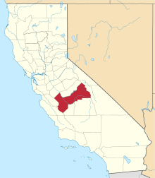
 Rolinda  Rolinda Location in California | |
| Coordinates: 36°44′07″N 119°57′43″W / 36.73528°N 119.96194°W | |
| Country | United States |
| State | California |
| County | Fresno County |
| Elevation[1] | 253 ft (77 m) |
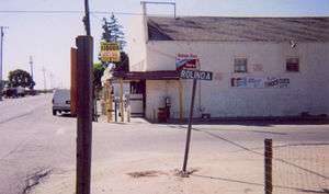
Rolinda is a small unincorporated agricultural community in Fresno County, California, United States.[1] It is located on the Southern Pacific Railroad 10 miles (16 km) west of downtown Fresno,[2] at an elevation of 253 feet (77 m).[1] It is located along State Route 180. Official U.S. Geological Survey coordinates for the community are 36°44′07″N 119°57′43″W / 36.73528°N 119.96194°W. The community is in area code 559. It does not have its own ZIP code and mail uses the Fresno ZIP code of 93706.
Land surrounding the small community is mostly irrigated, la Thompson seedless grapevines used for Raisin and agricultural land. Row crops include feed crops such as alfalfa. It is common to see cattle egrets patrolling the fields for insect life. Raptors including red-shouldered hawks are also widely visible during daylight hours.
A landmark south of town is the Houghton-Kearney Elementary School, 8905 W. Kearney Blvd., o preceded by the Houghton School at 9128 W Whitesbridge Road where the old bus barn still stands closed in 1953 operated by the K-12 Central Unified School District. The facility is located at 36°43′39″N 119°57′01″W / 36.72750°N 119.95028°W. In addition the preceding Kearney School was on Kearney Ave (now renamed Chateau Fresno Have...names were switched at one point in time?) Cross street Annadale that old timers tell me where the new Kearney Mansion was to be built about 4 times the size of the existing French style servants house still known as mansion and there is no records found that verify what I was told but Kearney school was there! A post office operated at Rolinda from 1895 to 1902.[2]