Sunnyside, Fresno County, California
| Sunnyside | |
|---|---|
| census-designated place | |
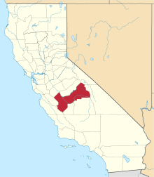
 Sunnyside Location in California | |
| Coordinates: 36°44′57″N 119°41′58″W / 36.74917°N 119.69944°WCoordinates: 36°44′57″N 119°41′58″W / 36.74917°N 119.69944°W | |
| Country |
|
| State |
|
| County | Fresno County |
| Area[1] | |
| • Total | 1.932 sq mi (5.005 km2) |
| • Land | 1.932 sq mi (5.005 km2) |
| • Water | 0 sq mi (0 km2) 0% |
| Elevation[2] | 328 ft (100 m) |
| Population (2010) | |
| • Total | 4,234 |
| • Density | 2,200/sq mi (850/km2) |
| Time zone | Pacific (PST) (UTC-8) |
| • Summer (DST) | PDT (UTC-7) |
| GNIS feature IDs | 1659922; 2583154 |
| U.S. Geological Survey Geographic Names Information System: Sunnyside, Fresno County, California; U.S. Geological Survey Geographic Names Information System: Sunnyside, Fresno County, California | |
Sunnyside (formerly, Maltermoro)[3] is a census-designated place[4] in Fresno County, California.[2] It is located on the Southern Pacific Railroad 5 miles (8 km) north-northeast of Malaga,[3] at an elevation of 328 feet (100 m).[2] At the 2010 census, Sunnyside's population was 4,235.
The Maltermoro post office operated from 1894 to 1913.[3] The name honored postmaster George H. Malter.[3]
Demographics
The 2010 United States Census[5] reported that Sunnyside had a population of 4,235. The population density was 2,191.7 people per square mile (846.2/km²). The racial makeup of Sunnyside was 2,687 (63.4%) White, 176 (4.2%) African American, 58 (1.4%) Native American, 467 (11.0%) Asian, 6 (0.1%) Pacific Islander, 640 (15.1%) from other races, and 201 (4.7%) from two or more races. Hispanic or Latino of any race were 1,525 persons (36.0%).
The Census reported that 4,231 people (99.9% of the population) lived in households, 4 (0.1%) lived in non-institutionalized group quarters, and 0 (0%) were institutionalized.
There were 1,490 households, out of which 484 (32.5%) had children under the age of 18 living in them, 916 (61.5%) were opposite-sex married couples living together, 154 (10.3%) had a female householder with no husband present, 71 (4.8%) had a male householder with no wife present. There were 61 (4.1%) unmarried opposite-sex partnerships, and 11 (0.7%) same-sex married couples or partnerships. 294 households (19.7%) were made up of individuals and 173 (11.6%) had someone living alone who was 65 years of age or older. The average household size was 2.84. There were 1,141 families (76.6% of all households); the average family size was 3.24.
The population was spread out with 981 people (23.2%) under the age of 18, 356 people (8.4%) aged 18 to 24, 861 people (20.3%) aged 25 to 44, 1,190 people (28.1%) aged 45 to 64, and 847 people (20.0%) who were 65 years of age or older. The median age was 43.1 years. For every 100 females there were 98.5 males. For every 100 females age 18 and over, there were 93.2 males.
There were 1,562 housing units at an average density of 808.3 per square mile (312.1/km²), of which 1,199 (80.5%) were owner-occupied, and 291 (19.5%) were occupied by renters. The homeowner vacancy rate was 1.5%; the rental vacancy rate was 5.5%. 3,237 people (76.4% of the population) lived in owner-occupied housing units and 994 people (23.5%) lived in rental housing units.
References
- ↑ "2010 Census U.S. Gazetteer Files – Places – California". United States Census Bureau.
- 1 2 3 U.S. Geological Survey Geographic Names Information System: Sunnyside, Fresno County, California
- 1 2 3 4 Durham, David L. (1998). California's Geographic Names: A Gazetteer of Historic and Modern Names of the State. Clovis, Calif.: Word Dancer Press. p. 1112. ISBN 1-884995-14-4.
- ↑ U.S. Geological Survey Geographic Names Information System: Sunnyside, Fresno County, California
- ↑ "2010 Census Interactive Population Search: CA - Sunnyside CDP". U.S. Census Bureau. Retrieved July 12, 2014.