Panoche Junction, California
Coordinates: 36°32′46″N 120°29′17″W / 36.54611°N 120.48806°W
| Panoche Junction | |
|---|---|
| Unincorporated community | |
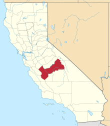
 Panoche Junction  Panoche Junction Location in California | |
| Coordinates: 36°32′46″N 120°29′17″W / 36.54611°N 120.48806°W | |
| Country | United States |
| State | California |
| County | Fresno County |
| Elevation[1] | 515 ft (157 m) |
Panoche Junction is an unincorporated community in Fresno County, California.[1] It is located 15 miles (24 km) west-southwest of Tranquillity,[2] at an elevation of 515 feet (157 m).[1]
References
This article is issued from Wikipedia - version of the 7/5/2016. The text is available under the Creative Commons Attribution/Share Alike but additional terms may apply for the media files.