Richfield Springs, New York
| Richfield Springs, New York | |
|---|---|
| Village | |
 | |
 Richfield Springs, New York Location within the state of New York | |
| Coordinates: 42°51′11″N 74°59′15″W / 42.85306°N 74.98750°WCoordinates: 42°51′11″N 74°59′15″W / 42.85306°N 74.98750°W | |
| Country | United States |
| State | New York |
| County | Otsego |
| Area | |
| • Total | 1.0 sq mi (2.6 km2) |
| • Land | 1.0 sq mi (2.6 km2) |
| • Water | 0.0 sq mi (0.0 km2) |
| Elevation | 1,312 ft (400 m) |
| Population (2010) | |
| • Total | 1,264 |
| • Density | 1,300/sq mi (490/km2) |
| Time zone | Eastern (EST) (UTC-5) |
| • Summer (DST) | EDT (UTC-4) |
| ZIP code | 13439 |
| Area code(s) | 315 |
| FIPS code | 36-61489 |
| GNIS feature ID | 0962471 |
| Website | Village of Richfield Springs |
Richfield Springs is a village located in the Town of Richfield, on the north-central border of Otsego County, New York. The population was 1,264 at the 2010 census. The name is derived from some local sulfur springs.
Geography
The village is at the north end of Canadarago Lake and is at the border of Herkimer County, New York.
Richfield Springs is located at 42°51′11″N 74°59′15″W / 42.85306°N 74.98750°W (42.853065, -74.987623).[1]
According to the United States Census Bureau, the village has a total area of 1.0 square mile (2.6 km2), all of it land.
U.S. Highway 20, New York State Route 28, and New York State Route 167 converge on Richfield Springs. US 20 and NY 28 intersect outside the western end of the village limits and overlap for a brief time inside the village, while NY 167 has its southern terminus at US 20 in the center of the village.
Demographics
| Historical population | |||
|---|---|---|---|
| Census | Pop. | %± | |
| 1870 | 696 | — | |
| 1880 | 1,307 | 87.8% | |
| 1890 | 1,623 | 24.2% | |
| 1900 | 1,537 | −5.3% | |
| 1910 | 1,503 | −2.2% | |
| 1920 | 1,388 | −7.7% | |
| 1930 | 1,333 | −4.0% | |
| 1940 | 1,209 | −9.3% | |
| 1950 | 1,534 | 26.9% | |
| 1960 | 1,630 | 6.3% | |
| 1970 | 1,540 | −5.5% | |
| 1980 | 1,561 | 1.4% | |
| 1990 | 1,565 | 0.3% | |
| 2000 | 1,255 | −19.8% | |
| 2010 | 1,264 | 0.7% | |
| Est. 2015 | 1,225 | [2] | −3.1% |
As of the census[4] of 2000, there were 1,255 people, 536 households, and 324 families residing in the village. The population density was 1,259.2 people per square mile (484.6/km²). There were 619 housing units at an average density of 621.1 per square mile (239.0/km²). The racial makeup of the village was 96.02% White, 0.56% African American, 0.56% Native American, 0.88% Asian, 0.64% Pacific Islander, and 1.35% from two or more races. Hispanic or Latino of any race were 0.56% of the population.
There were 536 households out of which 22.8% had children under the age of 18 living with them, 47.0% were married couples living together, 9.7% had a female householder with no husband present, and 39.4% were non-families. 34.0% of all households were made up of individuals and 19.0% had someone living alone who was 65 years of age or older. The average household size was 2.27 and the average family size was 2.93.
In the village the population was spread out with 20.7% under the age of 18, 7.1% from 18 to 24, 22.1% from 25 to 44, 27.1% from 45 to 64, and 23.0% who were 65 years of age or older. The median age was 45 years. For every 100 females there were 85.9 males. For every 100 females age 18 and over, there were 79.3 males.
The median income for a household in the village was $30,170, and the median income for a family was $40,956. Males had a median income of $29,097 versus $20,455 for females. The per capita income for the village was $16,865. About 7.1% of families and 12.2% of the population were below the poverty line, including 16.1% of those under age 18 and 9.7% of those age 65 or over.
Noted architecture
Industrialist Cyrus McCormick from Chicago commissioned the famed New York architectural firm of McKim, Mead, and White to build a shingle-style "cottage" for him and his family on the edge of the village, on Warren Street, the estate would be known as Clayton Lodge. Built in 1882 the sprawling estate with stables and other outbuildings afforded him fresh air living in the summers. The grounds of the estate were landscaped by the foremost designer, Frederick Law Olmsted. The mansion was razed in 1957, but the shingle style stable, albeit altered, is extant today.
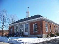
Neighboring McCormick's estate, also on Sunset Hill, was the residence of Eugene D. Stocker. His estate, complete with main house, guest house, and stable, was designed by architect Dwight James Baum in 1923. It is extant today and for tax purposes it resides in the Town of Warren, in Herkimer County New York. The Stocker estate, named "Sunset Hill" was listed with the National Register of Historic Places January 4, 2007.[5] The Richfield Springs Post Office was listed on the National Register of Historic Places in 1989.[5]
The village is home to three national historic districts: Church Street Historic District, East Main Street Historic District, and West Main Street-West James Street Historic District. Also listed is the Baker Octagon Barn.[5]
Notable People
- Gaylord Graves, former Wisconsin State Assemblyman
- Benjamin Pringle, former US Congressman
References
- ↑ "US Gazetteer files: 2010, 2000, and 1990". United States Census Bureau. 2011-02-12. Retrieved 2011-04-23.
- ↑ "Annual Estimates of the Resident Population for Incorporated Places: April 1, 2010 to July 1, 2015". Retrieved July 2, 2016.
- ↑ "Census of Population and Housing". Census.gov. Archived from the original on May 11, 2015. Retrieved June 4, 2015.
- ↑ "American FactFinder". United States Census Bureau. Retrieved 2008-01-31.
- 1 2 3 National Park Service (2009-03-13). "National Register Information System". National Register of Historic Places. National Park Service.
External links
Municipalities and communities of Otsego County, New York, United States | ||
|---|---|---|
| City | 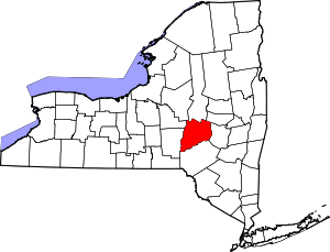 | |
| Towns | ||
| Villages | ||
| CDPs | ||
| Other hamlets | ||
| Footnotes | ‡This populated place also has portions in an adjacent county or counties | |