Oneonta (town), New York
| Oneonta, New York | |
|---|---|
| Town | |
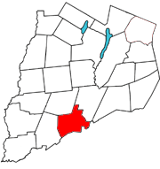 Otsego County map with the Town of Oneonta in Red | |
| Coordinates: 42°28′20″N 75°4′28″W / 42.47222°N 75.07444°WCoordinates: 42°28′20″N 75°4′28″W / 42.47222°N 75.07444°W | |
| Country | United States |
| State | New York |
| County | Otsego |
| Area | |
| • Total | 33.6 sq mi (87.1 km2) |
| • Land | 33.5 sq mi (86.8 km2) |
| • Water | 0.1 sq mi (0.4 km2) |
| Elevation | 1,368 ft (417 m) |
| Population (2010) | |
| • Total | 5,229 |
| • Density | 160/sq mi (60/km2) |
| Time zone | Eastern (EST) (UTC-5) |
| • Summer (DST) | EDT (UTC-4) |
| ZIP code | 13820 |
| Area code(s) | 607 |
| FIPS code | 36-54892 |
| GNIS feature ID | 0979310 |
Oneonta is a town in Otsego County, New York, USA. The population was 5,229 at the 2010 census.
The Town of Oneonta surrounds the City of Oneonta which has a population of 13,791. The meaning of the native word "oneonta" is City of the Hills.
History
The town was first settled before the American Revolution by Palatine Germans and Dutch settlers from the Hudson Valley. In 1779, the army of General Clinton passed through the area to join the Sullivan Expedition.
The Town of Oneonta was established in 1830 from parts of the Towns of Otego and Milford.
The community of Oneonta, developed from earlier "McDonaldville" and "Milfordville," in the town became a railroad center for such lines as the Delaware and Hudson. The world's largest locomotive roundhouse stood in Oneonta until a larger one was constructed in Germany. This community set itself off from the town by incorporating as a village in 1848.
The normal school, established in 1889, is now the State University of New York at Oneonta.
The Village of Oneonta became a city in 1908. This small city was an important manufacturing center in the early 20th Century.
The Linn Trailer Corp. was built in West End in 1929. Founded by H.H. Linn of nearby Morris, he was replaced in 1937 by Arthur Perkins of the Unadilla Trailer Co. of New Berlin, NY, who obtained several patents of his own relating to trailers and built front wheel drive vans until Great American Industries took over in 1948. Union problems closed their doors in 1952, delaying vital military contracts that Lyncoach Corp. was formed to complete, who later moved into the original Linn building until the 1970s when relocating to a branch factory in Troy, AL.
People of note
- Harlow E. Bundy, the Bundy Manufacturing Company was a forerunner of IBM.
- Paul Reubens, resided briefly on Chestnut St. as a child.
- Jerry Jeff Walker, musician, grew up on East End Ave.
- Henry E. Huntington, railroad magnate, was born in Oneonta (1850)
Geography
According to the United States Census Bureau, the town has a total area of 33.6 square miles (87.1 km²), of which, 33.5 square miles (86.8 km²) of it is land and 0.1 square miles (0.4 km²) of it (0.42%) is water.
The town is bordered by the Town of Otego to the West, the Town of Laurens to the Northwest, the Town of Milford to the Northeast, and Delaware County to the South.
Otego Creek and Oneonta Creek flow into the Susquehanna River in the town.
Interstate 88 follows the course of the Susquehanna River through the town. New York State Route 7 and New York State Route 23, New York State Route 28 and New York State Route 205 all pass through the town.
Demographics
| Historical population | |||
|---|---|---|---|
| Census | Pop. | %± | |
| 1830 | 1,828 | — | |
| 1840 | 1,936 | 5.9% | |
| 1850 | 1,902 | −1.8% | |
| 1860 | 2,158 | 13.5% | |
| 1870 | 2,568 | 19.0% | |
| 1880 | 4,461 | 73.7% | |
| 1890 | 1,746 | −60.9% | |
| 1900 | 1,763 | 1.0% | |
| 1910 | 1,307 | −25.9% | |
| 1920 | 1,601 | 22.5% | |
| 1930 | 2,314 | 44.5% | |
| 1940 | 2,673 | 15.5% | |
| 1950 | 3,508 | 31.2% | |
| 1960 | 4,068 | 16.0% | |
| 1970 | 4,185 | 2.9% | |
| 1980 | 4,655 | 11.2% | |
| 1990 | 4,963 | 6.6% | |
| 2000 | 4,994 | 0.6% | |
| 2010 | 5,229 | 4.7% | |
| Est. 2014 | 5,123 | [1] | −2.0% |
As of the census[3] of 2000, there were 4,994 people, 1,958 households, and 1,298 families residing in the town. The population density was 149.1 people per square mile (57.6/km²). There were 2,117 housing units at an average density of 63.2 per square mile (24.4/km²). The racial makeup of the town was 90.67% White, 6.15% Black or African American, 0.34% Native American, 0.80% Asian, 0.04% Pacific Islander, 0.92% from other races, and 1.08% from two or more races. Hispanic or Latino of any race were 3.38% of the population.
There were 1,958 households out of which 28.4% had children under the age of 18 living with them, 52.5% were married couples living together, 9.5% had a female householder with no husband present, and 33.7% were non-families. 27.1% of all households were made up of individuals and 11.4% had someone living alone who was 65 years of age or older. The average household size was 2.32 and the average family size was 2.80.
In the town the population was spread out with 23.8% under the age of 18, 9.1% from 18 to 24, 23.6% from 25 to 44, 26.9% from 45 to 64, and 16.5% who were 65 years of age or older. The median age was 41 years. For every 100 females there were 96.8 males. For every 100 females age 18 and over, there were 91.4 males.
The median income for a household in the town was $35,634, and the median income for a family was $43,125. Males had a median income of $34,679 versus $23,246 for females. The per capita income for the town was $18,841. About 6.2% of families and 15.2% of the population were below the poverty line, including 10.8% of those under age 18 and 4.8% of those age 65 or over.
Locations and settlements
- Emmons – Community at the eastern edge of the town.
- Oneonta – The City of Oneonta.
- Oneonta Plains – A lowland north of the Susquehanna River.
- Southside – The area south of The Susquehanna River which has a major retail shopping district, hotels, and some private residences.
- West End – The area just west of the City of Oneonta.
- West Oneonta – A hamlet northwest of the City of Oneonta.
Parks and recreation
- Fortin Park – At the former site of F&F Airpark at the eastern edge of the town, Fortin Park features large, flat, open, grassy spaces, with pavilions, barbecues, walking trails, playgrounds, ballfields, and former aircraft hangars used for skating in the winter and available for other activities in the warmer months.
- Oneonta Greenway Trail – A series of trails located behind the city municipal complex. In the future there are plans of extending this network of trails to Fortin Park more than 6 miles away.
- Otego Creek Access Site (former Hemstreet Park) – The town assumed ownership of the former Hemstreet Park located on the Otego Creek in 2004. This small park nestled on the bank of the Otego Creek offers picnicking and fishing from the bank and a place to launch a boat on the creek, which flows into the Susquehanna.
Retail
Southside Mall was built in 1983.
References
- ↑ "Annual Estimates of the Resident Population for Incorporated Places: April 1, 2010 to July 1, 2014". Retrieved June 4, 2015.
- ↑ "Census of Population and Housing". Census.gov. Retrieved June 4, 2015.
- ↑ "American FactFinder". United States Census Bureau. Retrieved 2008-01-31.
External links
Municipalities and communities of Otsego County, New York, United States | ||
|---|---|---|
| City | 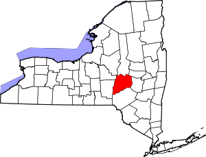 | |
| Towns | ||
| Villages | ||
| CDPs | ||
| Other hamlets | ||
| Footnotes | ‡This populated place also has portions in an adjacent county or counties | |