Pleš, Kočevje
| Pleš | |
|---|---|
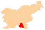
 Pleš Location in Slovenia | |
| Coordinates: 45°33′14.20″N 14°47′20.19″E / 45.5539444°N 14.7889417°ECoordinates: 45°33′14.20″N 14°47′20.19″E / 45.5539444°N 14.7889417°E | |
| Country |
|
| Traditional region | Lower Carniola |
| Statistical region | Southeast Slovenia |
| Municipality | Kočevje |
| Elevation | 644.1 m (2,113.2 ft) |
| Population (2002) | |
| • Total | none |
Pleš (pronounced [ˈpleːʃ]; German: Plösch[1][2]) is a remote settlement in the Municipality of Kočevje in southern Slovenia. The area is part of the traditional region of Lower Carniola and is now included in the Southeast Slovenia Statistical Region.[3] Its territory is now part of the village of Borovec pri Kočevski Reki.[4]
History
Pleš was listed in the land registry of 1498 as having a full farm; in the land registry of 1574 the farm had been divided into two halves. Pleš gradually grew into a settlement with six houses. In 1971 Pleš had only one house, located about 100 m west of the road to Kočevska Reka.[4]
References
- ↑ Leksikon občin kraljestev in dežel zastopanih v državnem zboru, vol. 6: Kranjsko. 1906. Vienna: C. Kr. Dvorna in Državna Tiskarna, p. 34.
- ↑ Ferenc, Mitja. 2007. Nekdanji nemški jezikovni otok na kočevskem. Kočevje: Pokrajinski muzej, p. 4.
- ↑ Kočevje municipal site
- 1 2 Savnik, Roman, ed. 1971. Krajevni leksikon Slovenije, vol. 2. Ljubljana: Državna založba Slovenije, p. 217.
External links
This article is issued from Wikipedia - version of the 6/6/2016. The text is available under the Creative Commons Attribution/Share Alike but additional terms may apply for the media files.