Gornja Topla Reber
| Gornja Topla Reber | |
|---|---|
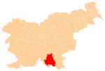
 Gornja Topla Reber Location in Slovenia | |
| Coordinates: 45°45′40.58″N 14°58′33.73″E / 45.7612722°N 14.9760361°ECoordinates: 45°45′40.58″N 14°58′33.73″E / 45.7612722°N 14.9760361°E | |
| Country |
|
| Traditional region | Lower Carniola |
| Statistical region | Southeast Slovenia |
| Municipality | Kočevje |
| Elevation | 838.9 m (2,752.3 ft) |
| Population (2002) | |
| • Total | none |
Gornja Topla Reber (pronounced [ˈɡoːɾnja ˈtɔːpla ˈɾeːbəɾ]; German: Oberwarmberg[1]) is a remote abandoned settlement in the Municipality of Kočevje in southern Slovenia. The area is part of the traditional region of Lower Carniola and is now included in the Southeast Slovenia Statistical Region.[2] Its territory is now part of the village of Topla Reber.[3]
History
Gornja Topla Reber was a village inhabited by Gottschee Germans. In the winter of 1941–1942 one of the first Partisan bases in the Kočevje area was established in the vicinity. The settlement was burned by Italian troops on 14 August 1942 during the Rog Offensive.[3] Together with Dolnja Topla Reber, it was merged into the settlement of Topla Reber in 1955.[4]
References
- ↑ Ferenc, Mitja. 2007. Nekdanji nemški jezikovni otok na kočevskem. Kočevje: Pokrajinski muzej, p. 4.
- ↑ Kočevje municipal site
- 1 2 Savnik, Roman, ed. 1971. Krajevni leksikon Slovenije, vol. 2. Ljubljana: Državna založba Slovenije, p. 246.
- ↑ "Preimovanje, dopolnitve in popravki nekaterih krajevnih imen." 1955. Dolenjski list 8(25) (1 July): 4. (Slovene)
External links
- Gornja Topla Reber on Geopedia
- Pre–World War II list of oeconyms and family names in Gornja Topla Reber
This article is issued from Wikipedia - version of the 11/18/2016. The text is available under the Creative Commons Attribution/Share Alike but additional terms may apply for the media files.