Kočarji
| Kočarji | |
|---|---|
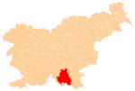
 Kočarji Location in Slovenia | |
| Coordinates: 45°35′30.28″N 14°56′59.98″E / 45.5917444°N 14.9499944°ECoordinates: 45°35′30.28″N 14°56′59.98″E / 45.5917444°N 14.9499944°E | |
| Country |
|
| Traditional region | Lower Carniola |
| Statistical region | Southeast Slovenia |
| Municipality | Kočevje |
| Area | |
| • Total | 4.22 km2 (1.63 sq mi) |
| Elevation | 496.4 m (1,628.6 ft) |
| Population (2002) | |
| • Total | 29 |
| • Density | 6.9/km2 (18/sq mi) |
| [1] | |
Kočarji (pronounced [ˈkoːtʃaɾji]; sometimes Kožarji,[2][3] German: Niedermösel[2][4]) is a settlement in the hills southeast of the town of Kočevje in southern Slovenia. The area is part of the traditional region of Lower Carniola and is now included in the Southeast Slovenia Statistical Region.[5]
The local church, dedicated to Saint Ambrose, was first mentioned in documents dating to 1526 and only survives as a ruin.[6]
References
- ↑ Statistical Office of the Republic of Slovenia
- 1 2 Leksikon občin kraljestev in dežel zastopanih v državnem zboru, vol. 6: Kranjsko. 1906. Vienna: C. Kr. Dvorna in Državna Tiskarna, p. 38.
- ↑ Glonar, Joža. 1933. Poučni slovar, vol. 2. Ljubljana: Umetniška propaganda, p. 562.
- ↑ Ferenc, Mitja. 2007. Nekdanji nemški jezikovni otok na kočevskem. Kočevje: Pokrajinski muzej, p. 4.
- ↑ Kočevje municipal site
- ↑ Slovenian Ministry of Culture register of national heritage reference number ešd 2768
External links
This article is issued from Wikipedia - version of the 8/14/2014. The text is available under the Creative Commons Attribution/Share Alike but additional terms may apply for the media files.