Pim Island
 2005 photo of Pim Island | |
| Geography | |
|---|---|
| Location | Northern Canada |
| Coordinates | 78°44′N 074°25′W / 78.733°N 74.417°W |
| Archipelago |
Queen Elizabeth Islands Canadian Arctic Archipelago |
| Administration | |
|
Canada | |
| Territory | Nunavut |
| Region | Qikiqtaaluk |
| Demographics | |
| Population | Uninhabited |
Pim Island (previously Bedford Pim Island)[1] is located off the eastern coast of Ellesmere Island, part of the Qikiqtaaluk Region of the Canadian territory of Nunavut. Located within the Canadian Arctic Archipelago, it is a part of the Queen Elizabeth Islands.
Pim Island is separated from Ellesmere Island by Rice Strait, the waterway that connects Rosse Bay to the north and Buchanan Strait to the south.[2] Nares Strait is to the east. Pim Island is 6 km. from Cocked Hat Island.
History
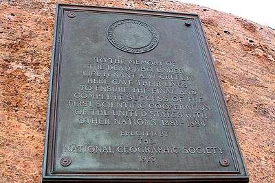
The Adolphus Greely expedition wintered at Camp Clay in 1883,[3] and in 1884, Cape Sabine was the rescue site for Greely and the Lady Franklin Bay Expedition.[4] The island is named in honour of naval officer and barrister Bedford Clapperton Trevelyan Pim of the HMS Resolute.
References
- ↑ Greely, A. W. (2007). Handbook of Polar Discoveries. Read Books. p. 238. ISBN 1-4067-6645-3.
- ↑ Dieck, Herman Dieck (1885). The Marvellous Wonders of the Polar World. Philadelphia: Thompson National Pub. Co. p. 521. OCLC 6878914.
- ↑ Dick, Lyle (2001). Muskox land: Ellesmere Island in the age of contact. University of Calgary Press. p. 281. ISBN 1-55238-050-5.
- ↑ Guttridge, Leonard F. (2000-09-01). "Ghosts of Cape Sabine: the harrowing true story of the Greely expedition". Arctic Institute of North America of the University of Calgary. Retrieved 2008-04-14.
External links
- Pim Island in the Atlas of Canada - Toporama; Natural Resources Canada