Pico da Cruz (village)
| Pico da Cruz | |
|---|---|
|
The mountain peak and the northern part of the village. | |
 | |
| Coordinates: 17°06′10″N 25°03′11″W / 17.1028°N 25.0531°WCoordinates: 17°06′10″N 25°03′11″W / 17.1028°N 25.0531°W | |
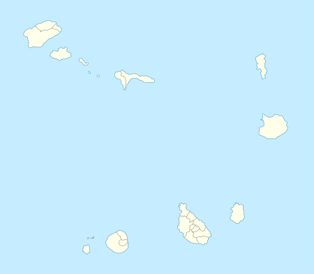
| Country | Cape Verde |
| Island | Santo Antão |
| Municipality | Paul |
| Civil parish | Santo António das Pombas |
| Population (2010)[1] | |
| • Total | 138 |

Pico da Cruz is a settlement in the northeastern part of the island of Santo Antão, Cape Verde. Its 2010 census population was 128. It is situated 6 km southwest of Pombas and 10 km northeast of the island capital Porto Novo. Its elevation is about 1,400 meters. The village is named after its nearby peak. Access with the rest of the municipality is waliking through a pathway via Janela, its roads link to Estrada da Corda with one access. The area forms a part of the Cova-Ribeira da Torre-Paul Natural Park.[2]
The Paul-Porto Novo municipality had no official marcation. The municipal boundary is marked 50 meters south of the village center and halfway between Ribeirão Fundo is where the municipal boundary turns at Cintra de Vaca. The boundary is also the North-South Zone boundary of Santo Antão's sporting competitions. The natural park boundary is about 600 meters to a kilometer south of the village. There is another village named Pico da Cruz on the island, in the southern part Pico da Cruz - Parte Sul which the village does not include. The area mainly includes the portion of Cinta de Vaca.
The area around the village are mostly forested with pine, laurisilva and deciduous trees, grasslands dominates further north.
The area offers panoramic views incuding the Ribeira do Paul, Ribeira da Janela, the east of Porto Novo and the south of the island and the island of São Vicente and its surrounding islets.
See also
References
- ↑ "2010 Census results". Instituto Nacional de Estatística Cabo Verde (in Portuguese). 17 March 2014.
- ↑ Cabo Verde visor
Subdivisions of the island of Santo Antão | |||||||||||||||
|---|---|---|---|---|---|---|---|---|---|---|---|---|---|---|---|
| Paul |
|  | |||||||||||||
| Porto Novo | |||||||||||||||
| Ribeira Grande | |||||||||||||||
| Parish | 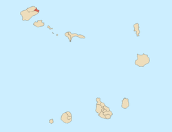 | |
|---|---|---|
| Communities and settlements | ||
| Geographical features |
| |
| Landmarks and points of Interests | ||
| Culture | ||