Ribeira do Paul
| Ribeira do Paul | |
|---|---|
 | |
| Country | Cape Verde |
| Basin | |
| Main source |
Cabo da Ribeira near Pico da Cruz Santo Antão |
| River mouth |
Atlantic Ocean 17°09′00″N 25°00′47″W / 17.150°N 25.013°WCoordinates: 17°09′00″N 25°00′47″W / 17.150°N 25.013°W |
| Physical characteristics | |
| Length | 8 km (5.0 mi) |
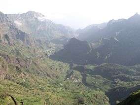
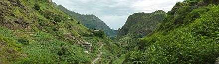
Ribeira do Paul is a stream that flows in the northeastern part of the island of Santo Antão in Cape Verde. The stream flows from southwest to northeast and is nearly 8 km in height. The entire valley belongs to Cova-Ribeira da Torre-Paul Natural Park.[1]

Geography
The stream begins northwest of the mountain top and the caldera (Cabo da Ribeira) of Pico da Cruz (1583 m). The river flows through a narrow steep gorge, some of which has been terraced and is irrigated to support agricultural production including sugar canes, coffees, banana and mandioka. The river flows into the Atlantic Ocean at the town of Pombas. Other settlements along the river include Eito de Baixo and Eito. Other features along the river including Chã de Canela, Lombo Comprido, Dragoeiro, Chã de Erva, Lombo de Joana, Lombinho, Chã de João Vaz, Chã de Padre, Ladeira and Chãzinha.
Flora
Endangered flora includes Tornabenea insularis.
See also
References
Further reading
- Carlos Ferrão, Estudos sobre a Ilha de Santo Antão (Studies on Santo Antão Island), Imprensa Nacional, Lisbon, 1898, p. 116
- Nótula sobre aspectos recentes e actuais da erosão fluvial na ilha de Santo Antão (article by Suzanne Daveau on Finisterra. Revista portuguesa de geografia, vol. XXIV, no. 46, 1988, p. 287-301)
| Parish | 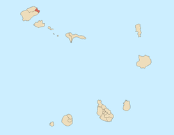 | |
|---|---|---|
| Communities and settlements | ||
| Geographical features |
| |
| Landmarks and points of Interests | ||
| Culture | ||