Parryville, Pennsylvania
| Parryville, Pennsylvania | |
|---|---|
| Borough | |
.jpg) | |
 Location of Parryville in Carbon County | |
 Parryville, Pennsylvania Location of Parryville in Pennsylvania | |
| Coordinates: 40°49′28″N 75°40′09″W / 40.82444°N 75.66917°WCoordinates: 40°49′28″N 75°40′09″W / 40.82444°N 75.66917°W | |
| Country | United States |
| State | Pennsylvania |
| County | Carbon |
| Area | |
| • Total | 1.6 sq mi (4 km2) |
| • Land | 1.6 sq mi (4 km2) |
| • Water | 0.04 sq mi (0.1 km2) |
| Elevation | 450 ft (140 m) |
| Population (2010) | |
| • Total | 525 |
| • Density | 330/sq mi (130/km2) |
| Time zone | EST (UTC-5) |
| • Summer (DST) | EDT (UTC-4) |
| ZIP code | 18244 |
| Area code(s) | 570 |
Parryville is a borough in Carbon County, Pennsylvania, United States. The population was 525 at the 2010 census.[1] Parryville is located 3 miles (5 km) southeast of Lehighton and 1 mile (1.6 km) north of Bowmanstown off Route 248 and 4 miles (6 km) northwest of Palmerton. Parryville's elevation is 450 feet (140 m) above sea level.
Geography
Parryville is located in southern Carbon County at 40°49′28″N 75°40′9″W / 40.82444°N 75.66917°W (40.824403, -75.669246),[2] along Pohopoco Creek just north of its confluence with the Lehigh River. Interstate 476 (the Northeast Extension of the Pennsylvania Turnpike) passes through the western part of the borough, with access from Exit 74 (U.S. Route 209) just north of the borough limits. I-476 leads south 20 miles (32 km) to the Allentown area and north 50 miles (80 km) to Scranton.
According to the United States Census Bureau, Parryville has a total area of 1.63 square miles (4.22 km2), of which 1.61 square miles (4.17 km2) is land and 0.02 square miles (0.04 km2), or 1.03%, is water.[1]
Demographics
| Historical population | |||
|---|---|---|---|
| Census | Pop. | %± | |
| 1880 | 657 | — | |
| 1890 | 605 | −7.9% | |
| 1900 | 723 | 19.5% | |
| 1910 | 590 | −18.4% | |
| 1920 | 578 | −2.0% | |
| 1930 | 553 | −4.3% | |
| 1940 | 521 | −5.8% | |
| 1950 | 598 | 14.8% | |
| 1960 | 580 | −3.0% | |
| 1970 | 528 | −9.0% | |
| 1980 | 481 | −8.9% | |
| 1990 | 488 | 1.5% | |
| 2000 | 478 | −2.0% | |
| 2010 | 525 | 9.8% | |
| Est. 2015 | 507 | [3] | −3.4% |
| Sources:[4][5][6] | |||
As of the census[5] of 2000, there were 478 people, 189 households, and 140 families residing in the borough. The population density was 293.2 people per square mile (113.2/km²). There were 222 housing units at an average density of 136.2 per square mile (52.6/km²). The racial makeup of the borough was 98.74% White, 0.21% African American, 0.42% Native American, 0.21% from other races, and 0.42% from two or more races. Hispanic or Latino of any race were 0.21% of the population.
There were 189 households, out of which 23.8% had children under the age of 18 living with them, 62.4% were married couples living together, 6.9% had a female householder with no husband present, and 25.9% were non-families. 19.6% of all households were made up of individuals, and 9.5% had someone living alone who was 65 years of age or older. The average household size was 2.53 and the average family size was 2.91.
In the borough the population was spread out, with 18.8% under the age of 18, 7.9% from 18 to 24, 29.5% from 25 to 44, 28.9% from 45 to 64, and 14.9% who were 65 years of age or older. The median age was 41 years. For every 100 females there were 108.7 males. For every 100 females age 18 and over, there were 112.0 males.
The median income for a household in the borough was $33,958, and the median income for a family was $37,917. Males had a median income of $28,409 versus $19,688 for females. The per capita income for the borough was $15,409. About 1.6% of families and 6.2% of the population were below the poverty line, including none of those under age 18 and 19.3% of those age 65 or over.
References
| Wikimedia Commons has media related to Parryville, Pennsylvania. |
- 1 2 "Geographic Identifiers: 2010 Demographic Profile Data (G001): Parryville borough, Pennsylvania". U.S. Census Bureau, American Factfinder. Retrieved April 3, 2015.
- ↑ "US Gazetteer files: 2010, 2000, and 1990". United States Census Bureau. 2011-02-12. Retrieved 2011-04-23.
- ↑ "Annual Estimates of the Resident Population for Incorporated Places: April 1, 2010 to July 1, 2015". Retrieved July 2, 2016.
- ↑ "Census of Population and Housing". U.S. Census Bureau. Archived from the original on May 11, 2015. Retrieved 11 December 2013.
- 1 2 "American FactFinder". United States Census Bureau. Archived from the original on September 11, 2013. Retrieved 2008-01-31.
- ↑ "Incorporated Places and Minor Civil Divisions Datasets: Subcounty Resident Population Estimates: April 1, 2010 to July 1, 2012". Population Estimates. U.S. Census Bureau. Archived from the original on June 17, 2013. Retrieved 11 December 2013.
Municipalities and communities of Carbon County, Pennsylvania, United States | ||
|---|---|---|
| Boroughs | 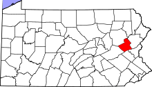 | |
| Townships | ||
| CDPs | ||
| Unincorporated communities | ||
| Footnotes | ‡This populated place also has portions in an adjacent county or counties | |