Weissport East, Pennsylvania
| Weissport East | |
| Census-designated place | |
| Country | United States |
|---|---|
| State | Pennsylvania |
| County | Carbon |
| Township | Franklin |
| Elevation | 607 ft (185.0 m) |
| Coordinates | 40°50′00″N 75°41′24″W / 40.83333°N 75.69000°WCoordinates: 40°50′00″N 75°41′24″W / 40.83333°N 75.69000°W |
| Area | 2.1 sq mi (5.4 km2) |
| - land | 2.1 sq mi (5 km2) |
| - water | 0.0 sq mi (0 km2), 0% |
| Population | 1,624 (2010) |
| Density | 774.0/sq mi (298.8/km2) |
| Timezone | EST (UTC-5) |
| - summer (DST) | EDT (UTC-4) |
| ZIP code | 18235 |
| Area code | 610 & 484 |
 Location of Weissport East in Carbon County | |
 Location of Weissport East in Pennsylvania | |
 Location of Pennsylvania in the United States | |
Weissport East is a census-designated place (CDP) in Franklin Township, Carbon County, Pennsylvania, United States. The population was 1,624 at the 2010 census,[1] down from 1,936 at the 2000 census.
Geography
Weissport East is located in southern Carbon County at 40°50′0″N 75°41′24″W / 40.83333°N 75.69000°W (40.833374, -75.690075).[2] It is bordered to the west by the borough of Weissport, to the southwest by the Lehigh River, and to the south by Pohopoco Creek, across which is the borough of Parryville.
According to the United States Census Bureau, the CDP has a total area of 2.1 square miles (5.4 km2), all of it land.[1]
U.S. Route 209 passes through the community, leading west into Weissport and then Lehighton, and intersecting Interstate 476, the Northeast Extension of the Pennsylvania Turnpike, just east of the community. I-476 leads north to the Wilkes-Barre and Scranton area and south to the Allentown–Bethlehem area.
Demographics
As of the census[3] of 2000, there were 1,936 people, 804 households, and 567 families residing in the CDP. The population density was 927.4 people per square mile (357.7/km²). There were 860 housing units at an average density of 412.0/sq mi (158.9/km²). The racial makeup of the CDP was 99.07% White, 0.05% African American, 0.26% Native American, 0.21% Asian, and 0.41% from two or more races. Hispanic or Latino of any race were 0.10% of the population.
There were 804 households, out of which 24.0% had children under the age of 18 living with them, 59.0% were married couples living together, 7.8% had a female householder with no husband present, and 29.4% were non-families. 23.6% of all households were made up of individuals, and 11.9% had someone living alone who was 65 years of age or older. The average household size was 2.40 and the average family size was 2.82.
In the CDP the population was spread out, with 19.1% under the age of 18, 7.0% from 18 to 24, 28.6% from 25 to 44, 27.3% from 45 to 64, and 18.1% who were 65 years of age or older. The median age was 42 years. For every 100 females there were 97.3 males. For every 100 females age 18 and over, there were 94.2 males.
The median income for a household in the CDP was $33,454, and the median income for a family was $48,558. Males had a median income of $36,356 versus $21,778 for females. The per capita income for the CDP was $19,432. About 1.2% of families and 3.8% of the population were below the poverty line, including 5.0% of those under age 18 and 11.0% of those age 65 or over.
References
- 1 2 "Geographic Identifiers: 2010 Census Summary File 1 (G001): Weissport East CDP, Pennsylvania". U.S. Census Bureau, American Factfinder. Retrieved April 8, 2015.
- ↑ "US Gazetteer files: 2010, 2000, and 1990". United States Census Bureau. 2011-02-12. Retrieved 2011-04-23.
- ↑ "American FactFinder". United States Census Bureau. Retrieved 2008-01-31.
Municipalities and communities of Carbon County, Pennsylvania, United States | ||
|---|---|---|
| Boroughs | 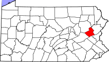 | |
| Townships | ||
| CDPs | ||
| Unincorporated communities | ||
| Footnotes | ‡This populated place also has portions in an adjacent county or counties | |