Packer Township, Carbon County, Pennsylvania
| Packer Township | |
| Settlement | |
 Mail Pouch barn near Hudsondale | |
| Country | United States |
|---|---|
| State | Pennsylvania |
| County | Carbon |
| Elevation | 1,637 ft (499.0 m) |
| Coordinates | 40°52′29″N 75°54′59″W / 40.87472°N 75.91639°WCoordinates: 40°52′29″N 75°54′59″W / 40.87472°N 75.91639°W |
| Area | 27.9 sq mi (72.3 km2) |
| - land | 27.9 sq mi (72 km2) |
| - water | 0.0 sq mi (0 km2), 0% |
| Population | 998 (2010) |
| Density | 35.7/sq mi (13.8/km2) |
| Timezone | EST (UTC-5) |
| - summer (DST) | EDT (UTC-4) |
| Area code | 570 |
 Location of Packer Township in Carbon County | |
 Location of Packer Township in Pennsylvania | |
 Location of Pennsylvania in the United States | |
Packer Township is a township in Carbon County, Pennsylvania, United States. The population was 998 at the 2010 census.[1]
Geography
The township is in the western part of Carbon County and is bounded by Schuylkill County on the west. According to the United States Census Bureau, the township has a total area of 27.9 square miles (72.3 km2), all of it land.[1] It is in the Delaware River watershed and is drained by Quakake Creek, a tributary of the Lehigh River, except for a portion in the southwest that is drained by the Schuylkill River via Still Creek and the Little Schuylkill River. Its villages include Gerhards, Hudsondale, and Stewarts.
Broad Mountain, reaching an elevation of 1,804 feet (550 m) above sea level, occupies the southern half of the township, while Spring Mountain is along the northern border and has a high point of 1,913 feet (583 m). Between the two mountains is the valley of Quakake Creek, the settled part of the township, with elevations from 1,050 to 1,300 feet (320 to 400 m). Pennsylvania Route 93 passes through the township, crossing Quakake Creek in Hudsondale and leading northwest across Spring Mountain 7 miles (11 km) to Hazleton and southeast across Broad Mountain 8 miles (13 km) to Jim Thorpe, the Carbon County seat.
Neighboring municipalities
- Banks Township (north)
- Weatherly (northeast)
- Lehigh Township (east)
- Nesquehoning (south)
- Rush Township, Schuylkill County (southwest)
- Kline Township, Schuylkill County (west)
Demographics
As of the census[2] of 2000, there were 986 people, 372 households, and 274 families residing in the township. The population density was 34.2 people per square mile (13.2/km²). There were 407 housing units at an average density of 14.1/sq mi (5.5/km²). The racial makeup of the township was 98.17% White, 0.10% Native American, 0.20% Asian, 0.20% from other races, and 1.32% from two or more races. Hispanic or Latino of any race were 0.10% of the population.
There were 372 households. Of the households surveyed, 32.0% had children under the age of 18 living with them, 64.0% were married couples living together, 6.7% had a female householder with no husband present, and 26.1% were non-families. 21.8% of all households were made up of individuals, and 9.9% had someone living alone who was 65 years of age or older. The average household size was 2.62 and the average family size was 3.08.
In the township the population was spread out, with 23.9% under the age of 18, 4.7% from 18 to 24, 29.7% from 25 to 44, 24.1% from 45 to 64, and 17.5% who were 65 years of age or older. The median age was 41 years. For every 100 females there were 98.4 males. For every 100 females age 18 and over, there were 100.0 males.
The median income for a household in the township was $39,038, and the median income for a family was $43,250. Males had a median income of $31,111 versus $21,181 for females. The per capita income for the township was $17,038. About 3.3% of families and 7.2% of the population were below the poverty line, including 1.7% of those under age 18 and 12.7% of those age 65 or over.
References
- 1 2 "Geographic Identifiers: 2010 Census Summary File 1 (G001): Packer township, Carbon County, Pennsylvania". U.S. Census Bureau, American Factfinder. Retrieved April 7, 2015.
- ↑ "American FactFinder". United States Census Bureau. Retrieved 2008-01-31.
Municipalities and communities of Carbon County, Pennsylvania, United States | ||
|---|---|---|
| Boroughs | 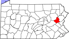 | |
| Townships | ||
| CDPs | ||
| Unincorporated communities | ||
| Footnotes | ‡This populated place also has portions in an adjacent county or counties | |