Orange, Vermont
| Orange, Vermont | |
|---|---|
| Town | |
 Orange, Vermont | |
 Orange, Vermont Location in the United States | |
| Coordinates: 44°9′11″N 72°23′27″W / 44.15306°N 72.39083°WCoordinates: 44°9′11″N 72°23′27″W / 44.15306°N 72.39083°W | |
| Country | United States |
| State | Vermont |
| County | Orange |
| Area | |
| • Total | 39.0 sq mi (101.0 km2) |
| • Land | 38.8 sq mi (100.4 km2) |
| • Water | 0.2 sq mi (0.6 km2) |
| Elevation | 1,923 ft (586 m) |
| Population (2000) | |
| • Total | 965 |
| • Density | 24.9/sq mi (9.6/km2) |
| Time zone | Eastern (EST) (UTC-5) |
| • Summer (DST) | EDT (UTC-4) |
| ZIP code | 05641 |
| Area code(s) | 802 |
| FIPS code | 50-53425[1] |
| GNIS feature ID | 1462167[2] |
Orange is a town in Orange County, Vermont, United States. The population was 965 at the 2000 census.
Geography
According to the United States Census Bureau, the town has a total area of 39.0 square miles (101.0 km2), of which 38.8 square miles (100.4 km2) is land and 0.2 square mile (0.6 km2) (0.59%) is water. The Waits River flows through the northeastern part of Orange.[3] Orange is also the site of the Dix Reservoir, the major water supply for adjoining Barre, along with its associated water processing facilities.
Demographics
| Historical population | |||
|---|---|---|---|
| Census | Pop. | %± | |
| 1800 | 348 | — | |
| 1810 | 686 | 97.1% | |
| 1820 | 751 | 9.5% | |
| 1830 | 1,016 | 35.3% | |
| 1840 | 984 | −3.1% | |
| 1850 | 1,007 | 2.3% | |
| 1860 | 936 | −7.1% | |
| 1870 | 733 | −21.7% | |
| 1880 | 731 | −0.3% | |
| 1890 | 589 | −19.4% | |
| 1900 | 598 | 1.5% | |
| 1910 | 644 | 7.7% | |
| 1920 | 485 | −24.7% | |
| 1930 | 508 | 4.7% | |
| 1940 | 482 | −5.1% | |
| 1950 | 410 | −14.9% | |
| 1960 | 430 | 4.9% | |
| 1970 | 540 | 25.6% | |
| 1980 | 752 | 39.3% | |
| 1990 | 915 | 21.7% | |
| 2000 | 965 | 5.5% | |
| 2010 | 1,072 | 11.1% | |
| Est. 2014 | 1,073 | [4] | 0.1% |
| U.S. Decennial Census[5] | |||
As of the census[1] of 2000, there were 965 people, 362 households, and 278 families residing in the town. The population density was 24.9 people per square mile (9.6/km2). There were 422 housing units at an average density of 10.9 per square mile (4.2/km2). The racial makeup of the town was 98.55% White, 0.10% Native American, 0.21% Asian, 0.52% from other races, and 0.62% from two or more races. Hispanic or Latino of any race were 1.55% of the population.
There were 362 households out of which 37.3% had children under the age of 18 living with them, 64.9% were couples living together and joined in either marriage or civil union, 6.6% had a female householder with no husband present, and 23.2% were non-families. 16.9% of all households were made up of individuals and 4.4% had someone living alone who was 65 years of age or older. The average household size was 2.67 and the average family size was 3.03.
In the town the population was spread out with 27.0% under the age of 18, 6.1% from 18 to 24, 29.2% from 25 to 44, 27.0% from 45 to 64, and 10.6% who were 65 years of age or older. The median age was 38 years. For every 100 females there were 97.3 males. For every 100 females age 18 and over, there were 97.8 males.
The median income for a household in the town was $40,300, and the median income for a family was $44,375. Males had a median income of $32,500 versus $22,614 for females. The per capita income for the town was $16,356. About 6.7% of families and 7.1% of the population were below the poverty line, including 3.5% of those under age 18 and 8.0% of those age 65 or over.
References
- 1 2 "American FactFinder". United States Census Bureau. Retrieved 2008-01-31.
- ↑ "US Board on Geographic Names". United States Geological Survey. 2007-10-25. Retrieved 2008-01-31.
- ↑ DeLorme (1996). Vermont Atlas & Gazetteer. Yarmouth, Maine: DeLorme. ISBN 0-89933-016-9
- ↑ "Annual Estimates of the Resident Population for Incorporated Places: April 1, 2010 to July 1, 2014". Retrieved June 4, 2015.
- ↑ "U.S. Decennial Census". United States Census Bureau. Archived from the original on May 11, 2015. Retrieved May 16, 2015.
External links
Municipalities and communities of Orange County, Vermont, United States | ||
|---|---|---|
| Towns | 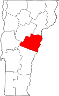 | |
| Villages | ||
| CDPs | ||
| Other communities | ||