Williamstown, Vermont
| Williamstown, Vermont | |
|---|---|
| Town | |
|
Historical society and church in Williamstown | |
 Williamstown, Vermont | |
 Williamstown, Vermont Location in the United States | |
| Coordinates: 44°6′58″N 72°32′27″W / 44.11611°N 72.54083°WCoordinates: 44°6′58″N 72°32′27″W / 44.11611°N 72.54083°W | |
| Country | United States |
| State | Vermont |
| County | Orange |
| Area | |
| • Total | 40.3 sq mi (104.5 km2) |
| • Land | 40.2 sq mi (104.1 km2) |
| • Water | 0.2 sq mi (0.4 km2) |
| Elevation | 896 ft (273 m) |
| Population (2000) | |
| • Total | 3,225 |
| • Density | 80.3/sq mi (31.0/km2) |
| Time zone | Eastern (EST) (UTC-5) |
| • Summer (DST) | EDT (UTC-4) |
| ZIP code | 05679 |
| Area code(s) | 802 |
| FIPS code | 50-84175[1] |
| GNIS feature ID | 1462262[2] |

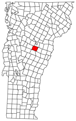
Williamstown is a town in Orange County, Vermont, United States. The population was 3,389 at the 2010 census, making it the second largest municipality in the county.
Geography
According to the United States Census Bureau, the town has a total area of 40.3 square miles (104.5 km2), of which 40.2 square miles (104.1 km2) is land and 0.2 square mile (0.4 km2) (0.40%) is water.
The Ainsworth State Park is a 905-acre (3.7 km2) park located in Williamstown which provides camping, hiking, and hunting.
Demographics
| Historical population | |||
|---|---|---|---|
| Census | Pop. | %± | |
| 1790 | 146 | — | |
| 1800 | 839 | 474.7% | |
| 1810 | 1,353 | 61.3% | |
| 1820 | 1,481 | 9.5% | |
| 1830 | 1,487 | 0.4% | |
| 1840 | 1,620 | 8.9% | |
| 1850 | 1,452 | −10.4% | |
| 1860 | 1,377 | −5.2% | |
| 1870 | 1,236 | −10.2% | |
| 1880 | 1,038 | −16.0% | |
| 1890 | 1,188 | 14.5% | |
| 1900 | 1,610 | 35.5% | |
| 1910 | 1,726 | 7.2% | |
| 1920 | 1,526 | −11.6% | |
| 1930 | 1,608 | 5.4% | |
| 1940 | 1,477 | −8.1% | |
| 1950 | 1,600 | 8.3% | |
| 1960 | 1,553 | −2.9% | |
| 1970 | 1,822 | 17.3% | |
| 1980 | 2,284 | 25.4% | |
| 1990 | 2,839 | 24.3% | |
| 2000 | 3,225 | 13.6% | |
| 2010 | 3,389 | 5.1% | |
| Est. 2014 | 3,383 | [3] | −0.2% |
| U.S. Decennial Census[4] | |||
As of the census[1] of 2000, there were 3,225 people, 1,248 households, and 889 families residing in the town. The population density was 80.3 people per square mile (31.0/km2). There were 1,318 housing units at an average density of 32.8 per square mile (12.7/km2). The racial makeup of the town was 98.33% White, 0.06% African American, 0.28% Native American, 0.12% Asian, 0.25% from other races, and 0.96% from two or more races. Hispanic or Latino of any race were 0.78% of the population.
There were 1,248 households out of which 34.1% had children under the age of 18 living with them, 58.7% were married couples living together, 8.4% had a female householder with no husband present, and 28.7% were non-families. 21.3% of all households were made up of individuals and 7.8% had someone living alone who was 65 years of age or older. The average household size was 2.58 and the average family size was 3.01.
In the town the population was spread out with 26.2% under the age of 18, 7.0% from 18 to 24, 32.5% from 25 to 44, 24.5% from 45 to 64, and 9.8% who were 65 years of age or older. The median age was 36 years. For every 100 females there were 105.0 males. For every 100 females age 18 and over, there were 98.4 males.
The median income for a household in the town was $38,929, and the median income for a family was $45,859. Males had a median income of $29,635 versus $22,378 for females. The per capita income for the town was $17,720. About 5.9% of families and 8.0% of the population were below the poverty line, including 10.9% of those under age 18 and 2.9% of those age 65 or over.
Notable people
- John Coughlin, awarded the Medal of Honor for his actions during the Civil War.[5]
- Thomas Davenport, inventor, constructed the first American DC electric motor.
- Rockwell J. Flint, Wisconsin state legislator and newspaper editor.
- Elijah Paine, United States senator.
- Joseph Raycroft, basketball coach.
References
- 1 2 "American FactFinder". United States Census Bureau. Retrieved 2008-01-31.
- ↑ "US Board on Geographic Names". United States Geological Survey. 2007-10-25. Retrieved 2008-01-31.
- ↑ "Annual Estimates of the Resident Population for Incorporated Places: April 1, 2010 to July 1, 2014". Retrieved June 4, 2015.
- ↑ "U.S. Decennial Census". United States Census Bureau. Retrieved May 16, 2015.
- ↑ "John Coughlin". Military Times. Retrieved July 2014. Check date values in:
|access-date=(help)
External links
Municipalities and communities of Orange County, Vermont, United States | ||
|---|---|---|
| Towns | 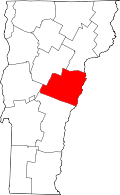 | |
| Villages | ||
| CDPs | ||
| Other communities | ||