National Register of Historic Places listings in North Smithfield, Rhode Island
This is a list of Registered Historic Places in North Smithfield, Rhode Island.
- This National Park Service list is complete through NPS recent listings posted December 2, 2016.[1]
| [2] |
Name on the Register[3] |
Image |
Date listed[4] |
Location |
City or town |
Description |
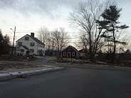
|---|
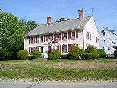
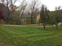
| 1 |
Peleg Arnold Tavern |
|
000000001974-07-30-0000July 30, 1974
(#74000046) |
Woonsocket Hill Rd.
41°59′21″N 71°32′02″W / 41.989167°N 71.533889°W / 41.989167; -71.533889 (Peleg Arnold Tavern) |
North Smithfield |
|
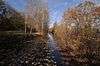
| 2 |
Blackstone Canal |
|
000000001971-05-06-0000May 6, 1971
(#71000030) |
From Steeple and Promenade Sts. in Providence to the Massachusetts border in North Smithfield
41°55′16″N 71°25′21″W / 41.921111°N 71.4225°W / 41.921111; -71.4225 (Blackstone Canal) |
Lincoln, Cumberland, Woonsocket, and North Smithfield |
Initial listing extended from Providence, through Pawtucket, and as far north as Lincoln; a 1991 expansion (#91001536) extended it to the state line; the canal itself extended into Worcester County, Massachusetts, where it is the subject of separate listings.
|
| 3 |
Forestdale Mill Village Historic District |
|
000000001972-06-05-0000June 5, 1972
(#72000041) |
East and west along Main St. and north on Maple Ave.
41°59′51″N 71°33′50″W / 41.9975°N 71.563889°W / 41.9975; -71.563889 (Forestdale Mill Village Historic District) |
North Smithfield |
|
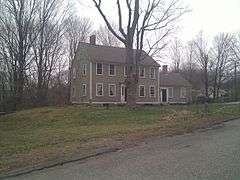
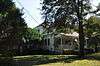
| 4 |
Tyler Mowry House |
|
000000001996-08-16-0000August 16, 1996
(#96000904) |
112 Sayles Hill Rd.
41°57′53″N 71°30′18″W / 41.964722°N 71.505°W / 41.964722; -71.505 (Tyler Mowry House) |
North Smithfield |
|
| 5 |
William Mowry House |
|
000000001983-02-10-0000February 10, 1983
(#83000001) |
Farnum Pike
41°56′52″N 71°33′33″W / 41.947778°N 71.559167°W / 41.947778; -71.559167 (William Mowry House) |
North Smithfield |
|
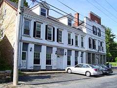
| 6 |
Slatersville Historic District |
|
000000001973-04-24-0000April 24, 1973
(#73000002) |
Main, Green, Church, and School Sts. and Ridge Rd.
41°59′53″N 71°34′57″W / 41.998056°N 71.5825°W / 41.998056; -71.5825 (Slatersville Historic District) |
North Smithfield |
|
| 7 |
Smithfield Road Historic District |
|
000000001987-02-18-0000February 18, 1987
(#87000036) |
Old Smithfield Rd., just north of Sayles Hill Road
41°58′02″N 71°29′34″W / 41.967222°N 71.492778°W / 41.967222; -71.492778 (Smithfield Road Historic District) |
North Smithfield |
|
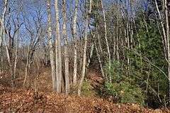
| 8 |
Three Dog Site, RI-151 |
|
000000001984-11-01-0000November 1, 1984
(#84000362) |
Off Routes 5/104 near the Smithfield line[5]
|
North Smithfield |
|
| 9 |
Todd Farm |
|
000000001983-02-10-0000February 10, 1983
(#83000004) |
670 Farnum Pike
41°57′57″N 71°32′26″W / 41.965833°N 71.540556°W / 41.965833; -71.540556 (Todd Farm) |
North Smithfield |
|
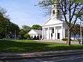
| 10 |
Union Village Historic District |
|
000000001978-07-28-0000July 28, 1978
(#78000011) |
West of Woonsocket on RI 146A
41°59′28″N 71°32′13″W / 41.991111°N 71.536944°W / 41.991111; -71.536944 (Union Village Historic District) |
North Smithfield |
|
See also
References
|
|---|
|
| Topics | | |
|---|
|
| Lists by county | |
|---|
|
| Lists by city | Bristol Coutny | |
|---|
| Kent County | |
|---|
| Newport County | |
|---|
| Providence County | |
|---|
| Washington County | |
|---|
|
|---|
|
-
 Category Category
-
 NRHP portal NRHP portal
- Massachusetts portal
|

_(extra_close)_(US48).svg.png)