National Register of Historic Places listings in Hopkinton, Rhode Island

This is a list of Registered Historic Places in Hopkinton, Rhode Island.

Contents: Counties in Rhode Island
This National Park Service list is complete through NPS recent listings posted December 2, 2016.[1]
[2] Name on the Register[3] Image Date listed[4] Location City or town Description
1 Black Farm Upload image
November 7, 1995
(#95001268)
Bounded by the Rockville-Alton Rd. (RI 112) and the Wood River
41°28′06″N 71°43′23″W / 41.468333°N 71.723056°W / 41.468333; -71.723056 (Black Farm)
Hopkinton
2 Bradford Village Historic District Upload image
May 30, 1996
(#96000573)
Roughly Bowling Ln. from the Pawcatuck River to Vars Ln. and Main St. from the Bradford Bridge to Church Ave.
41°24′08″N 71°45′06″W / 41.402222°N 71.751667°W / 41.402222; -71.751667 (Bradford Village Historic District)
Hopkinton and Westerly
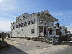
3 Hope Valley Historic District
Hope Valley Historic District
July 3, 2004
(#04000654)
Main Street
41°30′28″N 71°43′00″W / 41.507694°N 71.716586°W / 41.507694; -71.716586 (Hope Valley Historic District)
Hopkinton
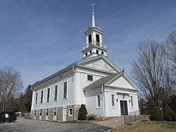
4 Hopkinton City Historic District
Hopkinton City Historic District
May 1, 1974
(#74000010)
Hopkinton
41°27′40″N 71°46′39″W / 41.461111°N 71.7775°W / 41.461111; -71.7775 (Hopkinton City Historic District)
Hopkinton
5 Tomaquag Rock Shelters Upload image
August 12, 1977
(#77000011)
Address Restricted
Hopkinton
6 Upper Rockville Mill
Upper Rockville Mill
July 5, 2006
(#06000552)
332 Canonchet Rd.
41°31′20″N 71°45′36″W / 41.522222°N 71.76°W / 41.522222; -71.76 (Upper Rockville Mill)
Hopkinton
7 Wyoming Village Historic District
Wyoming Village Historic District
May 2, 1974
(#74000014)
Roughly bounded by RI 3, RI 138, Old Nooseneck Hill Rd., Bridge and Prospect Sts.
41°30′57″N 71°42′12″W / 41.515833°N 71.703333°W / 41.515833; -71.703333 (Wyoming Village Historic District)
Hopkinton and Richmond

See also

References

  1. "National Register of Historic Places: Weekly List Actions". National Park Service, United States Department of the Interior. Retrieved on December 2, 2016.
  2. Numbers represent an ordering by significant words. Various colorings, defined here, differentiate National Historic Landmarks and historic districts from other NRHP buildings, structures, sites or objects.
  3. National Park Service (2009-03-13). "National Register Information System". National Register of Historic Places. National Park Service.
  4. The eight-digit number below each date is the number assigned to each location in the National Register Information System database, which can be viewed by clicking the number.
This article is issued from Wikipedia - version of the 11/8/2016. The text is available under the Creative Commons Attribution/Share Alike but additional terms may apply for the media files.