| [3] |
Name on the Register[4] |
Image |
Date listed[5] |
Location |
City or town |
Description |
|---|
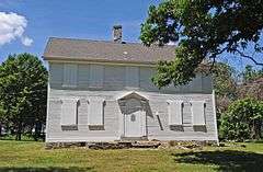
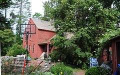
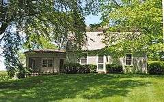
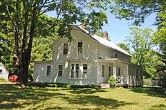
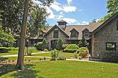
| 1 |
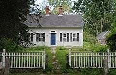
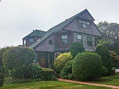
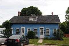
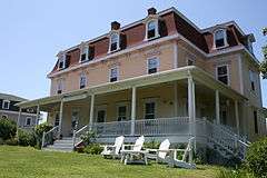
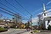
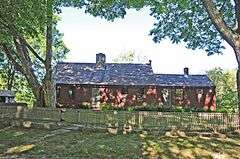
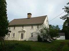
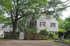
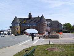
Allen-Madison House |
|
000000001980-03-28-0000March 28, 1980
(#80000015) |
Post Rd.
41°37′06″N 71°25′16″W / 41.618333°N 71.421111°W / 41.618333; -71.421111 (Allen-Madison House) |
North Kingstown |
|
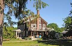
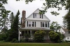
| 2 |
Anthony-Kinney Farm |
|
000000002013-04-17-0000April 17, 2013
(#13000178) |
505 Point Judith Road
41°24′26″N 71°28′44″W / 41.407219°N 71.478977°W / 41.407219; -71.478977 (Anthony-Kinney Farm) |
Narragansett |
|
| 3 |
Austin Farm Road Agricultural Area |
|
000000001977-08-16-0000August 16, 1977
(#77000009) |
6 mi (9.7 km) west of Exeter off Interstate 95
41°35′44″N 71°39′52″W / 41.595556°N 71.664444°W / 41.595556; -71.664444 (Austin Farm Road Agricultural Area) |
Exeter |
|
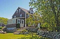
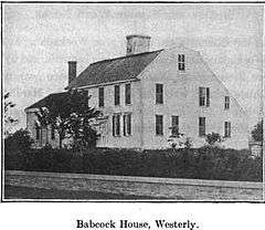
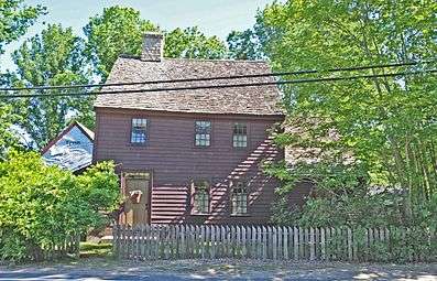
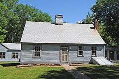
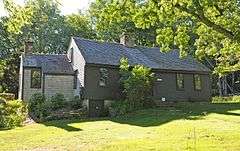
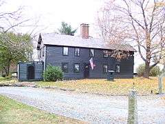
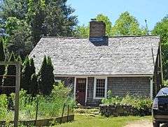
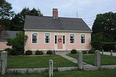
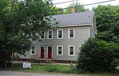
| 4 |
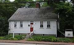
Babcock House |
|
000000001976-01-01-0000January 1, 1976
(#76000008) |
Main St.
41°20′14″N 71°42′43″W / 41.337222°N 71.711944°W / 41.337222; -71.711944 (Babcock House) |
Charlestown |
|
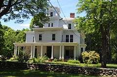
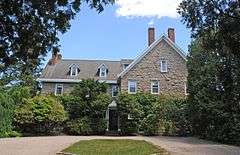
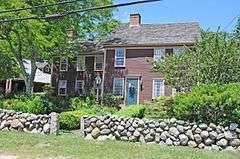
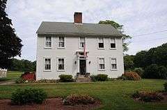
| 5 |
Babcock-Smith House |
|
000000001972-07-24-0000July 24, 1972
(#72000008) |
124 Granite St.
41°22′16″N 71°49′13″W / 41.371111°N 71.820278°W / 41.371111; -71.820278 (Babcock-Smith House) |
Westerly |
|
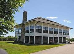
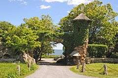
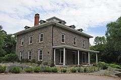
| 6 |
David S. Baker Estate |
|
000000002011-08-04-0000August 4, 2011
(#11000512) |
51 & 67 Prospect Ave.
41°33′54″N 71°27′11″W / 41.565°N 71.453056°W / 41.565; -71.453056 (David S. Baker Estate) |
North Kingstown |
|
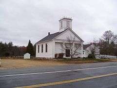
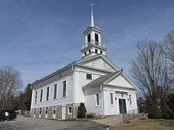
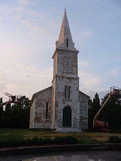
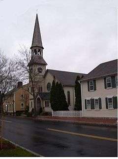
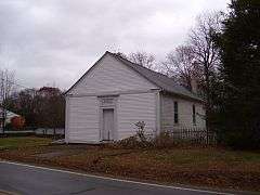
| 7 |
Baptist Church in Exeter |
|
000000001978-11-21-0000November 21, 1978
(#78000014) |
North of Arcadia on RI 165
41°34′36″N 71°42′36″W / 41.576667°N 71.71°W / 41.576667; -71.71 (Baptist Church in Exeter) |
Exeter |
|
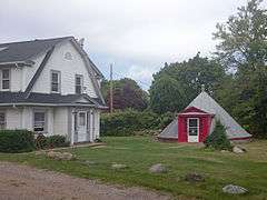
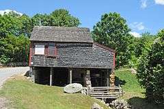
| 8 |
Black Farm |
Upload image |
000000001995-11-07-0000November 7, 1995
(#95001268) |
Bounded by the Rockville-Alton Rd. (RI 112) and the Wood River
41°28′06″N 71°43′23″W / 41.468333°N 71.723056°W / 41.468333; -71.723056 (Black Farm) |
Hopkinton |
|
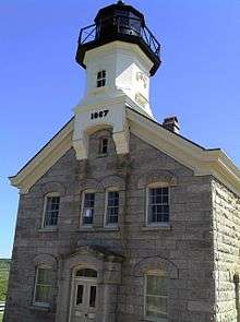
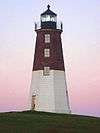
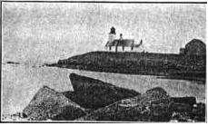
| 9 |
Block Island North Light |
|
000000001974-05-23-0000May 23, 1974
(#74000008) |
Sandy Point, off the northern end of Corn Neck Rd.
41°13′39″N 71°34′34″W / 41.2275°N 71.576111°W / 41.2275; -71.576111 (Block Island North Light) |
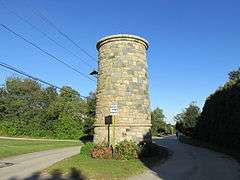
New Shoreham |
Built in 1867; still in use with its original lens.
|
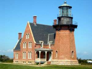
| 10 |
Block Island Southeast Light |
|
000000001997-09-25-0000September 25, 1997
(#97001264) |
South East Light Rd.
41°09′11″N 71°32′53″W / 41.153056°N 71.548056°W / 41.153056; -71.548056 (Block Island Southeast Light) |
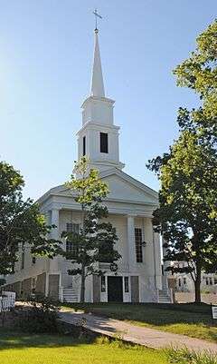
New Shoreham |
Built in 1874; best surviving example of late 19th-century U.S. lighthouse construction. Still in use.
|
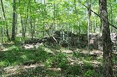
| 11 |
Bouchard Archeological Site, RI-1025 |
Upload image |
000000001984-11-01-0000November 1, 1984
(#84000370) |
Address Restricted
|
South Kingstown |
Listed in Usquepaug.
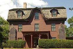
|
| 12 |
Bradford Village Historic District |
|
000000001996-05-30-0000May 30, 1996
(#96000573) |
Roughly Bowling Ln. from the Pawcatuck River to Vars Ln. and Main St. from the Bradford Bridge to Church Ave.
41°24′08″N 71°45′06″W / 41.402222°N 71.751667°W / 41.402222; -71.751667 (Bradford Village Historic District) |
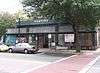
Hopkinton and Westerly |
|
| 13 |
Browning's Beach Historic District |
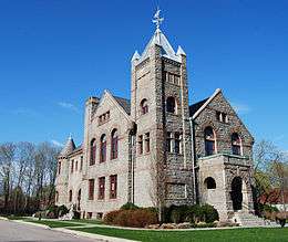
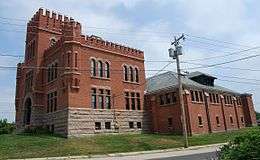
|
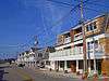
000000001997-09-05-0000September 5, 1997
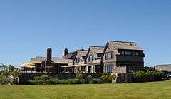
(#97000952) |
Browning's Beach, 0.5 mi (0.80 km) west of the junction of Card Pond and Matunuck Beach Rds.
41°22′26″N 71°33′52″W / 41.373889°N 71.564444°W / 41.373889; -71.564444 (Browning's Beach Historic District) |
South Kingstown |
|
| 14 |
Jireh Bull Blockhouse |
|
000000001983-11-03-0000November 3, 1983
(#83003869) |
Address Restricted
|
South Kingstown |
|
| 15 |
Camp Endicott |
|
000000001978-10-19-0000October 19, 1978
(#78000015) |
Between 7th and 10th Sts.
41°36′10″N 71°25′59″W / 41.602778°N 71.433056°W / 41.602778; -71.433056 (Camp Endicott) |
North Kingstown |
Mostly demolished; some Quonset huts survive at the Seabee Museum and Memorial Park
|
| 16 |
Carolina Village Historic District |
Upload image |
000000001974-05-02-0000May 2, 1974
(#74000009) |
Charlestown
41°27′31″N 71°39′51″W / 41.458611°N 71.664167°W / 41.458611; -71.664167 (Carolina Village Historic District) |
Charlestown and Richmond |
|
| 17 |
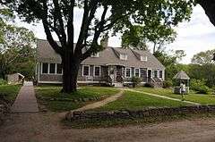
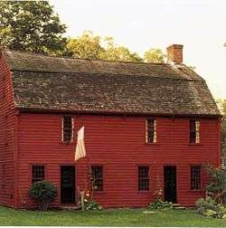
Silas Casey Farm |
|
000000001973-08-14-0000August 14, 1973
(#73000006) |
Boston Neck Rd.
41°30′40″N 71°26′01″W / 41.511111°N 71.433611°W / 41.511111; -71.433611 (Silas Casey Farm) |
North Kingstown |
|
| 18 |
Central Street Historic District |
|
000000001982-08-18-0000August 18, 1982
(#82000015) |
Both sides of Central Street from 5th Ave. to Boon St.
41°25′46″N 71°27′44″W / 41.429444°N 71.462222°W / 41.429444; -71.462222 (Central Street Historic District) |
Narragansett |
|
| 19 |
Peleg Champlin House |
Upload image |
000000001982-06-01-0000June 1, 1982
(#82000016) |
Rodman Pond Lane
41°11′24″N 71°35′38″W / 41.19°N 71.593889°W / 41.19; -71.593889 (Peleg Champlin House) |
New Shoreham |
|
| 20 |
Cocumscossoc Archeological Site |
|
000000001993-04-12-0000April 12, 1993
(#93000605) |
55 Richard Smith Drive
41°35′00″N 71°27′16″W / 41.5833°N 71.4544°W / 41.5833; -71.4544 (Cocumscossoc Archeological Site) |
North Kingstown |
Area around one of state's oldest houses has yielded considerable information from digs
|
| 21 |
Cottrell House |
|
000000001996-11-21-0000November 21, 1996
(#96001319) |
500 Waites Corner Rd.
41°29′22″N 71°33′55″W / 41.489444°N 71.565278°W / 41.489444; -71.565278 (Cottrell House) |
South Kingstown |
|
| 22 |
Crowfield Historic District |
|
000000001985-07-19-0000July 19, 1985
(#85001646) |
Boston Neck Rd.
41°32′00″N 71°25′27″W / 41.533333°N 71.424167°W / 41.533333; -71.424167 (Crowfield Historic District) |
North Kingstown |
|
| 23 |
Davisville Historic District |
|
000000001985-07-19-0000July 19, 1985
(#85001645) |
Davisville Rd.
41°37′17″N 71°28′52″W / 41.621389°N 71.481111°W / 41.621389; -71.481111 (Davisville Historic District) |
North Kingstown |
|
| 24 |
Devil's Foot Cemetery Archeological Site, RI-694 |
|
000000001984-11-15-0000November 15, 1984
(#84000562) |
Address Restricted
|
North Kingstown |
|
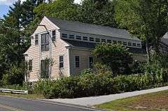
| 25 |
Dewey Cottage |
|
000000001992-05-07-0000May 7, 1992
(#92000467) |
668 Matunuck Beach Rd.
41°22′42″N 71°32′56″W / 41.378333°N 71.548889°W / 41.378333; -71.548889 (Dewey Cottage) |
South Kingstown |
|
| 26 |
District Schoolhouse No. 2 |
|
000000001980-01-04-0000January 4, 1980
(#80000016) |
Old Post Rd.
41°23′07″N 71°39′04″W / 41.385278°N 71.651111°W / 41.385278; -71.651111 (District Schoolhouse No. 2) |
Charlestown |
|
| 27 |
George Douglas House |
|
000000001975-10-10-0000October 10, 1975
(#75000006) |
South of Allenton at Tower Hill and Gilbert Stuart Rds.
41°31′18″N 71°27′46″W / 41.521667°N 71.462778°W / 41.521667; -71.462778 (George Douglas House) |
North Kingstown |
|
| 28 |
Druidsdream |
|
000000001989-07-20-0000July 20, 1989
(#89000940) |
144 Gibson Ave.
41°25′02″N 71°27′46″W / 41.417222°N 71.462778°W / 41.417222; -71.462778 (Druidsdream) |
Narragansett |
|
| 29 |
The Dunes Club |
|
000000002015-05-18-0000May 18, 2015
(#15000243) |
137 Boston Neck Rd.
41°26′23″N 71°26′56″W / 41.4398°N 71.4488°W / 41.4398; -71.4488 (The Dunes Club) |
Narragansett |
|
| 30 |
Dunmere |
|
000000002005-09-23-0000September 23, 2005
(#05001061) |
560 Ocean Rd.
41°24′16″N 71°27′44″W / 41.404444°N 71.462222°W / 41.404444; -71.462222 (Dunmere) |
Narragansett |
|
| 31 |
Earlscourt Historic District |
|
000000001982-08-18-0000August 18, 1982
(#82000017) |
Roughly bounded by Westmoreland, Noble, Woodward Sts., and Gibson Ave.(both sides)
41°25′15″N 71°27′42″W / 41.420833°N 71.461667°W / 41.420833; -71.461667 (Earlscourt Historic District) |
Narragansett |
|
| 32 |
Henry Eldred Farm |
|
000000001991-11-18-0000November 18, 1991
(#91001646) |
368 Old North Rd.
41°29′55″N 71°31′14″W / 41.498611°N 71.520556°W / 41.498611; -71.520556 (Henry Eldred Farm) |
South Kingstown |
|
| 33 |
George Fayerweather Blacksmith Shop |
|
000000001984-11-29-0000November 29, 1984
(#84000470) |
Intersection RI 108 and 138
41°28′49″N 71°31′13″W / 41.48038°N 71.52018°W / 41.48038; -71.52018 (George Fayerweather Blacksmith Shop) |
South Kingstown |
|
| 34 |
Fernwood Archeological Site, RI-702 |
Upload image |
000000001985-09-12-0000September 12, 1985
(#85002364) |
Address Restricted
|
South Kingstown |
|
| 35 |
Fisherville Historic and Archeological District |
Upload image |
000000001980-12-05-0000December 5, 1980
(#80000017) |
Address Restricted
|
Exeter |
|
| 36 |
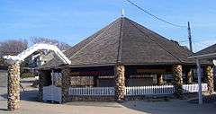
Flying Horse Carousel |
|
000000001980-01-11-0000January 11, 1980
(#80000019) |
Bay St.
41°18′32″N 71°51′31″W / 41.308889°N 71.858611°W / 41.308889; -71.858611 (Flying Horse Carousel) |
Westerly |
One of the earliest carousels still in use, dating to 1876. Horses suspended from chains rather than on poles, hence name.
|
| 37 |
Former Immaculate Conception Church |
|
000000001973-04-24-0000April 24, 1973
(#73000007) |
119 High St.
41°22′55″N 71°49′32″W / 41.381944°N 71.825556°W / 41.381944; -71.825556 (Former Immaculate Conception Church) |
Westerly |
|
| 38 |
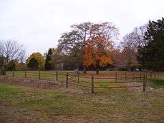
Fort Ninigret |
|
000000001970-04-28-0000April 28, 1970
(#70000004) |
Fort Neck Rd.
41°22′52″N 71°38′54″W / 41.381111°N 71.648333°W / 41.381111; -71.648333 (Fort Ninigret) |
Charlestown |
|
| 39 |
Foster Cove Archeological Site |
Upload image |
000000001980-05-06-0000May 6, 1980
(#80000018) |
Address Restricted
|
Charlestown |
|
| 40 |
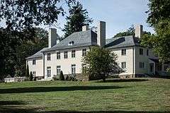
Gardencourt |
|
000000001982-08-18-0000August 18, 1982
(#82000018) |
10 Gibson Ave.
41°25′21″N 71°27′39″W / 41.4225°N 71.460833°W / 41.4225; -71.460833 (Gardencourt) |
Narragansett |
|
| 41 |
Ezekial Gardner House |
Upload image |
000000001985-07-19-0000July 19, 1985
(#85001654) |
297 Pendar Rd.
41°31′47″N 71°28′35″W / 41.529722°N 71.476389°W / 41.529722; -71.476389 (Ezekial Gardner House) |
North Kingstown |
|
| 42 |
R. R. Gardner House |
|
000000001996-11-21-0000November 21, 1996
(#96001320) |
700 Curtis Corner Rd.
41°27′10″N 71°31′54″W / 41.452778°N 71.531667°W / 41.452778; -71.531667 (R. R. Gardner House) |
South Kingstown |
|
| 43 |
Gladstone Springhouse and Bottling Plant |
|
000000001984-05-10-0000May 10, 1984
(#84002051) |
145A Boon St.
41°25′35″N 71°27′25″W / 41.426389°N 71.456944°W / 41.426389; -71.456944 (Gladstone Springhouse and Bottling Plant) |
Narragansett |
|
| 44 |
Great Salt Pond Archeological District |
Upload image |
000000001990-02-15-0000February 15, 1990
(#90000107) |
Address Restricted
|
New Shoreham |
|
| 45 |
Greene Inn |
|
000000001976-06-24-0000June 24, 1976
(#76000009) |
175 Ocean Rd.
41°25′23″N 71°27′23″W / 41.423056°N 71.456389°W / 41.423056; -71.456389 (Greene Inn) |
Narragansett |
Burned down in 1980.
|
| 46 |
Hale House |
|
000000002007-06-05-0000June 5, 2007
(#07000527) |
2625A Commodore Oliver Hazard Perry Highway
41°23′52″N 71°33′03″W / 41.397778°N 71.550833°W / 41.397778; -71.550833 (Hale House) |
South Kingstown |
|
| 47 |
Hallville Historic and Archeological District |
Upload image |
000000001980-12-05-0000December 5, 1980
(#80000020) |
Address Restricted
|
Exeter |
|
| 48 |
Hamilton Mill Village Historic District |
|
000000001983-11-03-0000November 3, 1983
(#83003874) |
Boston Neck and Martha Rds., Salisbury and Web Aves.
41°32′56″N 71°26′19″W / 41.548889°N 71.438611°W / 41.548889; -71.438611 (Hamilton Mill Village Historic District) |
North Kingstown |
|
| 49 |
Hillsdale Historic and Archeological District |
|
000000001980-11-24-0000November 24, 1980
(#80000021) |
Address Restricted
|
Richmond |
|
| 50 |
Historic Village of the Narragansetts in Charlestown |
Upload image |
000000001973-05-07-0000May 7, 1973
(#73000008) |
Bounded by Route 112, U.S. Route 1, King's Factory Road (Bureau of Indian Affairs Route 411), and Route 91
41°24′37″N 71°40′03″W / 41.4104°N 71.6674°W / 41.4104; -71.6674 (Historic Village of the Narragansetts in Charlestown) |
Charlestown |
|
| 51 |
Hope Valley Historic District |
|
000000002004-07-03-0000July 3, 2004
(#04000654) |
Main Street
41°30′28″N 71°43′00″W / 41.507694°N 71.716586°W / 41.507694; -71.716586 (Hope Valley Historic District) |
Hopkinton |
|
| 52 |
Hopkinton City Historic District |
|
000000001974-05-01-0000May 1, 1974
(#74000010) |
Hopkinton
41°27′40″N 71°46′39″W / 41.461111°N 71.7775°W / 41.461111; -71.7775 (Hopkinton City Historic District) |
Hopkinton |
|
| 53 |
John Hoxsie House |
|
000000001978-05-05-0000May 5, 1978
(#78000016) |
East of RI 112
41°28′35″N 71°38′37″W / 41.476389°N 71.643611°W / 41.476389; -71.643611 (John Hoxsie House) |
Richmond |
|
| 54 |
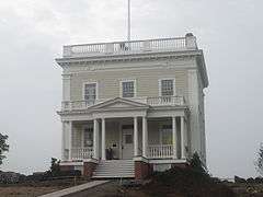
Hygeia House |
|
000000002001-10-22-0000October 22, 2001
(#01001156) |
Beach Ave.
41°10′40″N 71°34′18″W / 41.177778°N 71.571667°W / 41.177778; -71.571667 (Hygeia House) |
New Shoreham |
|
| 55 |
Indian Burial Ground |
Upload image |
000000001970-04-28-0000April 28, 1970
(#70000005) |
Narrow Lane
41°23′48″N 71°38′00″W / 41.396667°N 71.633333°W / 41.396667; -71.633333 (Indian Burial Ground) |
Charlestown |
|
| 56 |
Joseph Jeffrey House |
|
000000001978-03-08-0000March 8, 1978
(#78000017) |
Old Mill Road
41°25′47″N 71°39′54″W / 41.429722°N 71.665°W / 41.429722; -71.665 (Joseph Jeffrey House) |
Charlestown |
|
| 57 |
Kenyon's Department Store |
|
000000001992-11-05-0000November 5, 1992
(#92001540) |
344 Main St.
41°26′17″N 71°29′59″W / 41.438056°N 71.499722°W / 41.438056; -71.499722 (Kenyon's Department Store) |
South Kingstown |
|
| 58 |
Kingston Hill Farm |
|
000000001993-05-07-0000May 7, 1993
(#93000343) |
549 Old North Rd.
41°29′41″N 71°30′51″W / 41.494722°N 71.514167°W / 41.494722; -71.514167 (Kingston Hill Farm) |
South Kingstown |
|
| 59 |
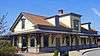
Kingston Railroad Station |
|
000000001978-04-26-0000April 26, 1978
(#78000018) |
Kingston Rd.
41°29′03″N 71°33′39″W / 41.484167°N 71.560833°W / 41.484167; -71.560833 (Kingston Railroad Station) |
South Kingstown |
Restored 1875 original station built by Providence and Stonington Railroad; still used today.
|
| 60 |
Kingston Village Historic District |
|
000000001974-05-01-0000May 1, 1974
(#74000011) |
South Kingstown
41°28′48″N 71°31′29″W / 41.48°N 71.524722°W / 41.48; -71.524722 (Kingston Village Historic District) |
South Kingstown |
|
| 61 |
Lafayette Village |
|
000000001978-11-14-0000November 14, 1978
(#78000019) |
Ten Rod Road
41°34′24″N 71°28′59″W / 41.573333°N 71.483056°W / 41.573333; -71.483056 (Lafayette Village) |
North Kingstown |
|
| 62 |
Lambda Chi Site, RI-704 |
Upload image |
000000001984-11-01-0000November 1, 1984
(#84000372) |
Address Restricted
|
South Kingstown |
|
| 63 |
Lawton's Mill |
|
000000001980-06-27-0000June 27, 1980
(#80000022) |
Ten Rod Rd.
41°34′54″N 71°34′13″W / 41.581667°N 71.570278°W / 41.581667; -71.570278 (Lawton's Mill) |
Exeter |
|
| 64 |
Lewis-Card-Perry House |
|
000000002005-10-04-0000October 4, 2005
(#05001152) |
12 Margin St.
41°22′08″N 71°49′57″W / 41.368789°N 71.832467°W / 41.368789; -71.832467 (Lewis-Card-Perry House) |
Westerly |
|
| 65 |
Simon Lillibridge Farm |
|
000000001978-11-28-0000November 28, 1978
(#78000020) |
Summit Rd.
41°34′16″N 71°42′47″W / 41.571111°N 71.713056°W / 41.571111; -71.713056 (Simon Lillibridge Farm) |
Exeter |
|
| 66 |
Main Street Historic District |
|
000000001978-01-09-0000January 9, 1978
(#78000021) |
113-132 Main St., 8, 7-13 School St., 3-14 Maple St.
41°22′25″N 71°49′51″W / 41.373611°N 71.830833°W / 41.373611; -71.830833 (Main Street Historic District) |
Westerly |
|
| 67 |
Henry Marchant Farm |
|
000000001979-08-16-0000August 16, 1979
(#79000009) |
S. County Trail
41°28′52″N 71°35′56″W / 41.481111°N 71.598889°W / 41.481111; -71.598889 (Henry Marchant Farm) |
South Kingstown |
|
| 68 |
William Davis Miller House |
|
000000001985-03-21-0000March 21, 1985
(#85000627) |
130 Main St.
41°26′08″N 71°30′27″W / 41.435556°N 71.5075°W / 41.435556; -71.5075 (William Davis Miller House) |
South Kingstown |
|
| 69 |
Ministerial Rd. Site, RI-781 |
Upload image |
000000001984-11-15-0000November 15, 1984
(#84000565) |
Address Restricted
|
South Kingstown |
|
| 70 |
Silas Mumford Site (Tappan Site RI-705) |
Upload image |
000000001984-11-01-0000November 1, 1984
(#84000382) |
Address Restricted
|
South Kingstown |
|
| 71 |
Narragansett Baptist Church |
|
000000001977-11-25-0000November 25, 1977
(#77000010) |
S. Ferry Rd.
41°29′34″N 71°25′34″W / 41.492778°N 71.426111°W / 41.492778; -71.426111 (Narragansett Baptist Church) |
Narragansett |
|
| 72 |
Narragansett Pier Life Saving Station |
|
000000001976-06-30-0000June 30, 1976
(#76000010) |
40 Ocean Rd.
41°25′48″N 71°27′20″W / 41.43°N 71.455556°W / 41.43; -71.455556 (Narragansett Pier Life Saving Station) |
Narragansett |
|
| 73 |
North End Historic District |
|
000000002006-04-20-0000April 20, 2006
(#06000298) |
Canal, Dayton, Friendship, High, Pearl, Pierce, Pleasant, Pond, West, Industrial Lila, Geranium, Marriott and Turano
41°23′16″N 71°49′38″W / 41.387778°N 71.827222°W / 41.387778; -71.827222 (North End Historic District) |
Westerly |
|
| 74 |
Stephen Northup House |
|
000000001985-07-19-0000July 19, 1985
(#85001653) |
99 Featherbed Lane
41°33′05″N 71°26′52″W / 41.551389°N 71.447778°W / 41.551389; -71.447778 (Stephen Northup House) |
North Kingstown |
Built by early Providence and Narragansett settler, Stephen Northup
|
| 75 |
Nursery Site, RI-273 |
Upload image |
000000001984-11-01-0000November 1, 1984
(#84000386) |
Address Restricted
|
Westerly |
|
| 76 |
Ocean Road Historic District |
|
000000001982-08-18-0000August 18, 1982
(#82000019) |
Ocean and Wildfield Farm Rds., and Newton and Hazard Aves.
41°24′45″N 71°27′22″W / 41.4125°N 71.456111°W / 41.4125; -71.456111 (Ocean Road Historic District) |
Narragansett |
|
| 77 |
Old Harbor Historic District |
|
000000001974-05-08-0000May 8, 1974
(#74000012) |
Roughly bounded by the Atlantic Ocean and Main St. (includes Spring and High Sts. and Main St.)
41°10′18″N 71°33′31″W / 41.171667°N 71.558611°W / 41.171667; -71.558611 (Old Harbor Historic District) |
New Shoreham |
|
| 78 |
Old Narragansett Cemetery |
|
000000001985-07-19-0000July 19, 1985
(#85001655) |
Shermantown Rd.
41°31′08″N 71°28′42″W / 41.518889°N 71.478333°W / 41.518889; -71.478333 (Old Narragansett Cemetery) |
North Kingstown |
|
| 79 |
Old Narragansett Church |
|
000000001973-07-02-0000July 2, 1973
(#73000009) |
60 Church Lane, Wickford
41°34′21″N 71°26′59″W / 41.5725°N 71.449722°W / 41.5725; -71.449722 (Old Narragansett Church) |
North Kingstown |
|
| 80 |
Palmer-Northrup House |
|
000000001973-04-11-0000April 11, 1973
(#73000010) |
7919 Post Rd.
41°34′37″N 71°27′40″W / 41.576944°N 71.461111°W / 41.576944; -71.461111 (Palmer-Northrup House) |
North Kingstown |
|
| 81 |
Parris Brook Historic and Archeological District |
Upload image |
000000001980-12-05-0000December 5, 1980
(#80000023) |
Address Restricted
|
Exeter |
|
| 82 |
Peace Dale Historic District |
|
000000001987-10-30-0000October 30, 1987
(#87000493) |
Roughly bounded by Kensey Rd., Oakwoods Dr., Kingstown Rd., School, Church and Railroad Sts.
41°27′04″N 71°29′42″W / 41.451111°N 71.495°W / 41.451111; -71.495 (Peace Dale Historic District) |
South Kingstown |
|
| 83 |
Commodore Oliver Perry Farm |
|
000000001982-08-26-0000August 26, 1982
(#82000020) |
Commodore Perry Highway (US Route 1)
41°25′08″N 71°31′51″W / 41.4190°N 71.5307°W / 41.4190; -71.5307 (Commodore Oliver Perry Farm) |
South Kingstown |
|
| 84 |
Perry Homestead Historic District |
Upload image |
000000002016-03-15-0000March 15, 2016
(#16000089) |
2, 4, 8, 12, 16 Margin & 15, 17 Beach Sts.
41°22′09″N 71°49′54″W / 41.369201°N 71.831741°W / 41.369201; -71.831741 (Perry Homestead Historic District) |
Westerly |
|
| 85 |
Perry-Carpenter Grist Mill |
|
000000001990-02-22-0000February 22, 1990
(#90000106) |
364 Moonstone Beach Rd.
41°23′35″N 71°34′34″W / 41.392956°N 71.576072°W / 41.392956; -71.576072 (Perry-Carpenter Grist Mill) |
South Kingstown |
|
| 86 |
Joseph Pierce Farm |
|
000000001985-07-19-0000July 19, 1985
(#85001652) |
933 Gilbert Stuart Rd.
41°31′22″N 71°26′42″W / 41.522778°N 71.445°W / 41.522778; -71.445 (Joseph Pierce Farm) |
North Kingstown |
|
| 87 |
Plum Beach Lighthouse |
|
000000001988-03-30-0000March 30, 1988
(#88000281) |
Off Plum Beach, western passage of Narragansett Bay
41°31′48″N 71°24′20″W / 41.53°N 71.405556°W / 41.53; -71.405556 (Plum Beach Lighthouse) |
North Kingstown |
|
| 88 |
Point Judith Lighthouse |
|
000000001988-03-30-0000March 30, 1988
(#88000279) |
1470 Ocean Rd.
41°21′39″N 71°28′55″W / 41.360833°N 71.481944°W / 41.360833; -71.481944 (Point Judith Lighthouse) |
Narragansett |
|
| 89 |
Poplar Point Lighthouse |
|
000000001988-02-25-0000February 25, 1988
(#87001703) |
1 Poplar Ave.
41°34′15″N 71°26′23″W / 41.570833°N 71.439722°W / 41.570833; -71.439722 (Poplar Point Lighthouse) |
North Kingstown |
|
| 90 |
Potter Pond Archeological District |
Upload image |
000000001987-12-08-0000December 8, 1987
(#87002102) |
Address Restricted
|
South Kingstown |
|
| 91 |
Queen's Fort |
|
000000001980-11-26-0000November 26, 1980
(#80000024) |
Stony Lane
41°35′30″N 71°31′15″W / 41.591667°N 71.520833°W / 41.591667; -71.520833 (Queen's Fort) |
Exeter |
|
| 92 |
Ram Point |
Upload image |
000000002015-11-24-0000November 24, 2015
(#15000831) |
77 Watch Hill Rd.
41°20′16″N 71°49′45″W / 41.337704°N 71.829305°W / 41.337704; -71.829305 (Ram Point) |
Westerly |
|
| 93 |
Rathbun House |
|
000000001985-07-19-0000July 19, 1985
(#85001651) |
343 Beacon Dr.
41°34′20″N 71°30′20″W / 41.572222°N 71.505556°W / 41.572222; -71.505556 (Rathbun House) |
North Kingstown |
|
| 94 |
Red House |
|
000000001996-11-21-0000November 21, 1996
(#96001323) |
2403 Post Rd.
41°24′02″N 71°34′15″W / 41.400556°N 71.570833°W / 41.400556; -71.570833 (Red House) |
South Kingstown |
|
| 95 |
Gen. Isaac Peace Rodman House |
|
000000001990-04-23-0000April 23, 1990
(#90000596) |
1789 Kingstown Rd.
41°27′48″N 71°30′33″W / 41.463333°N 71.509167°W / 41.463333; -71.509167 (Gen. Isaac Peace Rodman House) |
South Kingstown |
|
| 96 |
Benoni Ross House |
|
000000002008-12-28-0000December 28, 2008
(#08000717) |
97 Lafayette Road
41°34′24″N 71°29′24″W / 41.573333°N 71.49°W / 41.573333; -71.49 (Benoni Ross House) |
North Kingstown |
|
| 97 |
St. Paul's Church |
|
000000001972-06-30-0000June 30, 1972
(#72000009) |
76 Main St.
41°34′17″N 71°27′01″W / 41.571389°N 71.450278°W / 41.571389; -71.450278 (St. Paul's Church) |
North Kingstown |
|
| 98 |
Esbon Sanford House |
|
000000001985-07-19-0000July 19, 1985
(#85001649) |
88 Featherbed Lane
41°33′04″N 71°26′55″W / 41.551111°N 71.448611°W / 41.551111; -71.448611 (Esbon Sanford House) |
North Kingstown |
|
| 99 |
Saunderstown Historic District |
|
000000001985-07-19-0000July 19, 1985
(#85001647) |
Roughly bounded by Stillman, Waterway, Willet, Boston Neck & Ferry Rds.
41°30′28″N 71°25′21″W / 41.507778°N 71.4225°W / 41.507778; -71.4225 (Saunderstown Historic District) |
North Kingstown |
|
| 100 |
Scrabbletown Historic and Archeological District |
Upload image |
000000001985-04-11-0000April 11, 1985
(#85000790) |
Address Restricted
|
North Kingstown |
|
| 101 |
Shadow Farm |
|
000000001986-02-07-0000February 7, 1986
(#86000785) |
Kingstown Rd.
41°26′15″N 71°29′28″W / 41.4375°N 71.491111°W / 41.4375; -71.491111 (Shadow Farm) |
South Kingstown |
|
| 102 |
Shady Lea Historic District |
|
000000001985-07-19-0000July 19, 1985
(#85001644) |
Shady Lea and Tower Hill Rds.
41°32′07″N 71°27′56″W / 41.535278°N 71.465556°W / 41.535278; -71.465556 (Shady Lea Historic District) |
North Kingstown |
|
| 103 |
Shannock Historic District |
|
000000001983-08-04-0000August 4, 1983
(#83000005) |
Main St., N. Shannock and W. Shannock Rds.
41°26′53″N 71°38′28″W / 41.448056°N 71.641111°W / 41.448056; -71.641111 (Shannock Historic District) |
Charlestown and Richmond |
|
| 104 |
Sheffield House |
Upload image |
000000001976-01-01-0000January 1, 1976
(#76000011) |
Beach Rd.
41°20′09″N 71°42′32″W / 41.335833°N 71.708889°W / 41.335833; -71.708889 (Sheffield House) |
Charlestown |
|
| 105 |
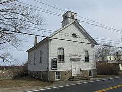
Six Principle Baptist Church |
|
000000001978-11-21-0000November 21, 1978
(#78000022) |
85 Old Baptist Rd.
41°35′34″N 71°29′29″W / 41.592778°N 71.491389°W / 41.592778; -71.491389 (Six Principle Baptist Church) |
North Kingstown |
|
| 106 |
Joseph Slocum House |
Upload image |
000000001985-07-19-0000July 19, 1985
(#85001648) |
Slocum Rd.
41°31′35″N 71°31′04″W / 41.526389°N 71.517778°W / 41.526389; -71.517778 (Joseph Slocum House) |
North Kingstown |
|
| 107 |
Sodom Mill Historic and Archeological District |
Upload image |
000000001980-11-24-0000November 24, 1980
(#80000025) |
Address Restricted
|
Exeter |
|
| 108 |
Spink Farm |
|
000000001985-07-19-0000July 19, 1985
(#85001650) |
1325 Shermantown Rd.
41°30′34″N 71°29′50″W / 41.509444°N 71.497222°W / 41.509444; -71.497222 (Spink Farm) |
North Kingstown |
|
| 109 |
Joseph Stanton House |
|
000000001980-01-11-0000January 11, 1980
(#80000026) |
U.S. Route 1
41°21′25″N 71°42′17″W / 41.356944°N 71.704722°W / 41.356944; -71.704722 (Joseph Stanton House) |
Charlestown |
|
| 110 |
Gilbert Stuart Birthplace |
|
000000001966-10-15-0000October 15, 1966
(#66000004) |
Gilbert Stuart Rd.
41°31′36″N 71°26′44″W / 41.526667°N 71.445556°W / 41.526667; -71.445556 (Gilbert Stuart Birthplace) |
North Kingstown |
Birthplace of Gilbert Stuart, portraitist of George Washington and other Revolutionary figures. Preserved intact.
|
| 111 |
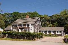
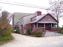
Theatre-By-the-Sea |
|
000000001980-07-10-0000July 10, 1980
(#80004597) |
Card Ponds Rd.
41°22′37″N 71°33′46″W / 41.376944°N 71.562778°W / 41.376944; -71.562778 (Theatre-By-the-Sea) |
South Kingstown |
|
| 112 |
Tomaquag Rock Shelters |
Upload image |
000000001977-08-12-0000August 12, 1977
(#77000011) |
Address Restricted
|
Hopkinton |
|
| 113 |
Tootell House |
|
000000002000-05-26-0000May 26, 2000
(#00000552) |
1747 Mooresfield Rd.
41°28′51″N 71°31′02″W / 41.480833°N 71.517222°W / 41.480833; -71.517222 (Tootell House) |
South Kingstown |
|
| 114 |
Towers Historic District |
|
000000001982-08-18-0000August 18, 1982
(#82000021) |
Bounded by the Atlantic Ocean, Exchange Pl., and Mathewson and Taylor Sts.
41°25′48″N 71°27′23″W / 41.43°N 71.456389°W / 41.43; -71.456389 (Towers Historic District) |
Narragansett |
|
| 115 |
The Towers |
|
000000001969-11-25-0000November 25, 1969
(#69000001) |
Ocean Rd.
41°25′50″N 71°27′22″W / 41.430556°N 71.456111°W / 41.430556; -71.456111 (The Towers) |
Narragansett |
|
| 116 |
Upper Rockville Mill |
|
000000002006-07-05-0000July 5, 2006
(#06000552) |
332 Canonchet Rd.
41°31′20″N 71°45′36″W / 41.522222°N 71.76°W / 41.522222; -71.76 (Upper Rockville Mill) |
Hopkinton |
|
| 117 |
US Post Office |
|
000000001971-08-12-0000August 12, 1971
(#71000004) |
5 High St.[6]
41°22′40″N 71°49′49″W / 41.3778°N 71.8302°W / 41.3778; -71.8302 (US Post Office) |
Westerly |
|
| 118 |
US Weather Bureau Station |
|
000000001983-08-04-0000August 4, 1983
(#83000006) |
Beach Avenue
41°10′35″N 71°34′09″W / 41.176389°N 71.569167°W / 41.176389; -71.569167 (US Weather Bureau Station) |
New Shoreham |
|
| 119 |
Usquepaug Road Historic District |
|
000000001987-10-30-0000October 30, 1987
(#87001298) |
Usquepaug Rd.
41°30′14″N 71°36′01″W / 41.503889°N 71.600278°W / 41.503889; -71.600278 (Usquepaug Road Historic District) |
South Kingstown |
|
| 120 |
Wakefield Historic District |
|
000000001996-05-30-0000May 30, 1996
(#96000572) |
Roughly, Main St. from Belmont Ave. to Columbia St.
41°26′15″N 71°30′04″W / 41.4375°N 71.501111°W / 41.4375; -71.501111 (Wakefield Historic District) |
South Kingstown |
|
| 121 |
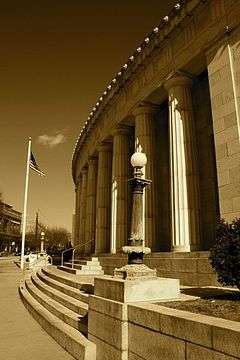
Washington County Court House |
|
000000001992-11-05-0000November 5, 1992
(#92001542) |
3481 Kingstown Rd.
41°29′02″N 71°33′21″W / 41.483889°N 71.555833°W / 41.483889; -71.555833 (Washington County Court House) |
South Kingstown |
former county courthouse, now an arts center
|
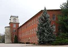
| 122 |
Watch Hill Historic District |
|
000000001985-09-05-0000September 5, 1985
(#85001948) |
Roughly bounded by Breen, Watch Hill, and E. Hill Rds., Block Island Sound, Little Narragansett Bay, and the Pawtucket River
41°18′49″N 71°51′23″W / 41.313611°N 71.856389°W / 41.313611; -71.856389 (Watch Hill Historic District) |
Westerly |
Well-preserved Victorian seaside resort area
|
| 123 |
Weekapaug Inn |
|
000000002007-01-25-0000January 25, 2007
(#06001305) |
25 Spray Rock Rd.
41°19′49″N 71°45′03″W / 41.330278°N 71.750833°W / 41.330278; -71.750833 (Weekapaug Inn) |
Westerly |
|
| 124 |
Westerly Armory |
|
000000001996-11-07-0000November 7, 1996
(#96001322) |
Railroad Ave., west of downtown Westerly
41°22′55″N 71°49′40″W / 41.381944°N 71.827778°W / 41.381944; -71.827778 (Westerly Armory) |
Westerly |
|
| 125 |
Westerly Downtown Historic District |
|
000000001984-07-19-0000July 19, 1984
(#84002055) |
Railroad Ave., High, Canal, Broad, Union, and Main Sts.
41°22′45″N 71°49′49″W / 41.379167°N 71.830278°W / 41.379167; -71.830278 (Westerly Downtown Historic District) |
Westerly |
|
| 126 |
Wickford Historic District |
|
000000001974-12-31-0000December 31, 1974
(#74000013) |
Roughly bounded by Tower Hill and Post Rds. as far N as Mill Cove and S to Lindley Ave
41°34′12″N 71°27′24″W / 41.57°N 71.456667°W / 41.57; -71.456667 (Wickford Historic District) |
North Kingstown |
|
| 127 |
Wilcox Park Historic District |
|
000000001973-05-07-0000May 7, 1973
(#73000011) |
Roughly bounded by Broad, Granite, High Sts. and Grove Ave. and running along Elm St.
41°22′36″N 71°49′43″W / 41.376667°N 71.828611°W / 41.376667; -71.828611 (Wilcox Park Historic District) |
Westerly |
|
| 128 |
Willow Dell |
|
000000001996-11-21-0000November 21, 1996
(#96001321) |
2700 Commodore Oliver Hazard Perry Highway
41°23′47″N 71°33′04″W / 41.396389°N 71.551111°W / 41.396389; -71.551111 (Willow Dell) |
South Kingstown |
|
| 129 |
Wyoming Village Historic District |
|
000000001974-05-02-0000May 2, 1974
(#74000014) |
Roughly bounded by RI 3, RI 138, Old Nooseneck Hill Rd., Bridge and Prospect Sts.
41°30′57″N 71°42′12″W / 41.515833°N 71.703333°W / 41.515833; -71.703333 (Wyoming Village Historic District) |
Hopkinton and Richmond |
|
| 130 |
YWCA Site |
Upload image |
000000001980-11-20-0000November 20, 1980
(#80000027) |
Address Restricted
|
North Kingstown |
|


.jpg)

.jpg)


_-_Westerly%2C_RI.JPG)
_(extra_close)_(US48).svg.png)