Moneyshanere
| Moneyshanere | |
|---|---|
 | |
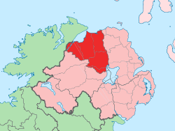
 Moneyshanere Moneyshanere shown within Northern Ireland | |
| Coordinates: 54°48′43″N 6°43′23″W / 54.812°N 6.723°WCoordinates: 54°48′43″N 6°43′23″W / 54.812°N 6.723°W | |
| Country | Northern Ireland |
| County | County Londonderry |
| Barony | Loughinsholin |
| Civil parish | Kilcronaghan |
| Plantation grant | Drapers Company and Crown freeholds |
| First recorded | 1609 |
| Settlements | Tobermore |
| Government | |
| • Council | Magherafelt District Council |
| • Ward | Tobermore |
| Area[1] | |
| • Total | 149.03 ha (368.27 acres) |
| Irish grid ref | H8196 |
Moneyshanere (locally [ˌmӧniʃïnˈair][2]) is a townland lying within the civil parish of Kilcronaghan, County Londonderry, Northern Ireland. It lies in the north-west of the parish on the boundary with the civil parish of Ballynascreen, and it is bounded by the townlands of: Calmore, Drumcrow, Drumballyhagan Clark, Duntibryan, Granny, Moneyguiggy, Moybeg Kirley, and Tobermore. It was apportioned to the Drapers company and Crown freeholds.[3]
The townland currently lies within Tobermore electoral ward of Magherafelt District Council, however in 1926, it was part of Tobermore district electoral division as part of the Maghera division of Magherafelt Rural District.[4] It was also part of the historic barony of Loughinsholin.[3]
The town of Tobermore lies partially in this townland, and those of Calmore, Moyesset, and Tobermore. The local parish church of Kilcronaghan also lies within Moneyshanere.
Etymology
The Irish origin the name Moneyshanere derives from is unknown. Several possible origins have however been given over the years:
- Moín na Seánoir (bog of the old man/bard/druid) [3]
- Muine Sean Iúir (thicket of old yews)
- Muine Sean Oir (thicket of old spindle trees)
- Muine Sean Fhéir (brake of the old coarse grass) [3]
- Mona Sean Saighir (crest/ridge of the ancient priest) [3]
Alfred Munn Moore in his Notes on the Place Names of the Parishes and Townlands of the County of Londonderry, makes note that St. Ciaran was known as the "ancient priest" or "Sean Saighir", possibly referring to St. Ciarán of Saigir.
History
|
|
| ||||||||||||||||||||||||||||||||||||||||||||||||||||
See also
References
- ↑ Northern Ireland Environment Agency. "NIEA Map Viewer". Retrieved 27 January 2012.
- ↑ Toner, Gregory: Place-Names of Northern Ireland, page 129-130. Queen's University of Belfast, 1996, ISBN 0-85389-613-5
- 1 2 3 4 5 6 7 8 Notes on the Place Names of the Parishes and Townlands of the County of Londonderry, 1925, Alfred Moore Munn, Clerk of the Crown and Peace of the City and County of Londonderry
- 1 2 3 4 5 HistPop; County and County Borough of Londonderry, 1926, page 24
- 1 2 3 4 5 6 HistPop; Area, population and number of houses, Vol. III, Ireland, 1881, page 698
- ↑ HistPop; County of Londonderry, 1851, page 241
- ↑ Place Names NI - Moneyshanere