Milford Township, Iroquois County, Illinois
| Milford Township | |
|---|---|
| Township | |
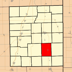 Location in Iroquois County | |
 Iroquois County's location in Illinois | |
| Coordinates: 40°37′40″N 87°42′41″W / 40.62778°N 87.71139°WCoordinates: 40°37′40″N 87°42′41″W / 40.62778°N 87.71139°W | |
| Country | United States |
| State | Illinois |
| County | Iroquois |
| Established | November 6, 1855 |
| Area | |
| • Total | 44.34 sq mi (114.8 km2) |
| • Land | 44.34 sq mi (114.8 km2) |
| • Water | 0 sq mi (0 km2) 0% |
| Elevation | 636 ft (194 m) |
| Population (2010) | |
| • Total | 1,659 |
| • Density | 37.4/sq mi (14.4/km2) |
| Time zone | CST (UTC-6) |
| • Summer (DST) | CDT (UTC-5) |
| ZIP code | 60953 |
| GNIS feature ID | 0429363 |
Milford Township is one of twenty-six townships in Iroquois County, Illinois, USA. As of the 2010 census, its population was 1,659 and it contained 819 housing units.[1]
Geography
According to the 2010 census, the township has a total area of 44.34 square miles (114.8 km2), all land.[1]
Cities, towns, villages
Unincorporated towns
(This list is based on USGS data and may include former settlements.)
Cemeteries
The township contains these three cemeteries: Maple Grove, Old Milford and Vennum.
Major highways
Airports and landing strips
- Milford Airport
Political districts
- Illinois' 15th congressional district
- State House District 105
- State Senate District 53
References
- "Milford Township, Iroquois County, Illinois". Geographic Names Information System. United States Geological Survey. Retrieved 2010-01-17.
- United States Census Bureau 2007 TIGER/Line Shapefiles
- United States National Atlas
- 1 2 "Population, Housing Units, Area, and Density: 2010 - County -- County Subdivision and Place -- 2010 Census Summary File 1". United States Census. Retrieved 2013-05-28.
External links
 |
Crescent Township | Belmont Township | | |
| Ash Grove Township | |
Stockland Township | ||
| ||||
| | ||||
| Fountain Creek Township | Lovejoy Township | Prairie Green Township |
Municipalities and communities of Iroquois County, Illinois, United States | ||
|---|---|---|
| Cities | ||
| Villages | ||
| Townships | ||
| Unincorporated communities |
| |
| Footnotes | ‡This populated place also has portions in an adjacent county or counties | |
This article is issued from Wikipedia - version of the 12/4/2013. The text is available under the Creative Commons Attribution/Share Alike but additional terms may apply for the media files.