Middleport Township, Iroquois County, Illinois
| Middleport Township | |
|---|---|
| Township | |
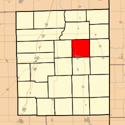 Location in Iroquois County | |
 Iroquois County's location in Illinois | |
| Coordinates: 40°49′01″N 87°42′29″W / 40.81694°N 87.70806°WCoordinates: 40°49′01″N 87°42′29″W / 40.81694°N 87.70806°W | |
| Country | United States |
| State | Illinois |
| County | Iroquois |
| Established | November 6, 1855 |
| Area | |
| • Total | 36.48 sq mi (94.5 km2) |
| • Land | 36.39 sq mi (94.2 km2) |
| • Water | 0.09 sq mi (0.2 km2) 0.25% |
| Elevation | 633 ft (193 m) |
| Population (2010) | |
| • Total | 4,375 |
| • Density | 120.2/sq mi (46.4/km2) |
| Time zone | CST (UTC-6) |
| • Summer (DST) | CDT (UTC-5) |
| ZIP codes | 60951, 60966, 60970 |
| GNIS feature ID | 0429360 |
Middleport Township is one of twenty-six townships in Iroquois County, Illinois, USA. As of the 2010 census, its population was 4,375 and it contained 2,099 housing units.[1] Middleport Township changed its name to Watseka Township in September 1863, but then changed back to Middleport Township on an unknown date.
Geography
According to the 2010 census, the township has a total area of 36.48 square miles (94.5 km2), of which 36.39 square miles (94.2 km2) (or 99.75%) is land and 0.09 square miles (0.23 km2) (or 0.25%) is water.[1]
Cities, towns, villages
- Watseka (the county seat) (north half)
Unincorporated towns
Cemeteries
The township contains these five cemeteries: Chamberlain, Gard Army of the Republic, Lyman, Oak Hill and Roberts.
Major highways
Airports and landing strips
- Songwood Inn Airport
Landmarks
- Forest Park
- Kay Park
- Peters Park
- Shagbark Airport
School districts
- Donovan Community Unit School District 3
- Iroquois County Community Unit School District 9
Political districts
- Illinois' 15th congressional district
- State House District 105
- State Senate District 53
References
- "Middleport Township, Iroquois County, Illinois". Geographic Names Information System. United States Geological Survey. Retrieved 2010-01-17.
- United States Census Bureau 2007 TIGER/Line Shapefiles
- United States National Atlas
- 1 2 "Population, Housing Units, Area, and Density: 2010 - County -- County Subdivision and Place -- 2010 Census Summary File 1". United States Census. Retrieved 2013-05-28.
External links
 |
Martinton Township | Beaver Township | | |
| Iroquois Township | |
Concord Township | ||
| ||||
| | ||||
| Crescent Township | Belmont Township | Sheldon Township |
Municipalities and communities of Iroquois County, Illinois, United States | ||
|---|---|---|
| Cities | ||
| Villages | ||
| Townships | ||
| Unincorporated communities |
| |
| Footnotes | ‡This populated place also has portions in an adjacent county or counties | |
This article is issued from Wikipedia - version of the 12/4/2013. The text is available under the Creative Commons Attribution/Share Alike but additional terms may apply for the media files.