Danforth Township, Iroquois County, Illinois
| Danforth Township | |
|---|---|
| Township | |
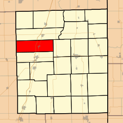 Location in Iroquois County | |
 Iroquois County's location in Illinois | |
| Coordinates: 40°49′03″N 88°00′22″W / 40.81750°N 88.00611°WCoordinates: 40°49′03″N 88°00′22″W / 40.81750°N 88.00611°W | |
| Country | United States |
| State | Illinois |
| County | Iroquois |
| Established | Before 1921 |
| Area | |
| • Total | 51.64 sq mi (133.7 km2) |
| • Land | 51.64 sq mi (133.7 km2) |
| • Water | 0 sq mi (0 km2) 0% |
| Elevation | 653 ft (199 m) |
| Population (2010) | |
| • Total | 928 |
| • Density | 18/sq mi (7/km2) |
| Time zone | CST (UTC-6) |
| • Summer (DST) | CDT (UTC-5) |
| ZIP codes | 60911, 60930, 60938, 60970 |
| GNIS feature ID | 0428871 |
Danforth Township is one of twenty-six townships in Iroquois County, Illinois, USA. As of the 2010 census, its population was 928 and it contained 385 housing units.[1]
History
Danforth Township was named for George M. Danforth, an early settler.[2] Danforth Township formed from Douglas Township and Ashkum Township sometime before 1921.
Geography
According to the 2010 census, the township has a total area of 51.64 square miles (133.7 km2), all land.[1]
Cities, towns, villages
Cemeteries
The township contains Bardon Cemetery.
Major highways
Airports and landing strips
- Classen Field RLA Airport
- Wilken Airport
School districts
- Iroquois West Community Unit School District 10
Political districts
- Illinois' 15th congressional district
- State House District 75
- State House District 105
- State Senate District 38
- State Senate District 53
References
- "Danforth Township, Iroquois County, Illinois". Geographic Names Information System. United States Geological Survey. Retrieved 2010-01-17.
- United States Census Bureau 2007 TIGER/Line Shapefiles
- United States National Atlas
- 1 2 "Population, Housing Units, Area, and Density: 2010 - County -- County Subdivision and Place -- 2010 Census Summary File 1". United States Census. Retrieved 2013-05-28.
- ↑ Gannett, Henry (1905). The Origin of Certain Place Names in the United States. Govt. Print. Off. p. 99.
External links
 |
Ashkum Township | | ||
| Mona Township, Ford County Pella Township, Ford County |
|
Iroquois Township | ||
| ||||
| | ||||
| Douglas Township |
Municipalities and communities of Iroquois County, Illinois, United States | ||
|---|---|---|
| Cities | ||
| Villages | ||
| Townships | ||
| Unincorporated communities |
| |
| Footnotes | ‡This populated place also has portions in an adjacent county or counties | |
This article is issued from Wikipedia - version of the 10/14/2016. The text is available under the Creative Commons Attribution/Share Alike but additional terms may apply for the media files.