Lovejoy Township, Iroquois County, Illinois
| Lovejoy Township | |
|---|---|
| Township | |
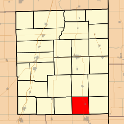 Location in Iroquois County | |
 Iroquois County's location in Illinois | |
| Coordinates: 40°32′13″N 87°42′14″W / 40.53694°N 87.70389°WCoordinates: 40°32′13″N 87°42′14″W / 40.53694°N 87.70389°W | |
| Country | United States |
| State | Illinois |
| County | Iroquois |
| Established | February 19, 1868 |
| Area | |
| • Total | 34.69 sq mi (89.8 km2) |
| • Land | 34.69 sq mi (89.8 km2) |
| • Water | 0 sq mi (0 km2) 0% |
| Elevation | 692 ft (211 m) |
| Population (2010) | |
| • Total | 406 |
| • Density | 11.7/sq mi (4.5/km2) |
| Time zone | CST (UTC-6) |
| • Summer (DST) | CDT (UTC-5) |
| ZIP codes | 60924, 60942, 60953, 60973 |
| GNIS feature ID | 0429286 |
Lovejoy Township is one of twenty-six townships in Iroquois County, Illinois, USA. As of the 2010 census, its population was 406 and it contained 184 housing units.[1] Lovejoy Township was formed from a portion of Milford Township on February 19, 1868.
Geography
According to the 2010 census, the township has a total area of 34.69 square miles (89.8 km2), all land.[1]
Cities, towns, villages
Extinct towns
- Alonzo at 40°34′00″N 87°43′52″W / 40.566703°N 87.731139°W
- Hickman at 40°34′03″N 87°45′52″W / 40.567536°N 87.764473°W
Cemeteries
The township contains these two cemeteries: Amity and Floral Hill.
Major highways
School districts
- Hoopeston Area Community Unit School District 11
Political districts
- Illinois' 16th congressional district
- State House District 105
- State Senate District 53
References
- "Lovejoy Township, Iroquois County, Illinois". Geographic Names Information System. United States Geological Survey. Retrieved 2010-01-17.
- United States Census Bureau 2007 TIGER/Line Shapefiles
- United States National Atlas
- 1 2 "Population, Housing Units, Area, and Density: 2010 - County -- County Subdivision and Place -- 2010 Census Summary File 1". United States Census. Retrieved 2013-05-28.
External links
 |
Ash Grove Township | Milford Township | Stockland Township | |
| Fountain Creek Township | |
Prairie Green Township | ||
| ||||
| | ||||
| Butler Township, Vermilion County | |
Grant Township, Vermilion County |
Municipalities and communities of Iroquois County, Illinois, United States | ||
|---|---|---|
| Cities | ||
| Villages | ||
| Townships | ||
| Unincorporated communities |
| |
| Footnotes | ‡This populated place also has portions in an adjacent county or counties | |
This article is issued from Wikipedia - version of the 11/22/2015. The text is available under the Creative Commons Attribution/Share Alike but additional terms may apply for the media files.