Marthasville, Missouri
| Marthasville, Missouri | |
|---|---|
| City | |
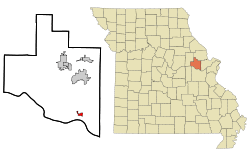 Location of Marthasville, Missouri | |
| Coordinates: 38°37′50″N 91°3′32″W / 38.63056°N 91.05889°WCoordinates: 38°37′50″N 91°3′32″W / 38.63056°N 91.05889°W | |
| Country | United States |
| State | Missouri |
| County | Warren |
| Area[1] | |
| • Total | 0.86 sq mi (2.23 km2) |
| • Land | 0.85 sq mi (2.20 km2) |
| • Water | 0.01 sq mi (0.03 km2) |
| Elevation | 561 ft (171 m) |
| Population (2010)[2] | |
| • Total | 1,136 |
| • Estimate (2012[3]) | 1,131 |
| • Density | 1,336.5/sq mi (516.0/km2) |
| Time zone | Central (CST) (UTC-6) |
| • Summer (DST) | CDT (UTC-5) |
| ZIP code | 63357 |
| Area code(s) | 636 |
| FIPS code | 29-46424[4] |
| GNIS feature ID | 0721912[5] |
Marthasville is a city in Warren County, Missouri, United States. The population was 1,136 at the 2010 census. The Katy Trail, a 225-mile long bike path, passes through Marthasville.
The original graves of Daniel Boone and his wife were located there.[6] In 1845, Boone's remains were disinterred and moved to Kentucky for burial. Resentment in Missouri about the disinterment grew over the years, and a legend arose that Boone's remains never left Missouri.
Because of the many wineries from here east to Defiance, Marthasville is considered to mark one end of the "Missouri Weinstrasse".
Geography
Marthasville is located at 38°37′50″N 91°3′32″W / 38.63056°N 91.05889°W (38.630458, -91.058864).[7] According to the United States Census Bureau, the city has a total area of 0.86 square miles (2.23 km2), of which, 0.85 square miles (2.20 km2) is land and 0.01 square miles (0.03 km2) is water.[1]
Because of the rich soils and steep slopes, the landscape is highly suitable for viticulture, growing grapes/vineyards. Thus Marthasville became part of what is known as the Missouri "wine route".
Demographics
| Historical population | |||
|---|---|---|---|
| Census | Pop. | %± | |
| 1860 | 76 | — | |
| 1870 | 178 | 134.2% | |
| 1930 | 394 | — | |
| 1940 | 321 | −18.5% | |
| 1950 | 347 | 8.1% | |
| 1960 | 339 | −2.3% | |
| 1970 | 415 | 22.4% | |
| 1980 | 543 | 30.8% | |
| 1990 | 674 | 24.1% | |
| 2000 | 837 | 24.2% | |
| 2010 | 1,136 | 35.7% | |
| Est. 2015 | 1,152 | [8] | 1.4% |
2010 census
As of the census[2] of 2010, there were 1,136 people, 431 households, and 310 families residing in the city. There were 478 housing units at an average density of 562.4 per square mile (217.1/km2). The racial makeup of the city was 97.5% White, 0.2% African American, 0.3% Native American, 0.1% Asian, 0.7% from other races, and 1.2% from two or more races. Hispanic or Latino of any race were 1.8% of the population.
There were 431 households of which 42.7% had children under the age of 18 living with them, 54.8% were married couples living together, 9.7% had a female householder with no husband present, 7.4% had a male householder with no wife present, and 28.1% were non-families. 23.9% of all households were made up of individuals and 9.3% had someone living alone who was 65 years of age or older. The average household size was 2.64 and the average family size was 3.12.
The median age in the city was 31.1 years. 29.2% of residents were under the age of 18; 8% were between the ages of 18 and 24; 33.4% were from 25 to 44; 19.3% were from 45 to 64; and 10.1% were 65 years of age or older. The gender makeup of the city was 52.0% male and 48.0% female.
2000 census
As of the census[4] of 2000, there were 837 people, 321 households, and 230 families residing in the city. There were 340 housing units at an average density of 406.0 per square mile (156.3/km²). The racial makeup of the city was 96.77% White, 1.08% African American, 0.48% Native American, 0.36% Asian, 0.36% from other races, and 0.96% from two or more races. Hispanic or Latino of any race were 0.36% of the population.
There were 321 households out of which 40.8% had children under the age of 18 living with them, 60.1% were married couples living together, 6.9% had a female householder with no husband present, and 28.3% were non-families. 22.4% of all households were made up of individuals and 8.4% had someone living alone who was 65 years of age or older. The average household size was 2.61 and the average family size was 3.09.
In the city the population was spread out with 28.8% under the age of 18, 8.2% from 18 to 24, 36.3% from 25 to 44, 17.0% from 45 to 64, and 9.7% who were 65 years of age or older. The median age was 33 years. For every 100 females there were 105.7 males. For every 100 females age 18 and over, there were 100.7 males.
The median income for a household in the city was $41,141, and the median income for a family was $45,521. Males had a median income of $32,083 versus $21,875 for females. The per capita income for the city was $17,979. About 5.9% of families and 8.5% of the population were below the poverty line, including 9.9% of those under age 18 and 9.5% of those age 65 or over.
References
- 1 2 "US Gazetteer files 2010". United States Census Bureau. Retrieved 2012-07-08.
- 1 2 "American FactFinder". United States Census Bureau. Retrieved 2012-07-08.
- ↑ "Population Estimates". United States Census Bureau. Retrieved 2013-05-30.
- 1 2 "American FactFinder". United States Census Bureau. Retrieved 2008-01-31.
- ↑ "US Board on Geographic Names". United States Geological Survey. 2007-10-25. Retrieved 2008-01-31.
- ↑ Eaton, David Wolfe (1918). How Missouri Counties, Towns and Streams Were Named. The State Historical Society of Missouri. p. 369.
- ↑ "US Gazetteer files: 2010, 2000, and 1990". United States Census Bureau. 2011-02-12. Retrieved 2011-04-23.
- ↑ "Annual Estimates of the Resident Population for Incorporated Places: April 1, 2010 to July 1, 2015". Retrieved July 2, 2016.
- ↑ "Census of Population and Housing". Census.gov. Retrieved June 4, 2015.
External links
Municipalities and communities of Warren County, Missouri, United States | ||
|---|---|---|
| Cities | 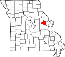 | |
| Villages | ||
| Townships |
| |
| Unincorporated communities | ||
| Footnotes | ‡This populated place also has portions in an adjacent county or counties | |