Truesdale, Missouri
| Truesdale, Missouri | |
|---|---|
| City | |
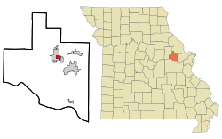 Location of Truesdale, Missouri | |
| Coordinates: 38°48′38″N 91°7′41″W / 38.81056°N 91.12806°WCoordinates: 38°48′38″N 91°7′41″W / 38.81056°N 91.12806°W | |
| Country | United States |
| State | Missouri |
| County | Warren |
| Area[1] | |
| • Total | 1.29 sq mi (3.34 km2) |
| • Land | 1.27 sq mi (3.29 km2) |
| • Water | 0.02 sq mi (0.05 km2) |
| Elevation | 860 ft (262 m) |
| Population (2010)[2] | |
| • Total | 732 |
| • Estimate (2012[3]) | 721 |
| • Density | 576.4/sq mi (222.5/km2) |
| Time zone | Central (CST) (UTC-6) |
| • Summer (DST) | CDT (UTC-5) |
| ZIP code | 63380 |
| Area code(s) | 636 |
| FIPS code | 29-73978[4] |
| GNIS feature ID | 0740024[5] |
Truesdale is a city in Warren County, Missouri, United States. The population was 732 according to the 2010 Census.
History
Truesdale was platted in 1857. It was named for its founder, William Truesdail, a railroad official.[6]
Geography
Truesdale is located at 38°48′38″N 91°7′41″W / 38.81056°N 91.12806°W (38.810499, -91.128194).[7]
According to the United States Census Bureau, the city has a total area of 1.29 square miles (3.34 km2), of which, 1.27 square miles (3.29 km2) is land and 0.02 square miles (0.05 km2) is water.[1]
Economy
Notable companies in Truesdale are Cascade Plastics, Oldcastle Glass, Warrenton Oil, Coca-Cola, River City Steel, Metso Minerals and Truesdale MFA. Truesdale has direct access to both rail and interstate traffic via Interstate 70. Industry consists of light manufacturing and a copper foundry.
Demographics
| Historical population | |||
|---|---|---|---|
| Census | Pop. | %± | |
| 1880 | 91 | — | |
| 1930 | 185 | — | |
| 1940 | 199 | 7.6% | |
| 1950 | 235 | 18.1% | |
| 1960 | 217 | −7.7% | |
| 1970 | 262 | 20.7% | |
| 1980 | 297 | 13.4% | |
| 1990 | 285 | −4.0% | |
| 2000 | 397 | 39.3% | |
| 2010 | 732 | 84.4% | |
| Est. 2015 | 730 | [8] | −0.3% |
2010 census
As of the census[2] of 2010, there were 732 people, 270 households, and 175 families residing in the city. The population density was 576.4 inhabitants per square mile (222.5/km2). There were 304 housing units at an average density of 239.4 per square mile (92.4/km2). The racial makeup of the city was 87.7% White, 5.6% African American, 1.0% Native American, 0.5% Asian, 0.4% Pacific Islander, 1.4% from other races, and 3.4% from two or more races. Hispanic or Latino of any race were 3.3% of the population.
There were 270 households of which 40.4% had children under the age of 18 living with them, 37.0% were married couples living together, 22.6% had a female householder with no husband present, 5.2% had a male householder with no wife present, and 35.2% were non-families. 28.5% of all households were made up of individuals and 6.7% had someone living alone who was 65 years of age or older. The average household size was 2.71 and the average family size was 3.30.
The median age in the city was 29.1 years. 30.9% of residents were under the age of 18; 10.9% were between the ages of 18 and 24; 30.1% were from 25 to 44; 20.1% were from 45 to 64; and 7.9% were 65 years of age or older. The gender makeup of the city was 51.9% male and 48.1% female.
2000 census
As of the census[4] of 2000, there were 397 people, 145 households, and 94 families residing in the city. The population density was 360.6 people per square mile (139.3/km²). There were 172 housing units at an average density of 156.2 per square mile (60.4/km²). The racial makeup of the city was 88.66% White, 6.05% African American, 1.26% Native American, 0.76% Asian, 0.76% from other races, and 2.52% from two or more races. Hispanic or Latino of any race were 5.29% of the population.
There were 145 households out of which 35.2% had children under the age of 18 living with them, 40.7% were married couples living together, 16.6% had a female householder with no husband present, and 34.5% were non-families. 29.0% of all households were made up of individuals and 8.3% had someone living alone who was 65 years of age or older. The average household size was 2.74 and the average family size was 3.45.
In the city the population was spread out with 32.0% under the age of 18, 8.1% from 18 to 24, 33.5% from 25 to 44, 15.4% from 45 to 64, and 11.1% who were 65 years of age or older. The median age was 32 years. For every 100 females there were 114.6 males. For every 100 females age 18 and over, there were 117.7 males.
The median income for a household in the city was $28,359, and the median income for a family was $29,583. Males had a median income of $27,679 versus $21,125 for females. The per capita income for the city was $10,483. About 20.2% of families and 21.8% of the population were below the poverty line, including 25.6% of those under age 18 and 20.0% of those age 65 or over.
Climate
Climate is characterized by relatively high temperatures and evenly distributed precipitation throughout the year. The Köppen Climate Classification subtype for this climate is "Cfa". (Humid Subtropical Climate).[10]
| Climate data for Truesdale, Missouri | |||||||||||||
|---|---|---|---|---|---|---|---|---|---|---|---|---|---|
| Month | Jan | Feb | Mar | Apr | May | Jun | Jul | Aug | Sep | Oct | Nov | Dec | Year |
| Average high °C (°F) | 39 (4) |
42 (6) |
53 (12) |
66 (19) |
75 (24) |
84 (29) |
89 (32) |
87 (31) |
80 (27) |
68 (20) |
53 (12) |
41 (5) |
64.8 (18.4) |
| Average low °C (°F) | 21 (−6) |
23 (−5) |
32 (0) |
42 (6) |
51 (11) |
60 (16) |
66 (19) |
64 (18) |
55 (13) |
44 (7) |
33 (1) |
24 (−4) |
42.9 (6.3) |
| Average precipitation mm (inches) | 2.0 (51) |
2.0 (51) |
3.3 (84) |
4.0 (102) |
4.4 (112) |
4.3 (109) |
3.4 (86) |
3.1 (79) |
3.9 (99) |
3.0 (76) |
2.9 (74) |
2.1 (53) |
38.3 (973) |
| Source: Weatherbase [11] | |||||||||||||
Police
The City of Truesdale has its own police department consisting of 1 full-time and 5 part-time officers.
Schools
Rebecca Boone Elementary (4th-5th) is located within the City of Truesdale.
References
- 1 2 "US Gazetteer files 2010". United States Census Bureau. Retrieved 2012-07-08.
- 1 2 "American FactFinder". United States Census Bureau. Retrieved 2012-07-08.
- ↑ "Population Estimates". United States Census Bureau. Retrieved 2013-05-30.
- 1 2 "American FactFinder". United States Census Bureau. Retrieved 2008-01-31.
- ↑ "US Board on Geographic Names". United States Geological Survey. 2007-10-25. Retrieved 2008-01-31.
- ↑ Eaton, David Wolfe (1918). How Missouri Counties, Towns and Streams Were Named. The State Historical Society of Missouri. p. 369.
- ↑ "US Gazetteer files: 2010, 2000, and 1990". United States Census Bureau. 2011-02-12. Retrieved 2011-04-23.
- ↑ "Annual Estimates of the Resident Population for Incorporated Places: April 1, 2010 to July 1, 2015". Retrieved July 2, 2016.
- ↑ "Census of Population and Housing". Census.gov. Retrieved June 4, 2015.
- ↑ Climate Summary
- ↑ "Weatherbase.com". Weatherbase. 2013. Retrieved on May 8, 2013.
Municipalities and communities of Warren County, Missouri, United States | ||
|---|---|---|
| Cities | 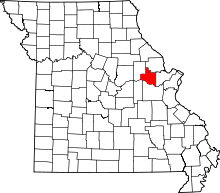 | |
| Villages | ||
| Townships |
| |
| Unincorporated communities | ||
| Footnotes | ‡This populated place also has portions in an adjacent county or counties | |