Pendleton, Missouri
| Pendleton, Missouri | |
|---|---|
| Village | |
| Area[1] | |
| • Total | 0.09 sq mi (0.23 km2) |
| • Land | 0.09 sq mi (0.23 km2) |
| • Water | 0 sq mi (0 km2) |
| Population (2010)[2] | |
| • Total | 43 |
| • Estimate (2012[3]) | 43 |
| • Density | 477.8/sq mi (184.5/km2) |
Pendleton is an incorporated village[4] in Warren County, Missouri, United States. The population was 43 at the 2010 census.
Geography
According to the United States Census Bureau, the village has a total area of 0.09 square miles (0.23 km2), all of it land.[1]
Demographics
| Historical population | |||
|---|---|---|---|
| Census | Pop. | %± | |
| 2010 | 43 | — | |
| Est. 2015 | 44 | [5] | 2.3% |
2010 census
As of the census[2] of 2010, there were 43 people, 14 households, and 11 families residing in the village. The population density was 477.8 inhabitants per square mile (184.5/km2). There were 15 housing units at an average density of 166.7 per square mile (64.4/km2). The racial makeup of the village was 100.0% White.
There were 14 households of which 42.9% had children under the age of 18 living with them, 42.9% were married couples living together, 28.6% had a female householder with no husband present, 7.1% had a male householder with no wife present, and 21.4% were non-families. 21.4% of all households were made up of individuals. The average household size was 3.07 and the average family size was 3.64.
The median age in the village was 33.5 years. 30.2% of residents were under the age of 18; 9.4% were between the ages of 18 and 24; 21% were from 25 to 44; 35% were from 45 to 64; and 4.7% were 65 years of age or older. The gender makeup of the village was 48.8% male and 51.2% female.
References
- 1 2 "US Gazetteer files 2010". United States Census Bureau. Retrieved 2012-07-08.
- 1 2 "American FactFinder". United States Census Bureau. Retrieved 2012-07-08.
- ↑ "Population Estimates". United States Census Bureau. Retrieved 2013-05-30.
- ↑ "Boundary Changes". Geographic Change Notes: Missouri. Population Division, United States Census Bureau. 2006-05-19. Retrieved 2008-07-13.
- ↑ "Annual Estimates of the Resident Population for Incorporated Places: April 1, 2010 to July 1, 2015". Retrieved July 2, 2016.
- ↑ "Census of Population and Housing". Census.gov. Retrieved June 4, 2015.
Municipalities and communities of Warren County, Missouri, United States | ||
|---|---|---|
| Cities | 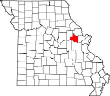 | |
| Villages | ||
| Townships |
| |
| Unincorporated communities | ||
| Footnotes | ‡This populated place also has portions in an adjacent county or counties | |
Coordinates: 38°49′38″N 91°14′07″W / 38.82722°N 91.23528°W