Lorenzo Geyres
| Lorenzo Geyres | |
|---|---|
| Village | |
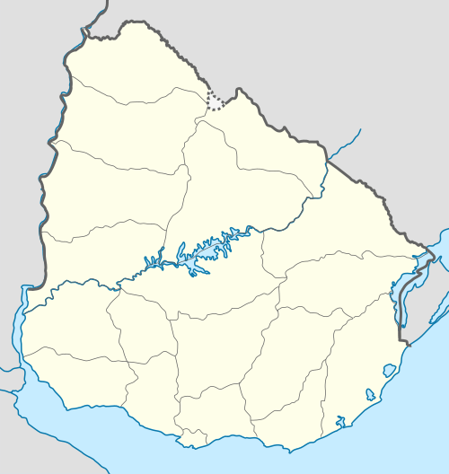 Lorenzo Geyres Location in Uruguay | |
| Coordinates: 32°5′0″S 57°55′0″W / 32.08333°S 57.91667°WCoordinates: 32°5′0″S 57°55′0″W / 32.08333°S 57.91667°W | |
| Country |
|
| Department | Paysandú Department |
| Population (2011) | |
| • Total | 774 |
| Time zone | UTC -3 |
| Postal code | 60004 |
| Dial plan | +598 4754 (+4 digits) |
Lorenzo Geyres is a village in Paysandú Department of western Uruguay.
Location
It is located about 3 kilometres (1.9 mi) northwest of Route 3 and about 30 kilometres (19 mi) north-northeast of the department capital Paysandú.
History
A nucleus of houses near the railroad station Queguay became recognized as a village named "Queguay" by the Act of Ley Nº 333 on 6 July 1853. It was renamed to "Lorenzo Geyres" and its status was elevated to "Pueblo" (village) by the Act of Ley Nº 8.226 on 29 May 1928.[1]
Population
In 2011 Lorenzo Geyres had a population of 774.[2]
| Year | Population |
|---|---|
| 1963 | 517 |
| 1975 | 474 |
| 1985 | 428 |
| 1996 | 573 |
| 2004 | 674 |
| 2011 | 774 |
Source: Instituto Nacional de Estadística de Uruguay[1]
References
- 1 2 "Statistics of urban localities (1963–2004) (see also "Queguay")" (PDF). INE. 2012. Retrieved 4 September 2012.
- ↑ "Censos 2011 Paysandú (needs flash plugin)". INE. 2012. Retrieved 31 August 2012.
External links
Capital: Paysandú | ||
| Towns and villages | 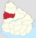 | |
| Sights | ||
This article is issued from Wikipedia - version of the 6/27/2014. The text is available under the Creative Commons Attribution/Share Alike but additional terms may apply for the media files.