Chacras de Paysandú
| Chacras de Paysandú | |
|---|---|
| Rural populated area | |
 Chacras de Paysandú Location in Uruguay | |
| Coordinates: 32°21′0″S 58°0′0″W / 32.35000°S 58.00000°WCoordinates: 32°21′0″S 58°0′0″W / 32.35000°S 58.00000°W | |
| Country |
|
| Department | Paysandú Department |
| Population (2011) | |
| • Total | 3,965 |
| Time zone | UTC -3 |
| Postal code | 60000 |
| Dial plan | +598 472 (+5 digits) |
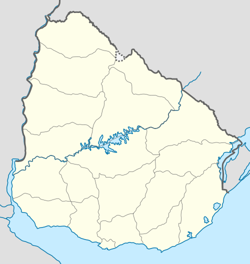
Chacras de Paysandú, which means "Ranches of Paysandú", is a wide but sparsely populated rural area, which is an east and southeast extension of the city of Paysandú in the Paysandú Department of western Uruguay.
Within Chacras de Paysandú are two villages, which form enclaves. These are Esperanza to the east and Porvenir to the southeast.
Population
In 2011 it had a population of 3,965.[1]
| Year | Population |
|---|---|
| 1975 | 3,013 |
| 1985 | 3,650 |
| 1996 | 3,957 |
| 2004 | 5,082 |
| 2011 | 3,965 |
Source: Instituto Nacional de Estadística de Uruguay[2]
References
- ↑ "Censos 2011 Cuadros Paysandú". INE. 2012. Retrieved 25 August 2012.
- ↑ "1963–1996 Statistics / C" (DOC). Instituto Nacional de Estadística de Uruguay. 2004. Retrieved 27 June 2011.
External links
Capital: Paysandú | ||
| Towns and villages | 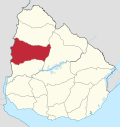 | |
| Sights | ||
This article is issued from Wikipedia - version of the 11/18/2016. The text is available under the Creative Commons Attribution/Share Alike but additional terms may apply for the media files.