El Eucaliptus
| El Eucaliptus | |
|---|---|
| Hamlet | |
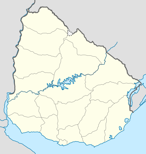 El Eucaliptus Location in Uruguay | |
| Coordinates: 31°54′0″S 57°16′0″W / 31.90000°S 57.26667°WCoordinates: 31°54′0″S 57°16′0″W / 31.90000°S 57.26667°W | |
| Country |
|
| Department | Paysandú Department |
| Population (2011) | |
| • Total | 197 |
| Time zone | UTC -3 |
| Postal code | 60017 |
| Dial plan | +598 474 (+5 digits) |
El Eucaliptus is a caserío (hamlet) in the centre of Paysandú Department, in western Uruguay.
Location
It is located on Route 26, about 100 kilometres (62 mi) northeast of the city of Paysandú.
Population
In 2011 El Eucaliptus had a population of 197.[1]
| Year | Population |
|---|---|
| 1963 | 145 |
| 1975 | 235 |
| 1985 | 176 |
| 1996 | 214 |
| 2004 | 401 |
| 2011 | 197 |
Source: Instituto Nacional de Estadística de Uruguay[2]
References
- ↑ "Censos 2011 Paysandú (needs flash plugin)". INE. 2012. Retrieved 31 August 2012.
- ↑ "1963–1996 Statistics / E" (DOC). Instituto Nacional de Estadística de Uruguay. 2004. Retrieved 29 June 2011.
External links
Capital: Paysandú | ||
| Towns and villages | 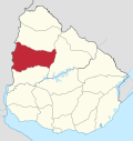 | |
| Sights | ||
This article is issued from Wikipedia - version of the 5/13/2013. The text is available under the Creative Commons Attribution/Share Alike but additional terms may apply for the media files.