Jingdong Yi Autonomous County
| Jingdong County | |
|---|---|
| Autonomous county | |
| Chinese transcription(s) | |
| • Characters | 景东彝族自治县 |
| • Pinyin | Jǐngdōng yízú Zìzhìxiàn |
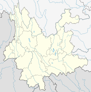
.png) Location of Jingdong County (pink) and Pu'er Prefecture (yellow) within Yunnan province of China | |
 Jingdong County Location within Yunnan, China | |
| Coordinates: 24°28′N 100°54′E / 24.467°N 100.900°E | |
| Country | China |
| Province | Yunnan |
| Prefecture | Pu'er |
| GB/T 2260 CODE[1] | 530821 |
| Area | |
| • Total | 4,532 km2 (1,750 sq mi) |
| ElevationEarthTools | 1,872 m (6,142 ft) |
| Population | |
| • Total | 348,082 |
| • Density | 77/km2 (200/sq mi) |
| Time zone | China Standard Time (UTC+8) |
| Postal code | 676200[2] |
| Area code(s) | 0879[2] |
| Website | Jingdong eGov |
|
1Yunnan Statistics Bureau 2Puer Gov. 3Yunnan Portal | |
Jingdong Yi Autonomous County (景东彝族自治县; pinyin: Jǐngdōng yízú Zìzhìxiàn) is an autonomous county under the jurisdiction of Pu'er Prefecture, Yunnan Province, China.
Ethnic groups
According to the Jingdong County Almanac (1994:519), ethnic Yao numbered 3,889 individuals in 1990, and lived mainly in Chaqing 岔箐[3] and Dasongshu 大松树[4] of Taizhong 太忠乡. Yao language speakers are found in Puya Village 普牙村, Chaqing Township 岔箐乡 (Jingdong County Ethnic Gazetteer 2012:144).[5][6][7]
The Hani of Jingdong (autonym: Kaduo 卡多) numbered 10,861 individuals as of 1990 and live primarily in Wenjing 文井, Zhehou 者后, and Huashan 花山 townships.
The Jingdong County Ethnic Gazetteer 景东县民族志 (2012:209) reports that are about 200 ethnic Bulang in Manbeng Village 曼崩村, Dachaoshandong Town 大朝山东镇.[8]
References
- ↑ http://www.stats.gov.cn/tjbz/xzqhdm/index.htm
- 1 2 Area Code and Postal Code in Yunnan Province
- ↑ http://www.ynszxc.gov.cn/villagePage/vIndex.aspx?departmentid=217095
- ↑ http://www.ynszxc.gov.cn/villagePage/vIndex.aspx?departmentid=217070
- ↑ http://www.ynszxc.gov.cn/villagePage/vIndex.aspx?departmentid=217633
- ↑ http://www.ynszxc.gov.cn/villagePage/vIndex.aspx?departmentid=217632
- ↑ http://www.ynszxc.gov.cn/villagePage/vIndex.aspx?departmentid=217630
- ↑ http://www.ynszxc.gov.cn/villagePage/vIndex.aspx?departmentid=245506
External links
Coordinates: 24°28′00″N 100°54′00″E / 24.4667°N 100.9°E