Dehong Dai and Jingpo Autonomous Prefecture
| Dehong Prefecture 德宏州 · | |
|---|---|
| Autonomous prefecture | |
德宏傣族景颇族自治州 · Sikung Sam Zaizo Byumyu Yumsing Upkang Mau | |
| Chinese transcription(s) | |
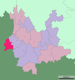 Location of Dehong Prefecture jurisdiction in Yunnan | |
| Country | People's Republic of China |
| Province | Yunnan |
| Prefecture seat | Mang City |
| Area | |
| • Total | 11,526 km2 (4,450 sq mi) |
| Population (2010)[1] | |
| • Total | 1,211,440 |
| • Density | 110/km2 (270/sq mi) |
| Time zone | China Standard |
| Postal code | 678400 |
| Area code(s) | 0692 |
| Website |
dh |
The Dehong Dai and Jingpo Autonomous Prefecture (Zaiwa: Sikung Sam Zaizo Byumyu Yumsing Upkang Mau; simplified Chinese: 德宏傣族景颇族自治州; traditional Chinese: 德宏傣族景頗族自治州; pinyin: Déhóng Dǎizú Jǐngpōzú Zìzhìzhōu) is located in western Yunnan province, People's Republic of China, and is one of the eight autonomous prefectures of the province, bordering Baoshan to the east and Burma's Kachin State to the west.
Geography
Dehong stretches 122 km (76 mi) from east to west and 170 km (110 mi) from north to south, its area is 11,526 km2 (4,450 sq mi).
Climate
| Climate data for Mang City, Yunnan | |||||||||||||
|---|---|---|---|---|---|---|---|---|---|---|---|---|---|
| Month | Jan | Feb | Mar | Apr | May | Jun | Jul | Aug | Sep | Oct | Nov | Dec | Year |
| Average high °C (°F) | 14 (57) |
17 (62) |
21 (69) |
25 (77) |
26 (78) |
25 (77) |
25 (77) |
25 (77) |
23 (73) |
20 (68) |
17 (62) |
15 (59) |
21.1 (69.7) |
| Average low °C (°F) | 2 (35) |
3 (37) |
6 (42) |
10 (50) |
15 (59) |
17 (62) |
17 (62) |
16 (60) |
14 (57) |
11 (51) |
7 (44) |
3 (37) |
10.1 (49.7) |
| Average precipitation mm (inches) | 15 (0.6) |
20 (0.8) |
20 (0.8) |
38 (1.5) |
99 (3.9) |
178 (7.0) |
185 (7.3) |
170 (6.7) |
114 (4.5) |
69 (2.7) |
36 (1.4) |
15 (0.6) |
959 (37.8) |
| Source: Weatherbase[2] | |||||||||||||
Administration
Dehong is divided into three counties and two county level cities:
| Map | # | Name | Hanzi | Hanyu Pinyin | Population (2010) | Area (km²) | Density (/km²) |
|---|---|---|---|---|---|---|---|
 | |||||||
| 1 | Mang City | 芒市 | Máng Shì | 389,891 | 2,987 | 131 | |
| 2 | Ruili City | 瑞丽市 | Ruìlì Shì | 180,627 | 1,020 | 177 | |
| 3 | Lianghe County | 梁河县 | Liánghé Xiàn | 154,175 | 1,159 | 133 | |
| 4 | Yingjiang County | 盈江县 | Yíngjiāng Xiàn | 305,167 | 4,429 | 69 | |
| 5 | Longchuan County | 陇川县 | Lǒngchuān Xiàn | 181,580 | 1,931 | 94 |
The prefectural government seat is Mang City.
Population
The population of Dehong in 2003 was of 1.02 million, 48.17% of whom were Han Chinese, 51.83% were national minorities, mostly Dai and Jingpo.
History
The area was declared an autonomous region in 1953, and in May 1956 became an autonomous prefecture. In 1960 when interprovincial migration took place many farmers came to Yunnan to farm bananas. This was during the "Great Leap Forward" when a biologist working for Mao Zedong wrote an article about the weather in Yunnan being very suitable for bananas to be planted. A very long time ago before this many Chinese were in fact very scared of going there because of an illness that lurked about. It was later discovered that this was an identifiable tropical disease. The farmers helped to get rid of the disease. They made clearings, roads and space for fields and plantations.
Further reading
- Luo, Yongxian. A Grammar of Dehong, Southwest China. Canberra, ACT: Pacific Linguistics, Research School of Pacific and Asian Studies, Australian National University, 1999. ISBN 0-85883-496-0
References
- ↑ According to 2010 China National Census
- ↑ "Historical Weather for Luxi, Yunnan, China". Weatherbase. Retrieved February 28, 2012.
External links
| Wikimedia Commons has media related to Dehong Dai and Jingpo Autonomous Prefecture. |
- Dehong local government site (in Chinese)
- Dehong tuanjie bao (magazine in Chinese)
- Dehong (from Xinhuanet.com, in Chinese)
Coordinates: 24°26′N 98°35′E / 24.433°N 98.583°E