Ingalls, North Carolina
| Ingalls | |
|---|---|
| Unincorporated community | |
 Ingalls Location within the state of North Carolina | |
| Coordinates: 35°58′17″N 82°00′42″W / 35.97139°N 82.01167°WCoordinates: 35°58′17″N 82°00′42″W / 35.97139°N 82.01167°W | |
| Country | United States |
| State | North Carolina |
| County | Avery County |
| Elevation | 2,766 ft (843 m) |
| Time zone | Eastern (EST) (UTC-5) |
| • Summer (DST) | EDT (UTC-4) |
| ZIP code | 28657 |
| Area code(s) | 828 |
| GNIS feature ID | 1012354[1] |
Ingalls is an unincorporated community in Avery County, North Carolina, United States. The community is located at the intersection of US 19-E and NC 194. The Avery County Airport (Morrison Field) is located two miles south from Ingalls, towards Spruce Pine.
See also
References
Municipalities and communities of Avery County, North Carolina, United States | ||
|---|---|---|
| Towns | 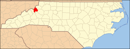 | |
| Villages | ||
| Unincorporated communities | ||
| Footnotes | ‡This populated place also has portions in an adjacent county or counties | |
This article is issued from Wikipedia - version of the 3/23/2014. The text is available under the Creative Commons Attribution/Share Alike but additional terms may apply for the media files.