Pineola, North Carolina
| Pineola | |
|---|---|
| Unincorporated community | |
 Pineola Location within the state of North Carolina | |
| Coordinates: 36°01′42″N 81°53′29″W / 36.02833°N 81.89139°WCoordinates: 36°01′42″N 81°53′29″W / 36.02833°N 81.89139°W | |
| Country | United States |
| State | North Carolina |
| County | Avery County |
| Elevation | 3,550 ft (1,082 m) |
| Time zone | Eastern (EST) (UTC-5) |
| • Summer (DST) | EDT (UTC-4) |
| ZIP code | 28662 |
| Area code(s) | 828 |
| GNIS feature ID | 1021936[1] |
Pineola is an unincorporated community in Avery County, North Carolina. Its boundaries, in general, span a three-mile radius from the intersection of U.S. Route 221 and NC 181.[2] The area was known as "Saginaw" until the early 20th century. In 1814 Pineola is listed as a county in North Carolina.
Pineola is the site of several businesses, including an asphalt plant, a concrete plant, a general store, a sawmill and a small hotel. The Linville River flows through the area, and is impounded by a dam into a small lake for a resort community. The Blue Ridge Parkway passes through the southeast portion of the area.
During the early 1900s, it was the site of a large logging operation and sawmill, owned by the W.M. Ritter Company. The East Tennessee and Western North Carolina Railroad ("Tweetsie") operated in the community until 1939, when it received permission from the Interstate Commerce Commission, to abandon Pineola.
See also
References
External links
Municipalities and communities of Avery County, North Carolina, United States | ||
|---|---|---|
| Towns | 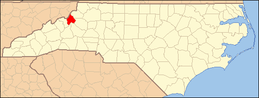 | |
| Villages | ||
| Unincorporated communities | ||
| Footnotes | ‡This populated place also has portions in an adjacent county or counties | |