Linville, North Carolina
| Linville | |
|---|---|
| Unincorporated community | |
|
Linville River | |
 Linville Location within the state of North Carolina | |
| Coordinates: 36°03′59″N 81°52′13″W / 36.06639°N 81.87028°WCoordinates: 36°03′59″N 81°52′13″W / 36.06639°N 81.87028°W | |
| Country | United States |
| State | North Carolina |
| County | Avery County |
| Founded | 1883 |
| Elevation | 3,665 ft (1,117 m) |
| Time zone | Eastern (EST) (UTC-5) |
| • Summer (DST) | EDT (UTC-4) |
| ZIP code | 28646 |
| Area code(s) | 828 |
| GNIS feature ID | 1021158[1] |

Linville is a community centered just south of the US 221 and NC 105 intersection in Avery County, North Carolina. The community—at times known as Clay or Porcelain—was founded in 1883 and designed by Samuel T. Kelsey of Kansas,[2] and named for William and John Linville, who were killed by Cherokees in 1766.[3][4] The East Tennessee and Western North Carolina Railroad ("Tweetsie") passed through the community from 1916 till 1940, when a major flood washed away the tracks;[5] the old rail route later became NC 105 in 1956.
Attractions
Linville has three country clubs in the area: Linville Golf Course, Grandfather Golf and Country Club, and Linville Ridge; all open late spring to early fall. The Eseeola Lodge is also a popular destination for lodging during the summer months. In the winter, nearby Ski Sugar, Ski Beech and Ski Hawknest are popular skiing and snow tubing destinations. Other popular attractions are just a short driving distance from Linville:
- Blue Ridge Parkway
- Blowing Rock
- Brown Mountain
- Grandfather Mountain
- Linville Gorge Wilderness
- Linville Caverns
- Linville Falls
The Linville Historic District was listed on the National Register of Historic Places in 1979.[6]
Health care
Linville has one hospital, Charles A. Cannon, Jr. Memorial Hospital, that serves all of Avery County.[7]
See also
References
- ↑ U.S. Geological Survey Geographic Names Information System: Linville, North Carolina
- ↑ "North Carolina Scenic Byways" (PDF). Retrieved 2010-10-04.
- ↑ "Linville, North Carolina Information".
- ↑ "Linville Gorge Wilderness".
- ↑ "East Tennessee & Western North Carolina Railroad (ET&WNC - Tweetsie)".
- ↑ National Park Service (2010-07-09). "National Register Information System". National Register of Historic Places. National Park Service.
- ↑ https://www.apprhs.org/cannon-memorial-hospital
External links
- Charles A. Cannon Jr. Memorial Hospital
- Eseeola Lodge
- Grandfather Golf and Country Club
- Linville Ridge
Municipalities and communities of Avery County, North Carolina, United States | ||
|---|---|---|
| Towns | 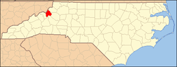 | |
| Villages | ||
| Unincorporated communities | ||
| Footnotes | ‡This populated place also has portions in an adjacent county or counties | |