Hrastje, Šentjernej
| Hrastje | |
|---|---|
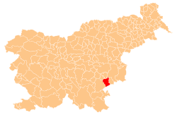
 Hrastje Location in Slovenia | |
| Coordinates: 45°48′51.61″N 15°17′54.68″E / 45.8143361°N 15.2985222°ECoordinates: 45°48′51.61″N 15°17′54.68″E / 45.8143361°N 15.2985222°E | |
| Country |
|
| Traditional region | Lower Carniola |
| Statistical region | Southeast Slovenia |
| Municipality | Šentjernej |
| Area | |
| • Total | 1.14 km2 (0.44 sq mi) |
| Elevation | 238.2 m (781.5 ft) |
| Population (2002) | |
| • Total | 95 |
| [1] | |
Hrastje (pronounced [ˈxɾaːstjɛ]) is a small settlement in the foothills of the Gorjanci Hills in the Municipality of Šentjernej in southeastern Slovenia. The area was traditionally part of Lower Carniola. It is now included in the Southeast Slovenia Statistical Region.[2]
Name
The name Hrastje is derived from the Slovene common noun hrast 'oak', referring to the local vegetation.[3]
Castle
Gracar Turn is a 14th-century castle on the northern outskirts of the village.[4]
References
- ↑ Statistical Office of the Republic of Slovenia
- ↑ Šentjernej municipal site
- ↑ Snoj, Marko. 2009. Etimološki slovar slovenskih zemljepisnih imen. Ljubljana: Modrijan and Založba ZRC, p. 163.
- ↑ Slovenian Ministry of Culture register of national heritage reference number ešd 158
External links
 Media related to Hrastje, Šentjernej at Wikimedia Commons
- Hrastje on Geopedia
| Settlements | Administrative centre: Šentjernej
|  |
|---|---|---|
| Landmarks |
| |
This article is issued from Wikipedia - version of the 6/13/2015. The text is available under the Creative Commons Attribution/Share Alike but additional terms may apply for the media files.