Dolenje Gradišče pri Šentjerneju
| Dolenje Gradišče pri Šentjerneju | |
|---|---|
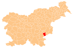
 Dolenje Gradišče pri Šentjerneju Location in Slovenia | |
| Coordinates: 45°50′39.87″N 15°17′26.06″E / 45.8444083°N 15.2905722°ECoordinates: 45°50′39.87″N 15°17′26.06″E / 45.8444083°N 15.2905722°E | |
| Country |
|
| Traditional region | Lower Carniola |
| Statistical region | Southeast Slovenia |
| Municipality | Šentjernej |
| Area | |
| • Total | 0.68 km2 (0.26 sq mi) |
| Elevation | 172.2 m (565.0 ft) |
| Population (2002) | |
| • Total | 113 |
| [1] | |
Dolenje Gradišče pri Šentjerneju (pronounced [dɔˈleːnjɛ ɡɾaˈdiːʃtʃɛ pɾi ʃɛntjɛɾˈnɛːju]; German: Untergradische[2]) is a settlement in the Municipality of Šentjernej in southeastern Slovenia. The area was traditionally part of Lower Carniola. It is now included in the Southeast Slovenia Statistical Region.[3]
Name
The name of the settlement was changed from Dolenje Gradišče to Dolenje Gradišče pri Šentjerneju in 1953.[4] In the past the German name was Untergradische.[2]
Cultural heritage
Remains of a Roman villa rustica have been found in the hamlet of Lazice in the settlement.[5]
References
- ↑ Statistical Office of the Republic of Slovenia
- 1 2 Leksikon občin kraljestev in dežel zastopanih v državnem zboru, vol. 6: Kranjsko. 1906. Vienna: C. Kr. Dvorna in Državna Tiskarna, p. 72.
- ↑ Šentjernej municipal site
- ↑ Spremembe naselij 1948–95. 1996. Database. Ljubljana: Geografski inštitut ZRC SAZU, DZS.
- ↑ Slovenian Ministry of Culture register of national heritage reference number ešd 26004
External links
| Settlements | Administrative centre: Šentjernej
|  |
|---|---|---|
| Landmarks |
| |
This article is issued from Wikipedia - version of the 9/24/2014. The text is available under the Creative Commons Attribution/Share Alike but additional terms may apply for the media files.