Gorenji Maharovec
| Gorenji Maharovec | |
|---|---|
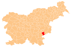
 Gorenji Maharovec Location in Slovenia | |
| Coordinates: 45°50′23.84″N 15°18′28.08″E / 45.8399556°N 15.3078000°ECoordinates: 45°50′23.84″N 15°18′28.08″E / 45.8399556°N 15.3078000°E | |
| Country |
|
| Traditional region | Lower Carniola |
| Statistical region | Southeast Slovenia |
| Municipality | Šentjernej |
| Area | |
| • Total | 0.95 km2 (0.37 sq mi) |
| Elevation | 187.8 m (616.1 ft) |
| Population (2002) | |
| • Total | 65 |
| [1] | |
Gorenji Maharovec (pronounced [ɡɔˈɾeːnji maxaˈɾɔːʋəts] or [ɡɔˈɾeːnji maxaˈɾoːʋəts]; German: Obermacharouz[2]) is a settlement west of Šentjernej in southeastern Slovenia. The area was traditionally part of Lower Carniola and is now included in the Southeast Slovenia Statistical Region.[3]
References
- ↑ Statistical Office of the Republic of Slovenia
- ↑ Leksikon občin kraljestev in dežel zastopanih v državnem zboru, vol. 6: Kranjsko. 1906. Vienna: C. Kr. Dvorna in Državna Tiskarna, p. 72.
- ↑ Šentjernej municipal site
External links
| Settlements | Administrative centre: Šentjernej
|  |
|---|---|---|
| Landmarks |
| |
This article is issued from Wikipedia - version of the 1/19/2016. The text is available under the Creative Commons Attribution/Share Alike but additional terms may apply for the media files.