Gorenje Gradišče pri Šentjerneju
| Gorenje Gradišče pri Šentjerneju | |
|---|---|
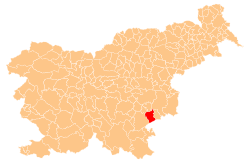
 Gorenje Gradišče pri Šentjerneju Location in Slovenia | |
| Coordinates: 45°50′29.51″N 15°17′25.08″E / 45.8415306°N 15.2903000°ECoordinates: 45°50′29.51″N 15°17′25.08″E / 45.8415306°N 15.2903000°E | |
| Country |
|
| Traditional region | Lower Carniola |
| Statistical region | Southeast Slovenia |
| Municipality | Šentjernej |
| Area | |
| • Total | 1.02 km2 (0.39 sq mi) |
| Elevation | 172.9 m (567.3 ft) |
| Population (2002) | |
| • Total | 93 |
| [1] | |
Gorenje Gradišče pri Šentjerneju (pronounced [ɡɔˈɾeːnjɛ ɡɾaˈdiːʃtʃɛ pɾi ʃɛntjɛɾˈnɛːju]; German: Obergradische[2]) is a settlement west of Šentjernej in southeastern Slovenia. The area was traditionally part of Lower Carniola. It is now included in the Southeast Slovenia Statistical Region.[3]
Name
The name of the settlement was changed from Gorenje Gradišče to Gorenje Gradišče pri Šentjerneju in 1953.[4] In the past the German name was Obergradische.[2]
Church
The local church, built outside the settlement to the east, is dedicated to Saints Cosmas and Damian and belongs to the Parish of Šentjernej. It was first mentioned in written documents dating to 1526, but the current Baroque building dates to the early 17th century.[5]
References
- ↑ Statistical Office of the Republic of Slovenia
- 1 2 Leksikon občin kraljestev in dežel zastopanih v državnem zboru, vol. 6: Kranjsko. 1906. Vienna: C. Kr. Dvorna in Državna Tiskarna, p. 72.
- ↑ Šentjernej municipal site
- ↑ Spremembe naselij 1948–95. 1996. Database. Ljubljana: Geografski inštitut ZRC SAZU, DZS.
- ↑ Slovenian Ministry of Culture register of national heritage reference number ešd 2436
External links
| Settlements | Administrative centre: Šentjernej
|  |
|---|---|---|
| Landmarks |
| |
This article is issued from Wikipedia - version of the 9/24/2014. The text is available under the Creative Commons Attribution/Share Alike but additional terms may apply for the media files.