Hellertown, Pennsylvania
| Hellertown, Pennsylvania | |
|---|---|
|
Detwiller Plaza in downtown Hellertown | |
 Location of Hellertown in Northampton County | |
 Hellertown, Pennsylvania Location of Hellertown in Pennsylvania | |
| Coordinates: 40°35′03″N 75°20′17″W / 40.58417°N 75.33806°WCoordinates: 40°35′03″N 75°20′17″W / 40.58417°N 75.33806°W | |
| Country | United States |
| State | Pennsylvania |
| County | Northampton |
| Government | |
| • Mayor | Richard T. Fluck |
| Area | |
| • Total | 1.3 sq mi (3 km2) |
| • Land | 1.3 sq mi (3 km2) |
| • Water | 0.0 sq mi (0 km2) |
| Elevation | 322 ft (98 m) |
| Population (2010) | |
| • Total | 5,898 |
| • Density | 4,500/sq mi (1,800/km2) |
| Time zone | EST (UTC-5) |
| • Summer (DST) | EDT (UTC-4) |
| ZIP Code | 18055 |
| Area code(s) | 610 and 484 |
| Website |
www |
.jpg)
Hellertown is a borough in Northampton County, Pennsylvania, United States. Hellertown is located in the Lehigh Valley region of the state, and geographically in the Lehigh Valley's Saucon Valley. The population of Hellertown was 5,898 at the 2010 census.
Hellertown is home to Lost River Caverns.
Geography
Hellertown is located at 40°35′3″N 75°20′17″W / 40.58417°N 75.33806°W (40.584099, -75.338139).[1]
According to the United States Census Bureau, the borough has a total area of 1.3 square miles (3.4 km2), all land.
Government and politics
Legislators
- State Representative Robert L. Freeman, Democrat, 136th district
- State Senator Lisa Boscola, Democrat, 18th district
- US Representative Charlie Dent, Republican, 15th district
Borough Council
Hellertown Borough elects seven council members at large.
- Thomas Rieger, President
- Philip Weber, Vice President
- James Hill
- Michael McKenna
- John Bate
- Herb Payung
- Earl Hall
Transportation
Hellertown was once served by the SEPTA Bethlehem Line, but service ended in 1981.
Demographics
| Historical population | |||
|---|---|---|---|
| Census | Pop. | %± | |
| 1880 | 605 | — | |
| 1890 | 708 | 17.0% | |
| 1900 | 745 | 5.2% | |
| 1910 | 915 | 22.8% | |
| 1920 | 3,008 | 228.7% | |
| 1930 | 3,851 | 28.0% | |
| 1940 | 4,031 | 4.7% | |
| 1950 | 5,435 | 34.8% | |
| 1960 | 6,716 | 23.6% | |
| 1970 | 6,615 | −1.5% | |
| 1980 | 6,025 | −8.9% | |
| 1990 | 5,662 | −6.0% | |
| 2000 | 5,606 | −1.0% | |
| 2010 | 5,898 | 5.2% | |
| Est. 2015 | 5,824 | [2] | −1.3% |
| Sources:[3][4][5] | |||
As of the census[4] of 2000, there were 5,606 people, 2,448 households, and 1,571 families residing in the borough. The population density was 4,180.8 people per square mile (1,615.3/km2). There were 2,570 housing units at an average density of 1,916.6 per square mile (740.5/km2). The racial makeup of the borough was 98.20% White, 0.30% African American, 0.07% Native American, 0.20% Asian, 0.68% from other races, and 0.55% from two or more races. Hispanic or Latino of any race were 2.48% of the population.
There were 2,448 households, out of which 24.7% had children under the age of 18 living with them, 51.2% were married couples living together, 10.3% had a female householder with no husband present, and 35.8% were non-families. 30.5% of all households were made up of individuals, and 17.2% had someone living alone who was 65 years of age or older. The average household size was 2.29 and the average family size was 2.85.
In the borough the population was distributed, with 20.2% under the age of 18, 6.6% from 18 to 24, 29.0% from 25 to 44, 21.2% from 45 to 64, and 23.1% who were 65 years of age or older. The median age was 42 years. For every 100 females there were 89.3 males. For every 100 females age 18 and over, there were 86.2 males.
The median income for a household in the borough was $39,651, and the median income for a family was $49,604. Males had a median income of $37,935 versus $26,322 for females. The per capita income for the borough was $20,119. About 4.1% of families and 4.6% of the population were below the poverty line, including 6.5% of those under age 18 and 3.3% of those age 65 or over.
Public education
Hellertown Borough and Lower Saucon Township are served by the Saucon Valley School District. Saucon Valley School District is made up of an elementary school, middle school and high school.
Notable people
- Home of Allen Woodring, 1920 Olympic gold medalist in the 200m.
- Birthplace of the mathematician and professor Carl Benjamin Boyer [6]
- Home of Ted Poley, Lead singer of the 1980s rock band Danger Danger
Mentioned in
- Solved episode titled "Sin" on Investigation Discovery network. This documentary profiles the murder of Hellertown resident Rhonda Smith, who was found dead in Trinity Lutheran Church at Springfield Township, Bucks County. (Original Airdate: August 31, 2009).
- Hellertown is mentioned in the Kurt Vonnegut novel Slaughterhouse Five"
References
- ↑ "US Gazetteer files: 2010, 2000, and 1990". United States Census Bureau. 2011-02-12. Retrieved 2011-04-23.
- ↑ "Annual Estimates of the Resident Population for Incorporated Places: April 1, 2010 to July 1, 2015". Retrieved July 2, 2016.
- ↑ "Census of Population and Housing". U.S. Census Bureau. Retrieved 11 December 2013.
- 1 2 "American FactFinder". United States Census Bureau. Retrieved 2008-01-31.
- ↑ "Incorporated Places and Minor Civil Divisions Datasets: Subcounty Resident Population Estimates: April 1, 2010 to July 1, 2012". Population Estimates. U.S. Census Bureau. Retrieved 11 December 2013.
- ↑ Dauben, Joseph Warren; Scriba, Christoph J. Writing the history of mathematics: its historical development, Birkhäuser, 2002. Cf. pp.380-381 for the biography of Boyer.
External links
| Wikimedia Commons has media related to Hellertown, Pennsylvania. |
 Hellertown travel guide from Wikivoyage
- Borough website
- Community website
- Hellertown Historical Society website
Municipalities and communities of Northampton County, Pennsylvania, United States | ||
|---|---|---|
| Cities | 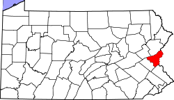 | |
| Boroughs | ||
| Townships | ||
| CDPs | ||
| Unincorporated communities | ||
| Footnotes | ‡This populated place also has portions in an adjacent county or counties | |