Bath, Pennsylvania
| Borough of Bath | |
| Settlement | |
 | |
| Country | United States |
|---|---|
| State | Pennsylvania |
| County | Northampton |
| Elevation | 432 ft (131.7 m) |
| Coordinates | 40°43′36″N 75°23′25″W / 40.72667°N 75.39028°WCoordinates: 40°43′36″N 75°23′25″W / 40.72667°N 75.39028°W |
| Area | 0.9 sq mi (2.3 km2) |
| - land | 0.9 sq mi (2 km2) |
| - water | 0.04 sq mi (0 km2), 4.44% |
| Population | 2,699 (2011) |
| Density | 2,890/sq mi (1,115.8/km2) |
| Timezone | EST (UTC-5) |
| - summer (DST) | EDT (UTC-4) |
| ZIP Code | 18014 |
| Area code | 610 and 484 (610-Exchange: 837) |
 Location of Bath in Northampton County
| |
 Location of Bath in Pennsylvania
| |
 Location of Pennsylvania in the United States
| |
| Website: Borough Website | |
Bath is a borough in Northampton County, Pennsylvania, United States. It is named for Bath, Somerset, England. It is located in the Lehigh Valley region of the state with a population of 2,699 according to the 2011 census.[1]
History
The Bath borough is located at the head of the Monocacy Creek (Lehigh River) in an area of the Lehigh Valley that was once rich in agriculture. The greater area of the town, however, lies east of the Monocacy Valley.[1]
Bath was established in 1728 as a Scotch-Irish settlement before the American Revolution as the first settlement by white people in the Forks of the Delaware. It is named for Bath, Somerset, England by Margaret DeLancey, who sold land under her father, lieutenant colonel of the Continental Army, William Allen, in the 1700s.[1]
On March 3, 1737, the 247 acres of land that is currently inside the boundaries of Bath was purchased and surveyed for Daniel Craig.[2][1] According to borough historians, this land spans from Chestnut Street to the north of Northampton Street. William Allen conveyed the greater part of Bath’s land to his son, Andrew, in 1776, the same year American declared its freedom from the British. That same year, Andrew Allen sold 150 acres of the land to John Lattimore. Andrew Allen also owned land west of the Monocacy, which was eventually confiscated and sold to local families in the area. Today, Bath’s current acreage is 576 acres and is less than 1 sq. mi. in area.[1]
On August 18, 2012, Bath celebrated its 275th anniversary.[2] In 1999, the Bath Business and Community Partnership (BBCP) was established for managing urban revitalization initiatives, including creating a greener town, organizing volunteers, and developing economic restructuring/asset enhancement.[1]
Geography
Bath is located at 40°43′36″N 75°23′25″W / 40.72667°N 75.39028°W (40.726556, -75.390338).[3]
According to the United States Census Bureau, the borough has a total area of 0.9 square miles (2.3 km2), all land.
Bath is located 6 miles (9.7 km) north of Bethlehem and 4 miles (6.4 km) west of Nazareth, Pennsylvania, at the intersection of Pennsylvania Routes 248 and 512. Bath is also 100 miles (160 km) southwest of New York City and 60 miles (96 km) northwest of Philadelphia. It is also located near Wind Gap as well as the Delaware and Lehigh water gaps.
Bath's elevation is 432 feet (132 m) above sea level as of 2011.[4]
Government
Bath’s government involves a mayor, 7 council members, and a tax collector. The current mayor is Fiorella ‘Fi’ Reginelli-Mirabito with Mark Saginario as the Council President and Michele Ehrgott as Council VP. The town’s general budget is $1.6 million with an assessed valuation of over $53.1 million. Bath represents the 138th House of Representatives District, the 16th Senate District, and the 15th Congressional District[1]
Demographics
| Historical population | |||
|---|---|---|---|
| Census | Pop. | %± | |
| 1860 | 486 | — | |
| 1870 | 707 | 45.5% | |
| 1880 | 698 | −1.3% | |
| 1890 | 723 | 3.6% | |
| 1900 | 731 | 1.1% | |
| 1910 | 1,057 | 44.6% | |
| 1920 | 1,401 | 32.5% | |
| 1930 | 1,625 | 16.0% | |
| 1940 | 1,720 | 5.8% | |
| 1950 | 1,824 | 6.0% | |
| 1960 | 1,736 | −4.8% | |
| 1970 | 1,829 | 5.4% | |
| 1980 | 1,953 | 6.8% | |
| 1990 | 2,358 | 20.7% | |
| 2000 | 2,678 | 13.6% | |
| 2010 | 2,693 | 0.6% | |
| Est. 2015 | 2,667 | [5] | −1.0% |
| Sources:[6][7][8] | |||
As of the census estimates [7] of 2011, there were 2,699 people living in Bath, an increase of +0.7 from 2000. There are 1,298 males (48.2%) and 1,398 females (51.8%). The population density was 2,890 people per square mile (1,148.9/km²). There were 1,126 housing units at an average density of 1,244.8 per square mile (483.1/km²). Racially, the borough consists of 88.9% White, 2.2% African American, 0.01% Native American, 1.0% Asian, and 1.3% from two or more races.[4]
The most common ancestries in Bath are German (33.2%), Irish (13.1%), Italian (10.2%), English (4.7%), and Polish (3.7%).[4]
The percentage of married families in Bath is 52.5%, while those who have never been married are 24.4%. Divorced residents account for 11.8%, followed by widowed (8.9%) and separated (2.3%) residents.[4]
As far as education, the number of people over the age of 25 with at least a high school diploma is 76.9%. Those with a bachelor's degree or higher is 14.8% and residents with at least a graduate or professional degree is 5.9%.[4]
The unemployment percentage in August 2012 was 8.7%.[4]
In 2009, the median income for a household in the borough was $43,983 and the per capita income for the borough was $21,999. The average house or condo value was $194,522 and the average cost for rent was $791. For houses with mortgages, the average property tax was $3,051.[4]
About 6.4% of families and 7.9% of the population were below the poverty line, including 10.9% of those under age 18 and 12.6% of those age 65 or over.
Community Organizations
Bath is home to several organizations that include the American Legion Eckley E. Patch Post 40, the BBCP, the Bath-East Allen Youth Club, Bath Improvements Committee, Bath Museum Committee, Bath Lions Club, Bath Lioness Club, Bath Lions Midget Football Committee, Governor Wolf Historical Society, Historical Architectural Review Board, Mid-County Senior Center, and the Park, Recreation, & Shade Tree Commission. There is also a Crime Watch in place.[1]
The four recreational areas in Bath include the Volunteer Firefighter’s Park, Keystone Park, Ciff Cowling Field, and Carl L. Rehrig Park.[1]
Locations of Interest
- Bath Farmer’s Market is located adjacent to the American Legion on Rt. 329 and offers local, fresh products from vegetables and bakery items to handmade soap. It is open from May–September on Fridays from 3-7 p.m.[9]
- The Wesselhoeft House was the first homeopathic school of medicine, located on Chestnut Street in 1829.[1]
- The Bath Museum is located at Penn and Washington Street on the second floor of the building. The Museum's building used to be the Red Brick Bath Public School, but through locals' efforts was converted into the Museum, which opened publicly on September 21, 2000. Items from the 1800s and up are displayed and the committee who runs the Museum are responsible for the permanent care of the artifacts. The Bath Museum is open 10:00 A.M. – 3:00 P.M. every third (3rd) Saturday of the month with the exception of December, when it will be open the first (1st) Saturday, per the Museum's website.[10]
- The Daniel Steckel House was added to the National Register of Historic Places in 1982.[11] Daniel Steckel built this house for his wife, Rebecca, in 1804, and raised 6 children. Steckel was a prominent man in Bath in the 1800s and lived to be 101 years old. The house was recently featured in Early American Life magazine in October 2011 and is currently registered with the National Register, the PA Inventory of Historic Places, and the Bath Historic District. It is currently a bed-and-breakfast located within minutes from the Bethlehem, Allentown, and Easton[12]
- The Lee and Virginia Graver Arboretum is owned by Muhlenberg College and located in Bath. The arboretum is free and features native and rare trees and various species of flowers.
Public education
The borough is served by the Northampton Area School District.
Media
The Home News is a weekly newspaper focusing on Bath and surrounding communities. It was first published in 1942.
Notable people
- Matt Christopher, the sports writer, was born in Bath.
- Rick Petko, fabricator at Orange County Choppers and cast member of American Choppers, is born in Bath.
References
| Wikimedia Commons has media related to Bath, Pennsylvania. |
- 1 2 3 4 5 6 7 8 9 10 Kearns, John (8-2-2013). "Bath Borough Web Page". Retrieved 11-2-2013. Check date values in:
|access-date=, |date=(help) - 1 2 "Lehigh Valley news, Easton news, Bethlem news, Allentown news, Phillipsburg news and Lehigh Valley sports & weather". Retrieved 11-2-2013. Check date values in:
|access-date=(help) - ↑ "US Gazetteer files: 2010, 2000, and 1990". United States Census Bureau. 2011-02-12. Retrieved 2011-04-23.
- 1 2 3 4 5 6 7 http://www.city-data.com
- ↑ "Annual Estimates of the Resident Population for Incorporated Places: April 1, 2010 to July 1, 2015". Retrieved July 2, 2016.
- ↑ "Census of Population and Housing". U.S. Census Bureau. Archived from the original on 11 May 2015. Retrieved 11 December 2013.
- 1 2 "American FactFinder". United States Census Bureau. Archived from the original on 2013-09-11. Retrieved 2008-01-31.
- ↑ "Incorporated Places and Minor Civil Divisions Datasets: Subcounty Resident Population Estimates: April 1, 2010 to July 1, 2012". Population Estimates. U.S. Census Bureau. Archived from the original on 17 June 2013. Retrieved 11 December 2013.
- ↑ Kearns, John. "Bath Farmers Market". Retrieved 11-2-2013. Check date values in:
|access-date=(help) - ↑ "Archived copy". Archived from the original on 2013-08-18. Retrieved 2013-03-20.
- ↑ National Park Service (2010-07-09). "National Register Information System". National Register of Historic Places. National Park Service.
- ↑ "Steckel House B&B and Antiques". 2005. Retrieved 11-2-2013. Check date values in:
|access-date=(help)
 |
Danielsville | Chapman | Wind Gap | |
| Cherryville | |
Nazareth | ||
| ||||
| | ||||
| Northampton | Bethlehem | Palmer Heights |
Municipalities and communities of Northampton County, Pennsylvania, United States | ||
|---|---|---|
| Cities | 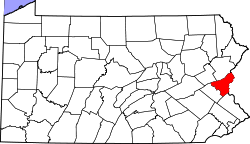 | |
| Boroughs | ||
| Townships | ||
| CDPs | ||
| Unincorporated communities | ||
| Footnotes | ‡This populated place also has portions in an adjacent county or counties | |