Harbledown
| Harbledown | |
 Harbledown |
|
| Population | 2,656 (2011.Ward)[1] area_total_km2=7,55 |
|---|---|
| OS grid reference | TR130579 |
| Civil parish | Harbledown and Rough Common |
| District | City of Canterbury |
| Shire county | Kent |
| Region | South East |
| Country | England |
| Sovereign state | United Kingdom |
| Post town | CANTERBURY |
| Postcode district | CT2 |
| Dialling code | 01227 |
| Police | Kent |
| Fire | Kent |
| Ambulance | South East Coast |
| EU Parliament | South East England |
| UK Parliament | Canterbury |
Coordinates: 51°16′59″N 1°03′14″E / 51.283°N 1.054°E
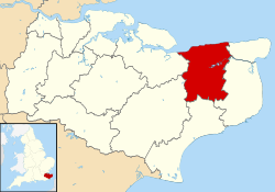
Harbledown is the village and clustered settlement immediately west of Canterbury, Kent, in England, contiguous with the city, at least at the lowest level of local government a separate village: it has the mainstay of homes in the civil parish of Harbledown and Rough Common. The High Street is a conservation area with many colloquial buildings either side of a sharp climb towards the city. It has a tall, intact Georgian terrace on the south side. The area includes several orchards for fruit on its outskirts within its bounds.
The Parish Church of St. Michael and All Angels is compact and attractive but more significant is the Hospital of St. Nicholas: this is now an Almshouse with a range of cottages for elderly people. Formerly, it was a leper hospital whose inmates supported themselves by displaying a slipper that had been worn by St. Thomas Becket; passing pilgrims would leave a donation for the privilege of seeing it. As you enter the Hospital of St. Nicholas a plaque reads:
"This ancient Hospital of St. Nicholas Harbledown was founded by Archbishop Lanfranc c. 1084 for the relief of Lepers. On the disappearance of Leprosy from England Lanfranc's foundation gradually developed into the Almshouses of today. The main door of the church is kept locked for security reasons but the interior of the building can be seen by appointment with the Sub Prior. Visitors are invited to walk in the grounds of the Hospital."
Aphra Behn, a pioneering female playwright, was baptized here on 14 December 1640.
There is thought to be a reference to the village of Harbledown towards the close of Geoffrey Chaucer's Canterbury Tales. In the Prologue to the Manciple's tale, the pilgrims are said to near 'Bobbe-up-and-doun, | Under the Blee, in Canterbury Weye' (IX.2-3).[2]
The much-despised Richard Culmer, a Puritan iconoclast, served as a minister of the parish.
Etymology
It is said that Henry II of England walked barefoot through Harbledown on a pilgrimage to Canterbury Cathedral, in repentance for his mistaken involvement in the murder of Thomas Becket. Thus the area was dubbed 'hobble down', becoming 'Harbledown'. Another explanation says the name 'Harbledown' is more directly the medieval village of 'Bobbe-up-and-doun', as named when Chaucer's pilgrims rested on their way to Canterbury. It was so-called because the road was of poor quality and would 'bob up and down'.
As the place used to be called and recorded as Herbaldoun before Victorian Britain at least, it is more likely the origins of the name has to do with the herbs growing in these hills. "The spot is remarked to be peculiarly healthful, and herbalists are said to come every year to collect medicinal plants which grow only on that particular place."[3] For this reason the leprosy hospital was founded on this spot.

Demography
| Harbledown compared | |||
|---|---|---|---|
| 2001 UK Census | Harbledown | Canterbury district | England |
| Population | 2,593 | 135,278 | 49,138,831 |
| Foreign born | 11.9% | 7.6% | 9.2% |
| White | 94.3% | 96.6% | 90.9% |
| Asian | 2.8% | 1.5% | 4.6% |
| Black | 0.8% | 0.5% | 2.3% |
| Christian | 73.3% | 73.3% | 72% |
| Muslim | 0.6% | 0.6% | 3.1% |
| Hindu | 0.4% | 0.4% | 1.1% |
| No religion | 15.7% | 16.7% | 15% |
| Unemployed | 1.5% | 2.7% | 3.3% |
| Retired | 17.9% | 15.2% | 13.5% |
At the 2001 UK census, the Harbledown electoral ward, which includes part of Chartham, had a population of 2,593. The ethnicity was 94.3% white, 1.2% mixed race, 2.8% Asian, 0.8% black and 0.9% other. The place of birth of residents was 88.1% United Kingdom, 0.8% Republic of Ireland, 3.1% other Western European countries, and 8% elsewhere. Religion was recorded as 73.3% Christian, 0.5% Buddhist, 0.4% Hindu, 0.2% Sikh, 0.2% Jewish and 0.6% Muslim. 15.7% were recorded as having no religion, 0.7% had an alternative religion and 8.5% did not state their religion.[4]
The economic activity of residents aged 16–74 was 35.9% in full-time employment, 12.7% in part-time employment, 11.3% self-employed, 1.5% unemployed, 2.3% students with jobs, 8.3% students without jobs, 17.9% retired, 4.9% looking after home or family, 3.3% permanently sick or disabled and 1.9% economically inactive for other reasons. The industry of employment of residents was 15.1% retail, 8.2% manufacturing, 5.8% construction, 12% real estate, 10.8% health and social work, 24.1% education, 4.6% transport and communications, 6.7% public administration, 2.7% hotels and restaurants, 2.9% finance, 2.6% agriculture and 4.5% other. Compared with national figures, the ward had a relatively high proportion of workers in education and agriculture. There were a relatively low proportion in manufacturing, hotels and restaurants, and transport and communications. Of the ward's residents aged 16–74, 31.3% had a higher education qualification or the equivalent, compared with 19.9% nationwide.[4]
See also
References
- ↑ "Canterbury Ward population 2011". Retrieved 2 October 2015.
- ↑ 'The Riverside Chaucer', ed. Benson (1987), p.952
- ↑ The Monthly Review, 1786
- 1 2 "Neighbourhood Statistics". Statistics.gov.uk. Retrieved 2008-02-21.
External links
| Wikimedia Commons has media related to Harbledown. |