Tankerton
| Tankerton | |
 Tankerton beach on the borders of Swalecliffe |
|
 Tankerton |
|
| Population | 4,613 (2011)[1] |
|---|---|
| OS grid reference | TR120669 |
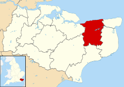
| District | City of Canterbury |
| Shire county | Kent |
| Region | South East |
| Country | England |
| Sovereign state | United Kingdom |
| Post town | Whitstable |
| Postcode district | CT5 |
| Dialling code | 01227 |
| Police | Kent |
| Fire | Kent |
| Ambulance | South East Coast |
| EU Parliament | South East England |
| UK Parliament | Canterbury |
Coordinates: 51°21′50″N 1°02′46″E / 51.364°N 1.046°E
Tankerton (formerly Tankerton-on-Sea) is a suburb of Whitstable in south-east England. It was designed in the late 19th century as the train network brought holidaymakers to the sea.
History
Tankerton-on-Sea was a commercial development by the Tankerton Estate Company in the late 19th century, and was designed with a grid of streets leading from the shoreline.
Environment
The slopes to the shore are a site of special scientific interest (SSSI) because they support the largest single population of the large umbellifer hog's fennel Peucedanum officinale in Britain.[2]
Economy
The economy is based around tourism. The little wooden beach huts at the base of the slopes are currently highly desirable, and notable owners have included Tracey Emin, who sold hers to Charles Saatchi for £75,000.[3] Seaview Caravan Holiday Park adjoins Tankerton, and formerly also contained a large number of chalets, as well as static caravans and camping. It is one of the largest holiday parks on the North Kent coast
Demography
At the 2001 UK census, the Tankerton electoral ward had a population of 4583. The ethnicity was 98.7% white, 0.4% mixed race, 0.6% Asian, 0.2% black and 0.1% other. The place of birth of residents was 95.3% United Kingdom, 0.7% Republic of Ireland, 1.3% other Western European countries, and 2.7% elsewhere. Religion was recorded as 80.2% Christian, 0.4% Buddhist, 0% Hindu, 0.1% Sikh and 0.2% Muslim. 12% were recorded as having no religion, 0.4% had an alternative religion and 6.6% did not state their religion.[4]
The economic activity of residents aged 16–74 was 34.3% in full-time employment, 12.6% in part-time employment, 11.3% self-employed, 1.9% unemployed, 2.2% students with jobs, 3.2% students without jobs, 22.3% retired, 5.8% looking after home or family, 4% permanently sick or disabled and 2.4% economically inactive for other reasons. The industry of employment of residents was 17% retail, 10.9% manufacturing, 8.2% construction, 9.9% real estate, 13% health and social work, 13.2% education, 6.9% transport and communications, 5.9% public administration, 4.2% hotels and restaurants, 4% finance, 1.2% agriculture and 5.6% other. Of the ward's residents aged 16–74, 20.6% had a higher education qualification or the equivalent, compared with 19.9% nationwide.[4]
Gallery
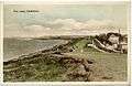 Tinted photograph on postcard dated around 1905-1914 showing "The Leas"
 All Saints Church
 Colourful rows of wooden huts on the grassy slopes below Marine Parade
See also
References
- ↑ "Whistable Ward population 2011". Retrieved 2 October 2015.
- ↑ "Natural England - SSSIs : Introduction". English-nature.org.uk. Retrieved 18 March 2012.
- ↑ Lynne Wallis (28 July 2003). "A little place beside the sea". Evening Standard. Retrieved 10 October 2016.
- 1 2 "Neighbourhood Statistics". Statistics.gov.uk. Retrieved 21 February 2008.
External links
| Wikimedia Commons has media related to Tankerton. |