Upper Hardres
| Upper Hardres | |
 Upper Hardres |
|
| Area | 8.11 km2 (3.13 sq mi) |
|---|---|
| Population | 385 (Civil Parish 2011)[1] |
| – density | 47/km2 (120/sq mi) |
| OS grid reference | TR152507 |
| Civil parish | Upper Hardres |
| District | City of Canterbury |
| Shire county | Kent |
| Region | South East |
| Country | England |
| Sovereign state | United Kingdom |
| Post town | CANTERBURY |
| Postcode district | CT4 |
| Dialling code | 01227 |
| Police | Kent |
| Fire | Kent |
| Ambulance | South East Coast |
| EU Parliament | South East England |
| UK Parliament | Canterbury |
Coordinates: 51°12′55″N 1°04′52″E / 51.2152°N 1.0811°E
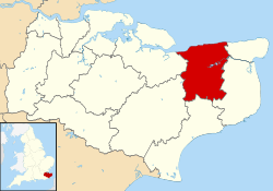
Upper Hardres /hɑːrdz/ is a village and civil parish in the City of Canterbury District of Kent, England.
The name of the Hardres family is perpetuated in the twin villages of Upper Hardres and Lower Hardres (pronounced 'hards'), on the Roman road, Stone Street, south-west of the city of Canterbury. The family owned this area for 700 years after the Norman Conquest. It is a said that Thomas Hardres, who was knighted for his valour at the Siege of Boulogne in 1544, brought back the town gates and erected them at Upper Hardres, though there is little evidence of their existence today.[2]
References
External links
![]() Media related to Upper Hardres at Wikimedia Commons
Media related to Upper Hardres at Wikimedia Commons
This article is issued from Wikipedia - version of the 9/11/2016. The text is available under the Creative Commons Attribution/Share Alike but additional terms may apply for the media files.