Greers Ferry, Arkansas
| Greers Ferry, Arkansas | |
|---|---|
| City | |
 Location in Cleburne County and the state of Arkansas | |
| Coordinates: 35°34′32″N 92°9′51″W / 35.57556°N 92.16417°WCoordinates: 35°34′32″N 92°9′51″W / 35.57556°N 92.16417°W | |
| Country | United States |
| State | Arkansas |
| County | Cleburne |
| Area | |
| • Total | 7.21 sq mi (18.68 km2) |
| • Land | 7.20 sq mi (18.66 km2) |
| • Water | 0.01 sq mi (0.03 km2) |
| Elevation | 604 ft (184 m) |
| Population (2010) | |
| • Total | 891 |
| • Density | 124/sq mi (47.8/km2) |
| Time zone | Central (CST) (UTC-6) |
| • Summer (DST) | CDT (UTC-5) |
| ZIP code | 72067 |
| Area code(s) | 501 |
| FIPS code | 05-28810 |
| GNIS feature ID | 0049672 |
Greers Ferry is a city in Cleburne County, Arkansas, United States. The population was 891 at the 2010 census.[1]
Geography
Greers Ferry is located in western Cleburne County at 35°34′32″N 92°9′51″W / 35.57556°N 92.16417°W (35.575588, -92.164042).[2] It is situated on the east side of Greers Ferry Lake, overlooking The Narrows portion of the lake. Arkansas Highways 16 and 92 cross The Narrows, connecting the city of Greers Ferry with Higden on the west side of the lake. Highway 16, heading north, crosses the northern arm of the lake via the Edgemont Bridge, leading to Fairfield Bay.
According to the United States Census Bureau, Greers Ferry has a total area of 7.2 square miles (18.7 km2), of which 0.012 square miles (0.03 km2), or 0.14%, is water.[1]
Demographics
| Historical population | |||
|---|---|---|---|
| Census | Pop. | %± | |
| 1970 | 389 | — | |
| 1980 | 558 | 43.4% | |
| 1990 | 724 | 29.7% | |
| 2000 | 930 | 28.5% | |
| 2010 | 891 | −4.2% | |
| Est. 2015 | 871 | [3] | −2.2% |
As of the census[5] of 2000, there were 930 people, 398 households, and 300 families residing in the city. The population density was 130.5 people per square mile (50.4/km²). There were 664 housing units at an average density of 93.1/sq mi (36.0/km²). The racial makeup of the city was 97.31% White, 0.11% Black or African American, 0.11% Native American, 0.22% Asian, 0.22% from other races, and 2.04% from two or more races. 1.18% of the population were Hispanic or Latino of any race.
There were 398 households out of which 24.6% had children under the age of 18 living with them, 65.3% were married couples living together, 7.0% had a female householder with no husband present, and 24.4% were non-families. 21.1% of all households were made up of individuals and 11.6% had someone living alone who was 65 years of age or older. The average household size was 2.34 and the average family size was 2.65.
In the city the population was spread out with 20.3% under the age of 18, 5.1% from 18 to 24, 21.3% from 25 to 44, 26.6% from 45 to 64, and 26.8% who were 65 years of age or older. The median age was 48 years. For every 100 females there were 99.6 males. For every 100 females age 18 and over, there were 96.0 males.
The median income for a household in the city was $30,238, and the median income for a family was $32,344. Males had a median income of $24,200 versus $16,250 for females. The per capita income for the city was $16,496. About 12.0% of families and 16.0% of the population were below the poverty line, including 26.4% of those under age 18 and 8.2% of those age 65 or over.
Education
Greers Ferry is home to the West Side School District, West Side Elementary School and West Side High School. The district encompasses more than 147.81 square miles (382.8 km2) of land that includes all or portions of Cleburne County and Van Buren County communities, including Higden, Bee Branch, Quitman, Heber Springs, Prim, Edgemont, Shirley, Fairfield Bay, Greers Ferry, and Drasco.
References
- 1 2 "Geographic Identifiers: 2010 Demographic Profile Data (G001): Greers Ferry city, Arkansas". U.S. Census Bureau, American Factfinder. Retrieved June 17, 2014.
- ↑ "US Gazetteer files: 2010, 2000, and 1990". United States Census Bureau. February 12, 2011. Retrieved April 23, 2011.
- ↑ "Annual Estimates of the Resident Population for Incorporated Places: April 1, 2010 to July 1, 2015". Retrieved July 2, 2016.
- ↑ "Census of Population and Housing". Census.gov. Retrieved June 4, 2015.
- ↑ "American FactFinder". United States Census Bureau. Retrieved January 31, 2008.
External links
Municipalities and communities of Cleburne County, Arkansas, United States | ||
|---|---|---|
| Cities | 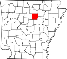 | |
| Towns | ||
| CDP | ||
| Unincorporated communities | ||
| Footnotes | ‡This populated place also has portions in an adjacent county or counties | |